'Route of the Mount Everest Expedition, 1933 - Darjeeling to Mt. Everest'
Early 20th century mountaineering expedition map, 1934
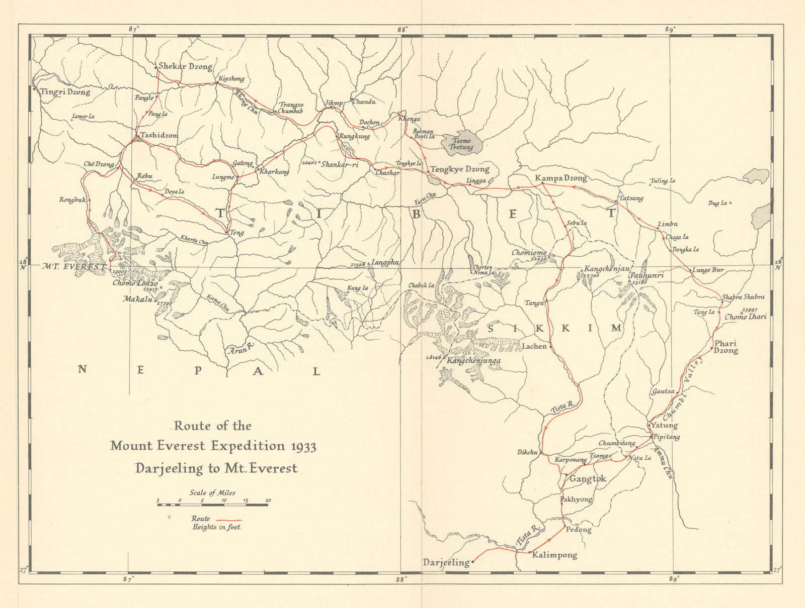
Caption below picture: 'Route of the Mount Everest Expedition, 1933 - Darjeeling to Mt. Everest'
A map of the 1933 British Mount Everest expedition; it was the fourth British venture to the mountain. Following the reconnaissance mission of 1921 and the expeditions of 1922 and 1924, it was the third expedition specifically aimed at achieving the first ascent of Everest. Although the expedition failed to summit, in two separate attempts, Lawrence Wager and Percy Wyn-Harris, followed by F. S. Smythe, set a new altitude record for climbing without supplemental oxygen�a record that remained unbroken until 1978. During Wager and Wyn-Harris's climb, they discovered the ice axe of Andrew Irvine, who, alongside George Mallory, had vanished during their 1924 summit attempt.
DATE PRINTED: 1934
IMAGE SIZE: Approx 23.0 x 30.0cm, 9 x 11.75 inches (Large); Please note that this is a folding map.
ARTIST/CARTOGRAPHER/ENGRAVER: Unattributed, but the author acknowledges the assistance of the Royal Geographical Society, and the map's style closely aligns with their characteristic presentation.
PROVENANCE: "Everest 1933" by Hugh Ruttledge. London: Hodder & Stoughton Ltd
TYPE: Early 20th century mountaineering expedition map
VERSO: There is nothing printed on the reverse side, which is plain
CONDITION: Good; suitable for framing. Please check the scan for any blemishes prior to making your purchase. Virtually all antiquarian maps and prints are subject to some normal aging due to use and time which is not obtrusive unless otherwise stated. I offer a no questions asked return policy - see below.
AUTHENTICITY: This is an authentic historic print, published at the date stated above. I do not offer reproductions. It is not a modern copy. The term 'original' when applied to a print means that it was printed at the first or original date of publication; it does not imply that the item is unique. 'Print' means any image created by applying an inked block to paper or card under pressure by any method including wood engraving, steel engraving, copperplate, wood cut and lithography.
REMARKS: FRANCE: Gravures et Cartes anciennes. DEUTSCHLAND: Alte Lankarten und Stadt ansichten. ITALIA: Stampe e Mappe antiche. ESPA�A: Mapas antiquos y impresiones antiguas. E and OE. Force Majeure. English law shall apply.
RETURNS POLICY: I offer a no questions returns policy. All I ask is that you pay return shipping and mail back to me in original condition, suitably packed & insured, within 14 days of receipt.