'Asia'
Vintage colour map; Scale 1:33,000,000, 1952
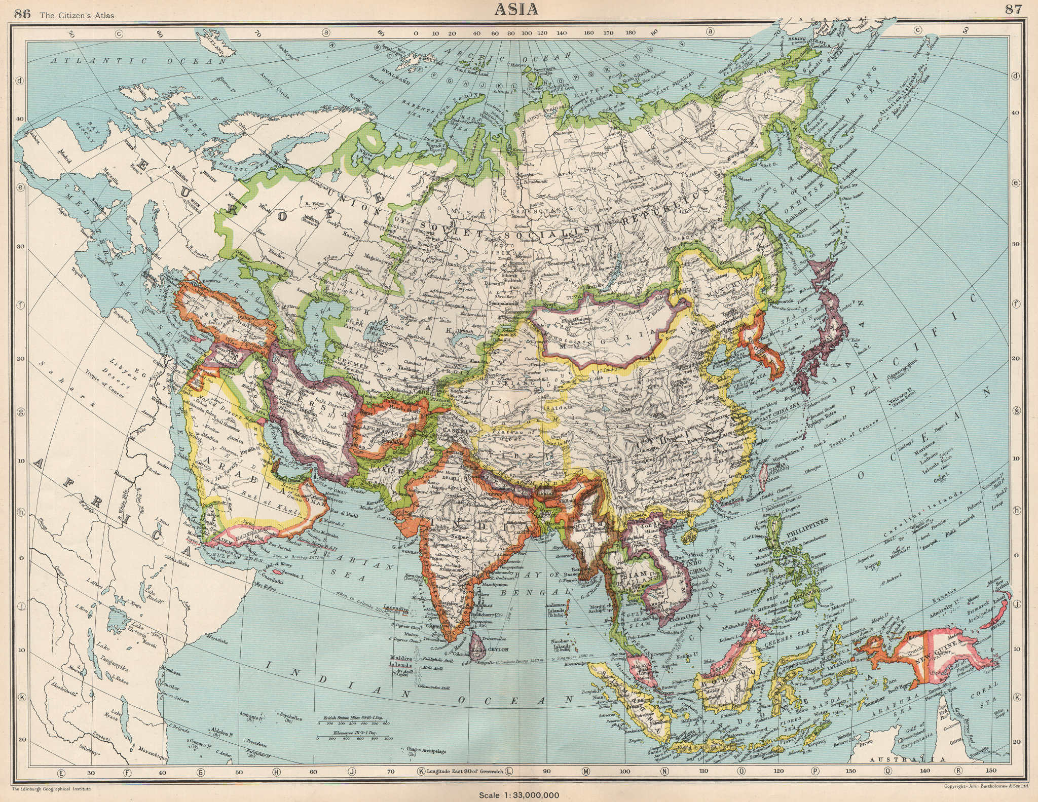
Title of map: 'Asia '
The map shows the Jordanian-occupied West Bank. Jordanian occupation of the West Bank refers to the occupation and annexation of the West Bank (including East Jerusalem) by Jordan (formerly Transjordan), during a period of nearly two decades (1948–1967) in the aftermath of the 1948 Arab-Israeli War. In 1948, the Arab Legion conquered the Old City of Jerusalem and took control of territory on the western side of the Jordan River, including the cities of Jericho, Bethlehem, Hebron and Nablus. Jordan’s annexation was regarded as illegal and void by the Arab League and others. It was recognized only by Britain, Iraq and Pakistan. The map was published during The First Indochina War (generally known as the Indochina War in France, and as the Anti-French Resistance War in contemporary Vietnam). French Indochina (modern Vietnam, Cambodia & Laos) is shown as a single entity.
DATE PRINTED: 1952
IMAGE SIZE: Approx 34.0 x 44.0cm, 13.25 x 17.25 inches (Large); Please note that this is a folding map.
ARTIST/CARTOGRAPHER/ENGRAVER: John Bartholomew
PROVENANCE: "The Citizen's Atlas of the World"; by John Bartholomew; Published by John Bartholomew & Son limited, Edinburgh; 10th Edition
TYPE: Vintage colour map; Scale 1:33,000,000
VERSO: There is another map or maps printed on the reverse side of the picture. The paper is thick, and the printing on the reverse does not show through to the front
CONDITION: Good; suitable for framing. However, please note: The image shown may have been taken from a different example of this map than that which is offered for sale. The map you will receive is in good condition but there may be minor variations in the condition from that shown in the image. Please check the scan for any blemishes prior to making your purchase. Virtually all antiquarian maps and prints are subject to some normal aging due to use and time which is not obtrusive unless otherwise stated. I offer a no questions asked return policy - see below.
AUTHENTICITY: This is an authentic historic print, published at the date stated above. I do not offer reproductions. It is not a modern copy. The term 'original' when applied to a print means that it was printed at the first or original date of publication; it does not imply that the item is unique. 'Print' means any image created by applying an inked block to paper or card under pressure by any method including wood engraving, steel engraving, copperplate, wood cut and lithography.
REMARKS: FRANCE: Gravures et Cartes anciennes. DEUTSCHLAND: Alte Lankarten und Stadt ansichten. ITALIA: Stampe e Mappe antiche. ESPAÑA: Mapas antiquos y impresiones antiguas. E and OE. Force Majeure. English law shall apply.
RETURNS POLICY: I offer a no questions returns policy. All I ask is that you pay return shipping and mail back to me in original condition, suitably packed & insured, within 14 days of receipt.