
1954 Press Photo Newsmap shows location of Hurricane Edna near Cape Hatteras, NC
Charleston, South Carolina - Hurricane Edna boiled the Carolina coast with uninterrupted fury and storm alerts were planned up to Maine. the erratic hurricane, 5th tropical tempest of the year, threatened the Carolinas and Virginia capes with 115 m.p.h. winds. Map shows location of the storm at 6 AM, 9/10 about 275 miles south of Cape Hatteras, North Carolina, moving north at 10 miles an hour. Photo measures 9 x 7.25 inches. Photo Is dated 1954.
PHOTO FRONT
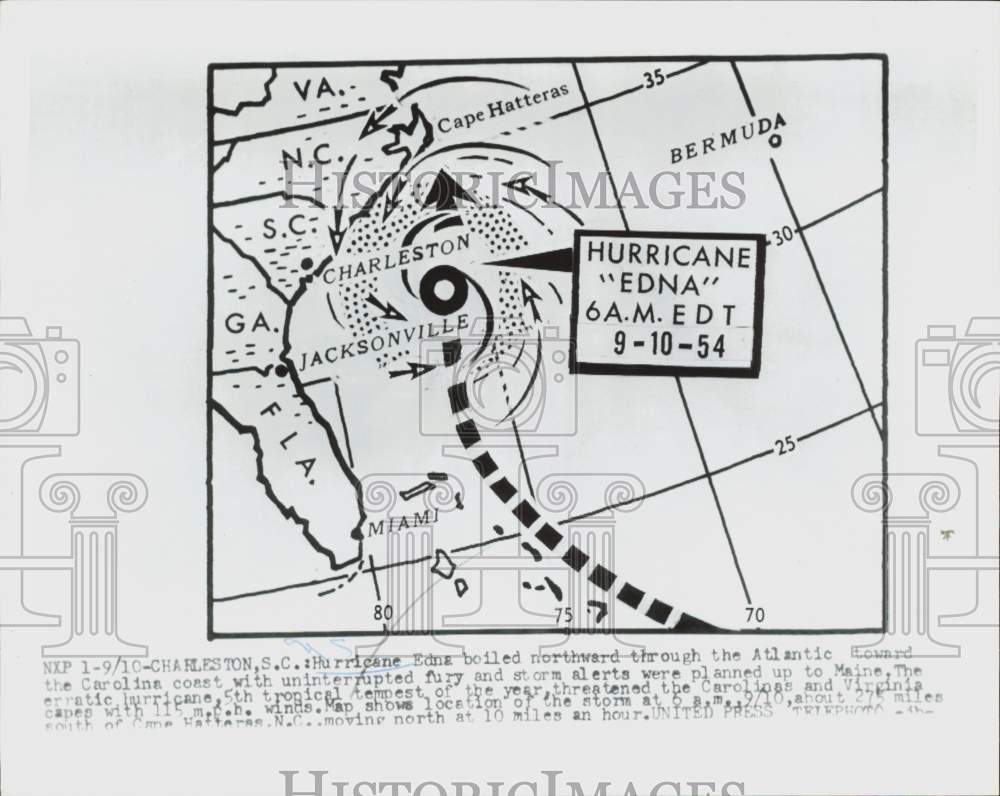
PHOTO BACK

Historic Images Part Number: nei50937