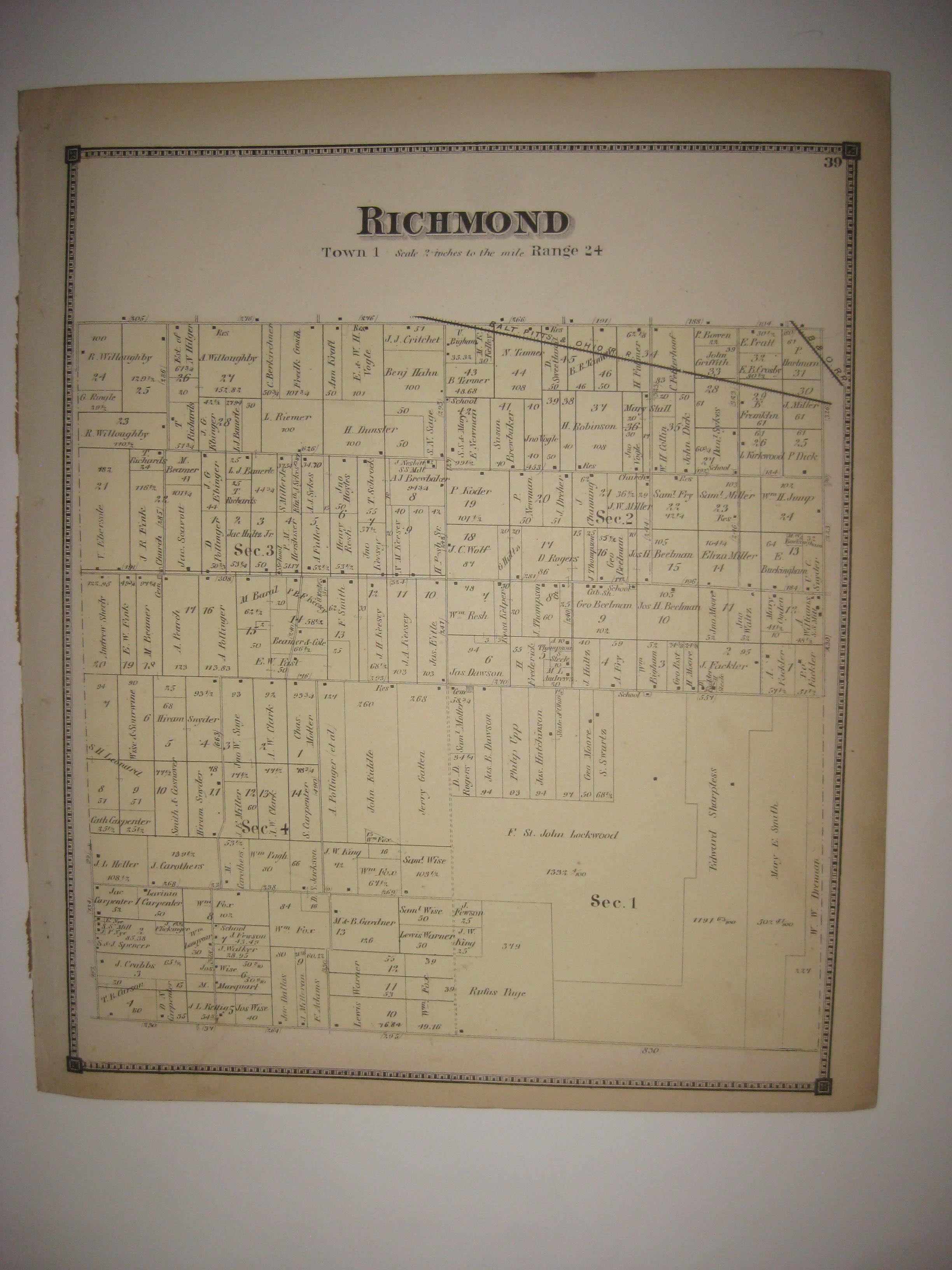
Vintage antique 1873 handcolored map, very rare map, the map is in very fine condition, printed on very thick paper, amazing paper, and no printing on reverse. Paper is much thicker than usual for maps of this period. The map shows Richmond Township, I see many interesting areas. The map is very detailed, with the named land owners, size of land parcels, locations of buildings, named roads, named railroads and much more of this period. Nice outside ornate border. This is an antique map and not a reprint or reproduction. The handcoloring on the map is period to the map, this is before color printing. The map is from the very rare 1873 DJ Lake Atlas of Huron County County Ohio. The map is a fascinating and historic period look at this area at this time. The size of the map is a large 14.5" by 23". Winning bidder pays $4.50 shipping domestic, more foreign.
Payment
I accept the following forms of payment:
- PayPal
Shipping & Handling
US Shipping |
International Shipping |
| FREE scheduling, supersized images and templates. Get Vendio Sales Manager. |
FREE scheduling, supersized images
and templates. Get Vendio Sales Manager.