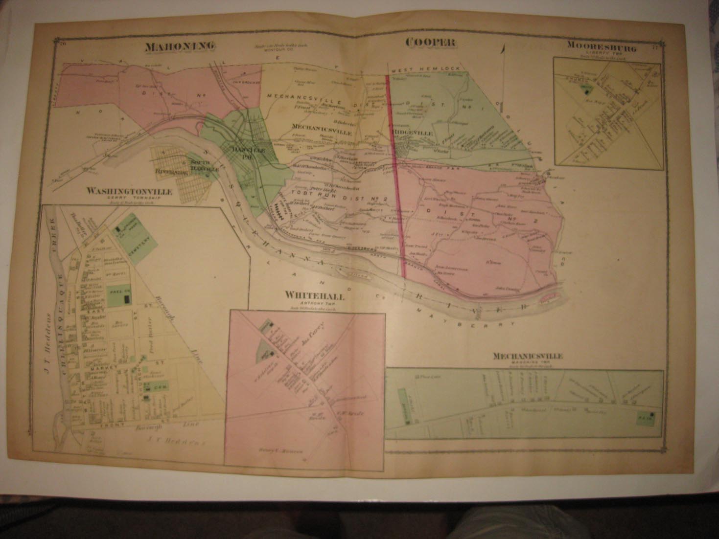
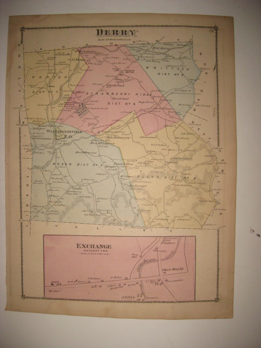
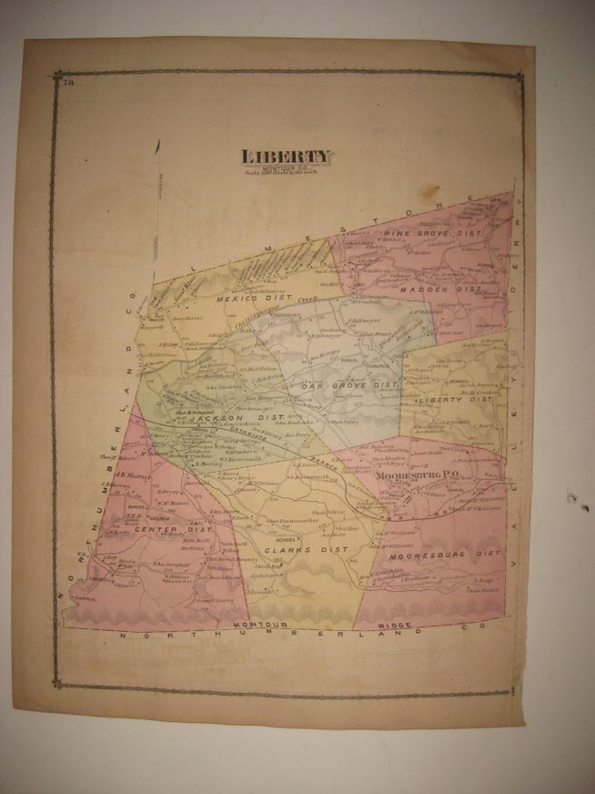
Rare, outstanding,vintage antique 1876 handcolored map . This is an antique map and not a reprint. The condition of the map is excellent, just amazing condition. The superb handcoloring on the map is period to the map, this is before color printing. The map is 4 pages and any side would frame and display beautifully, the firt page is Derry Township and at bottom Exchange, Anthony Twp, the next 2 pages is Mahoning Township and Cooper Township, with inset maps of Washingtonville, Whitehall, Mechanicsville and Mooresburg, on the main map I see Dansville PO, Mechanicsville, Ridgeville and more, the last page is Liberty Township, I se Mooreburg Po and more. The map shows the named land owners, locations of buildings, named railroads, the roads and much more of this period. The map is printed on thick paper, with no printing on reverse. A fascianting and detailed period look at this area at this time. The map is from the rare 1876 Beers Atlas of Columbia and Montour Counties Pennsylvania. Very rare county atlas. The size of the double page map is 16" by 24", and the single page map is half that size. The photo wont show the true beauty of the map . Winning bidder pays $4.00 shipping domestic, more foreign.
Payment
I accept the following forms of payment:
- PayPal
Shipping & Handling
US Shipping |
International Shipping |
| FREE scheduling, supersized images and templates. Get Vendio Sales Manager. |
FREE scheduling, supersized images
and templates. Get Vendio Sales Manager.