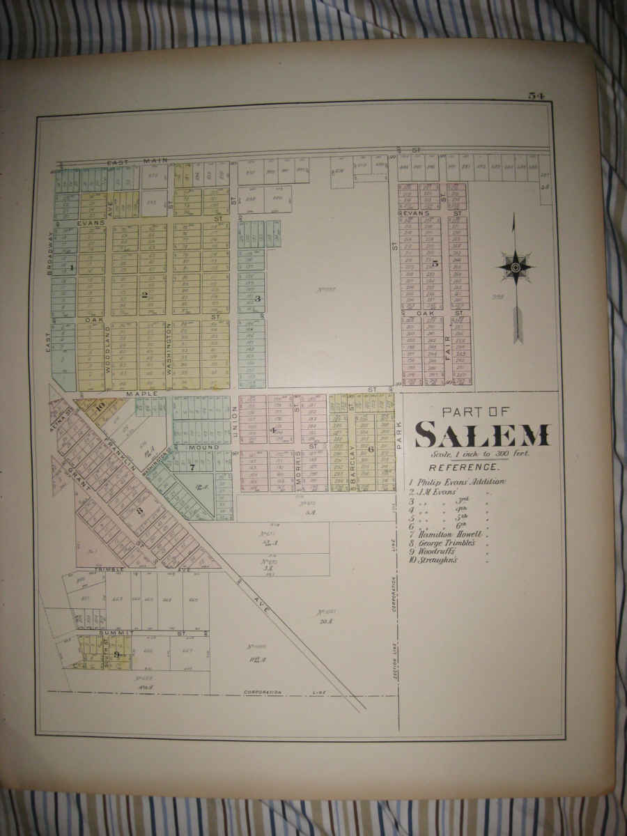
Superb, large antique 1902 handcolored map. The map is titled Part of Salem, the map shows the named land owners, named streets, named railroads, and much more. This is an antique from 1902, and is not a reprint or reproduction. The beautiful handcoloring on the map is period, this is before color printing was invented. The size of the map is 15.5" by 19", large and impressive. This would frame and display quite nicely. The map is in excellent condition. The map is from the rare 1902 Atlas of Columbiana County Ohio. The maps were produced by AH Mueller, one of the finest mapmakers of this period. Many fascinating period detials related to these areas in 1902 . Winning bidder pays $3.75 shipping domestic, $7.00 foreign airmail.
Payment
I accept the following forms of payment:
- PayPal
Shipping & Handling
US Shipping |
International Shipping |
| FREE scheduling, supersized images and templates. Get Vendio Sales Manager. |
FREE scheduling, supersized images
and templates. Get Vendio Sales Manager.