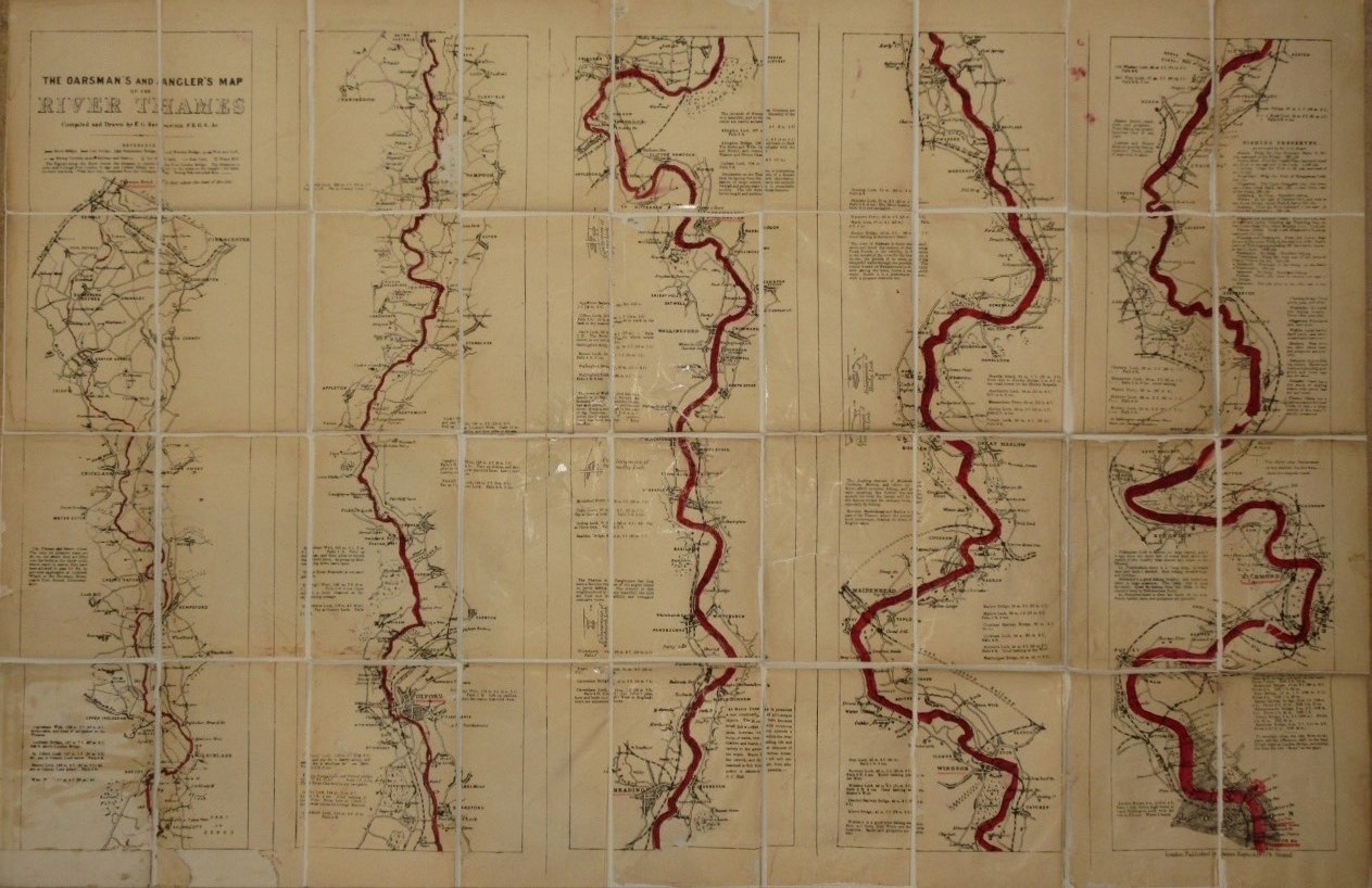
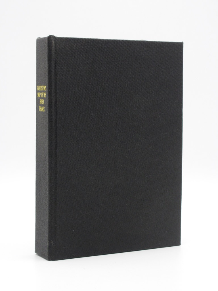
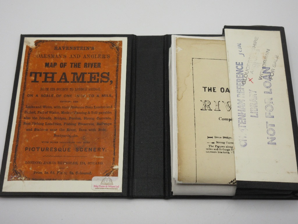
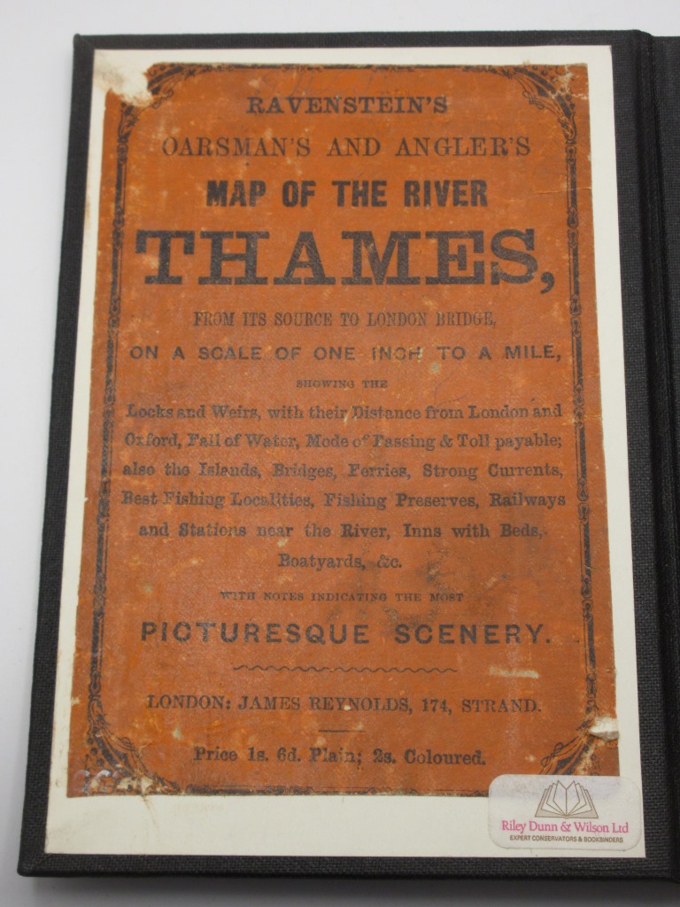
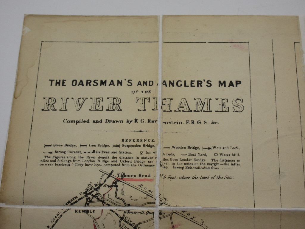
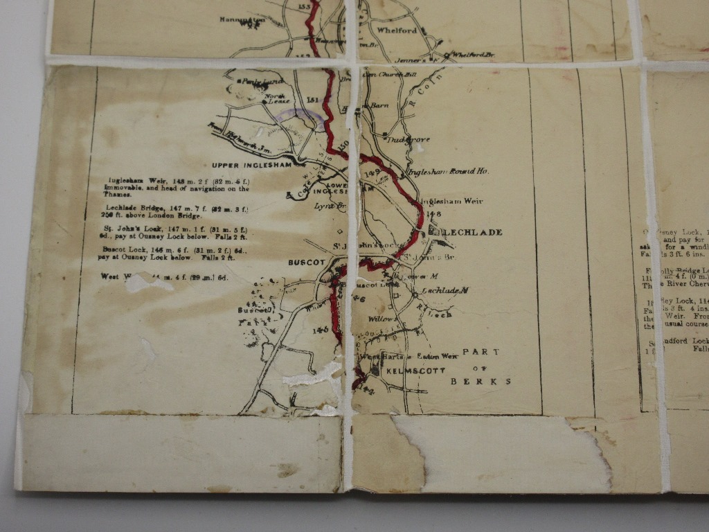
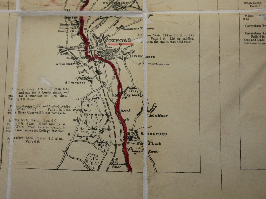
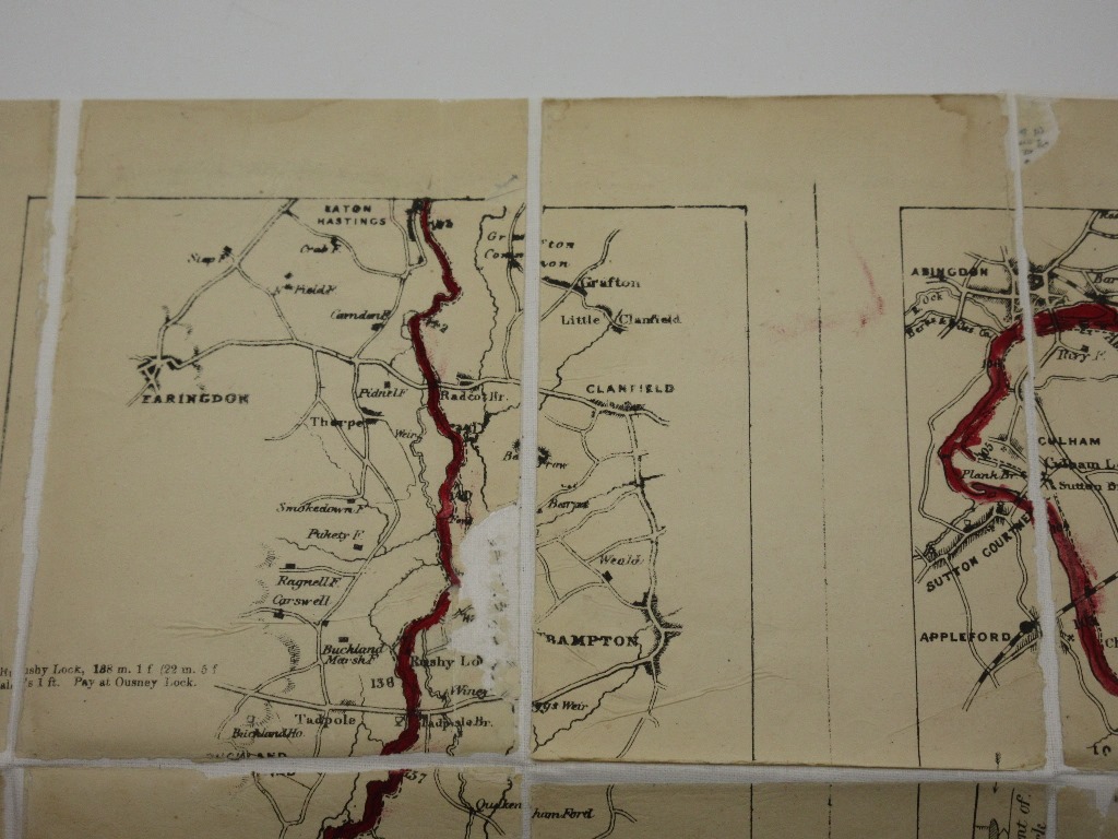
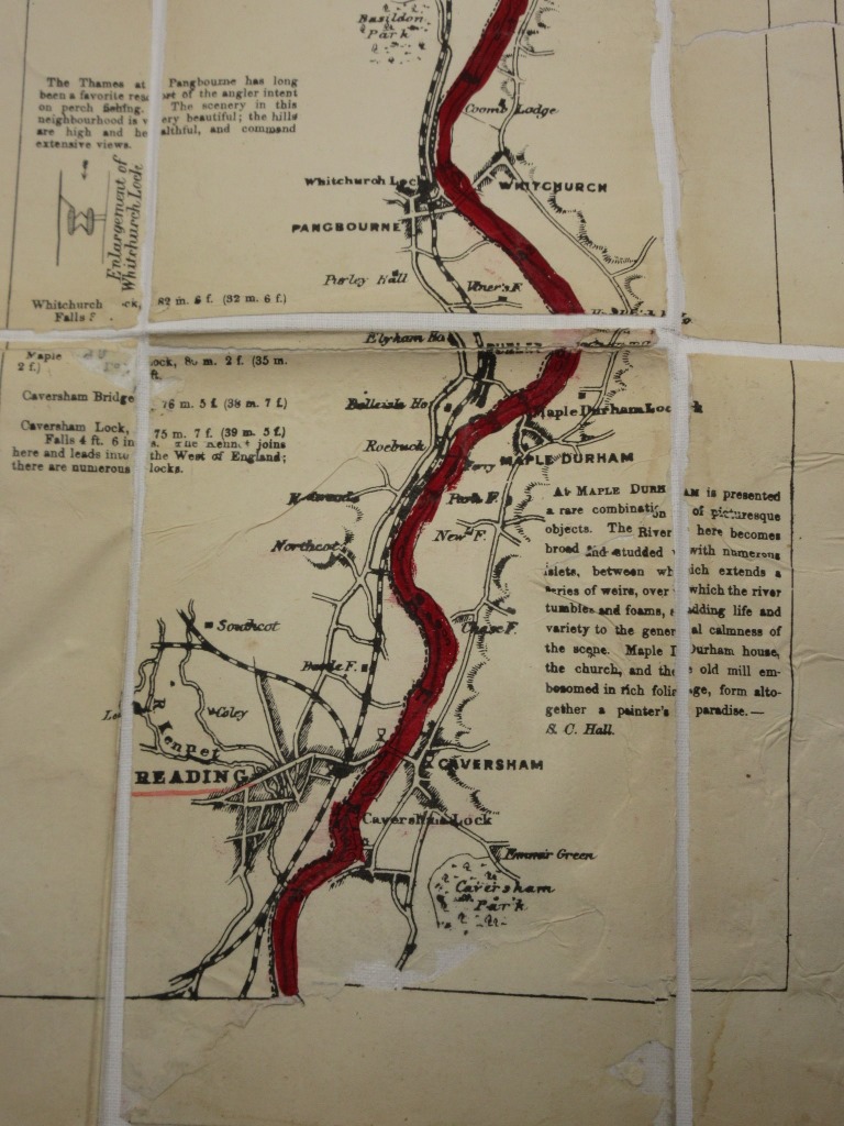
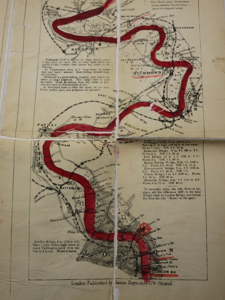
Ravenstein's Oarsman's and Angler's Map of the River Thames. From its Source to London Bridge, On a Scale of One Inch to a Mile, Showing the By Ernest George Ravenstein London: Approx Size: 4.5 x 6.25 inches (12 x 16 cms) Hardback. Undated early printing, circa 1880. Housed in a custom made black cloth folder, retaining the original printed cover. Map has been extensively restored and is now mounted on new canvas. Library stamps to the folder and to the reverse of the map. The map has some small areas of loss and light staining. The river has been rather crudely coloured in dark red. Map dimensions: 88 x 57 cm (34.25 x 22.5 inches). Scarce. Overall Condition is Good There are many more rare and collectable books in our eBay shop, all at very reasonable prices Why not take a look... HERE Keyword SearchTerms: London, Fishing, Angling, Rowing, Victorian, MAP |