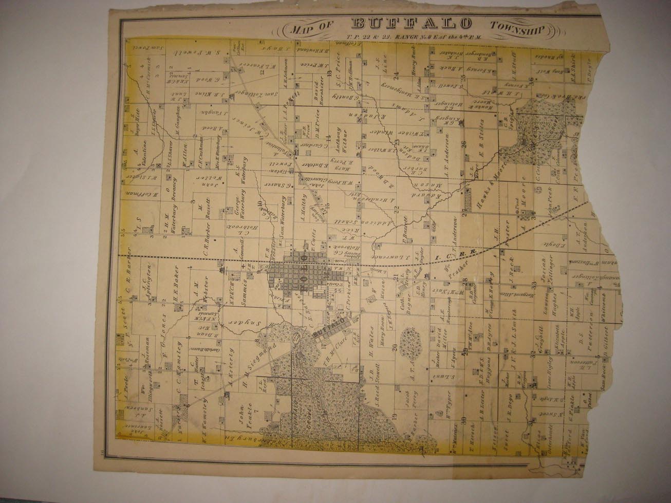
Vintage antique 1872 ,antique handcolored map. The map is titled , in fancy antique lettering, Map of Buffalo Township. The right hand side of the map is lost. There is an archival tape repair towards right hand side as well. I see Polo, Buffalo and many fascianting areas and details. This is an antique map and not a reprint or reproduction. The handcoloring on the map is period to the map, this is before color printing. The map is from the very rare Everts, Baskin and Stewart Atlas of Ogle County Illinois, produced in 1872. These are some of the finest producers of these antique county atlases ever, their maps and views are superb The map is a fascinating and historic period look at this area at this time. The map shows the home and land owners, the business and industry, the few roads, railroads etc that existed at that time. Printed on thick paper, with no printing on reverse. The map is in nice shape and would frame and display quite beautifully. The size of the map is 14.5" by 17". Winning bidder pays $4.00 shipping domestic, more foreign.
Payment
I accept the following forms of payment:
- PayPal
Shipping & Handling
US Shipping |
International Shipping |
| FREE scheduling, supersized images and templates. Get Vendio Sales Manager. |
FREE scheduling, supersized images
and templates. Get Vendio Sales Manager.