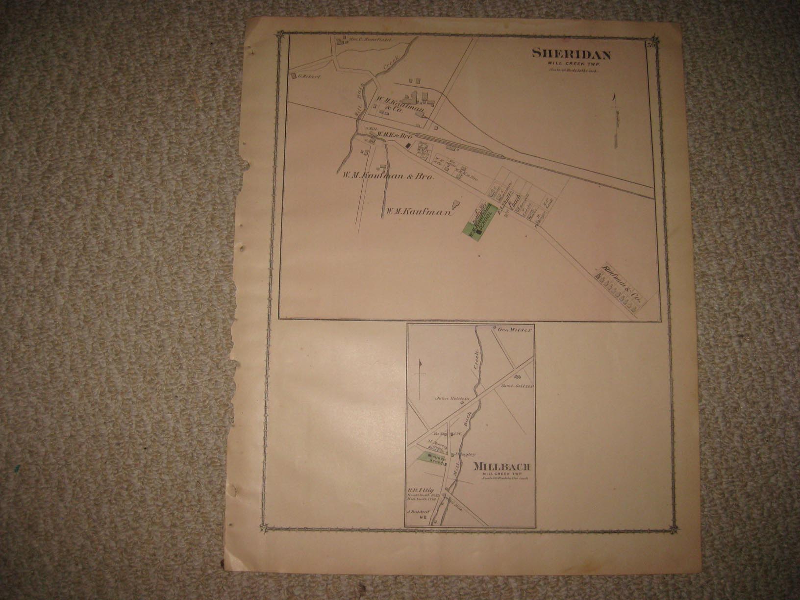
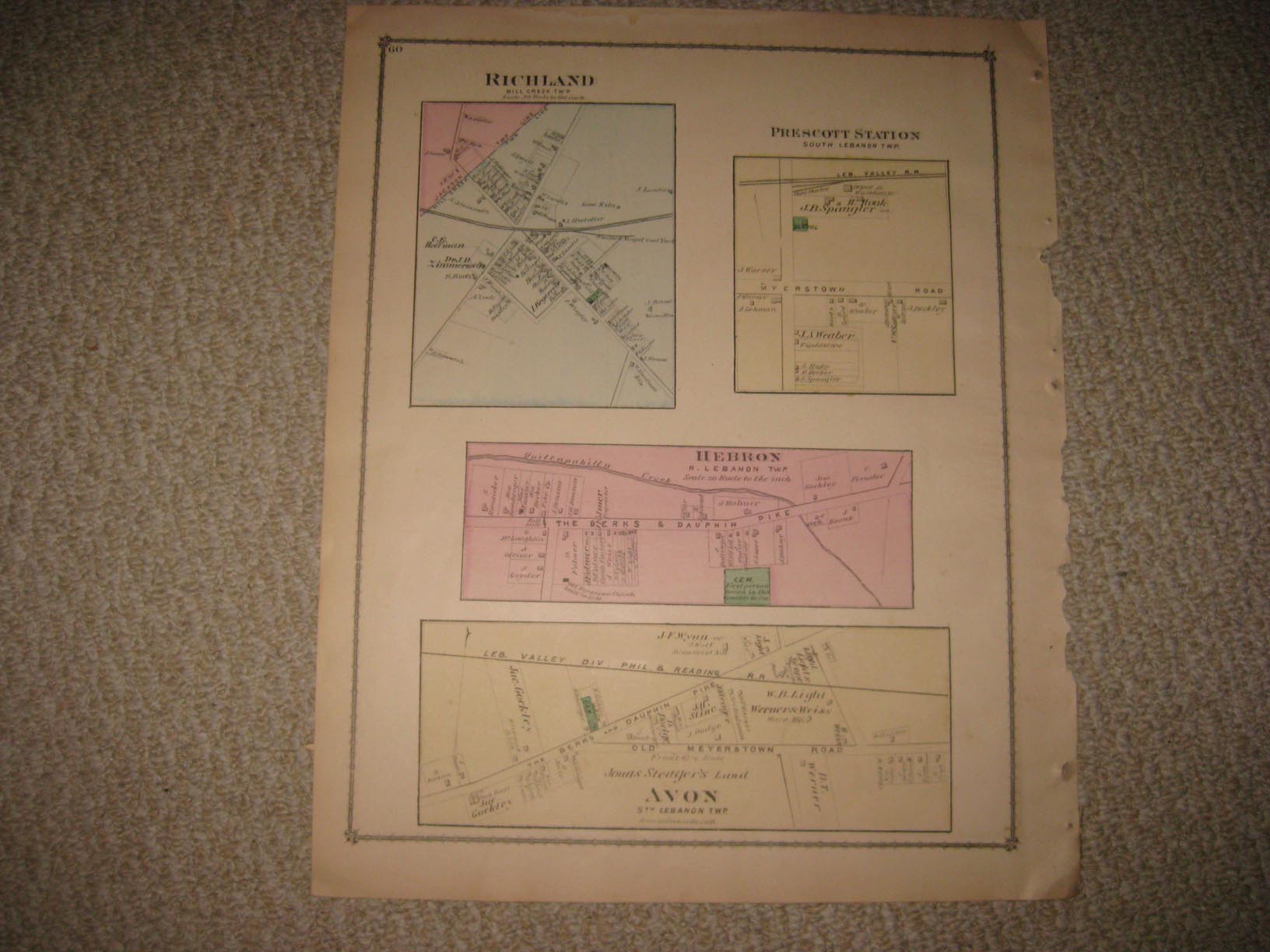
Vintage antique 1875 handcolored map. The map is 2 sided and either side would frame nicely, one side is Sheridan, Mill Creek Township, bottom is Millbach, also Mill Creek Twp, verso is Richland, Mill Creek Twp, Prescott Station, South Lebanon Twp, Hebron, North Lebanon Township, and Avon , South Lebanon Township. This is an antique map and not a reprint or reproduction, I don't like or sell reproductions, they are cheap copies, this is the vintage map, an heirloom to enjoy and pass on, not a cheap mass produced map, produced in a printing shop somewhere. Often the actual antique map is close in price to a reproduction, so why buy a cheap worthless reproduction when you can buy the actual original heirloom? The handcoloring on the map is period to the map, this is before color printing. The map is from the very rare 1875 Beers Atlas of Lebanon County Pennsylvania. The map is a fascinating and historic period look at this area at this time. The map shows the home and land owners, the business and industry, the few roads, railroads etc that existed at that time. The scans wont show all of the map, or the true beauty of this fine antique map. The map is in nice shape and would frame and display quite beautifully. The size of the map is 13" by 16". Winning bidder pays $3.75 shipping domestic, more foreign. Please see my eBay store for other rare maps for sale, at very reasonable prices.
Payment
I accept the following forms of payment:
- PayPal
Shipping & Handling
US Shipping |
International Shipping |
| FREE scheduling, supersized images and templates. Get Vendio Sales Manager. |
FREE scheduling, supersized images
and templates. Get Vendio Sales Manager.