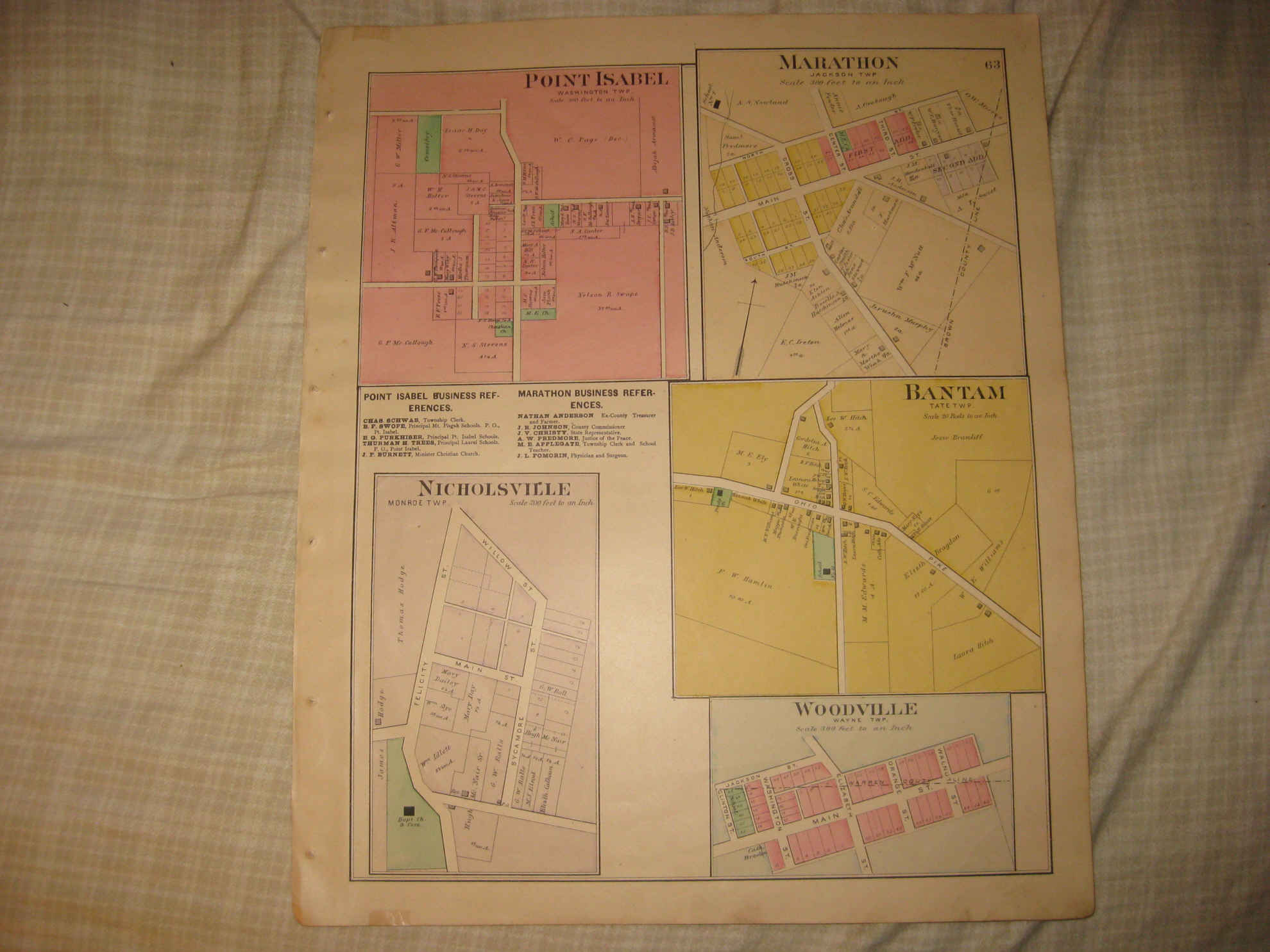
Vintage antique 1891 handcolored map. The map is titled Point Isabel, Washington Twp, Marathon, Jackson Twp, Bantam, Tate Twp, Woodville, Wayne Twp, and Nicholsville, Monroe Twp.. The map shows the named home and land owners, size and location of buildings, named streets, named buildings, and more. The map is in nice condition. This is an antique map and not a reprint or reproduction, printed on thick paper, no printing on reverse. The handcoloring on the map is period to the map, this is before color printing. The map is from the very rare 1891 Lake and Gordon Atlas of Clermont County Ohio . The map is a fascinating and historic period look at this area at this time. The photo wont show the full beauty of the map. The map is in nice shape and would frame and display quite beautifully. The size of the map is 15" by 18.5". Winning bidder pays $4.00 shipping domestic, more foreign.
Payment
I accept the following forms of payment:
- PayPal
Shipping & Handling
US Shipping |
International Shipping |
| FREE scheduling, supersized images and templates. Get Vendio Sales Manager. |
FREE scheduling, supersized images
and templates. Get Vendio Sales Manager.