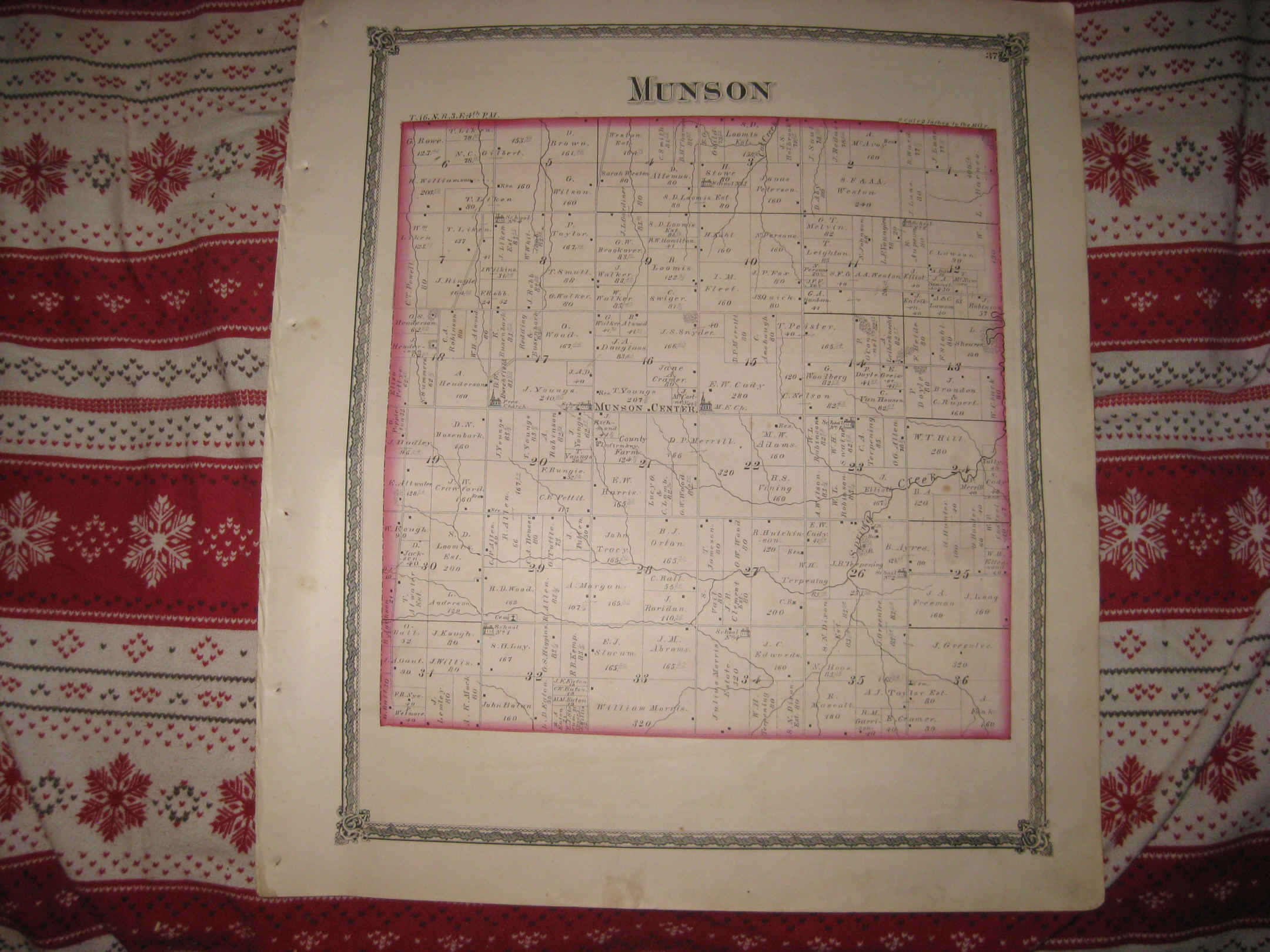
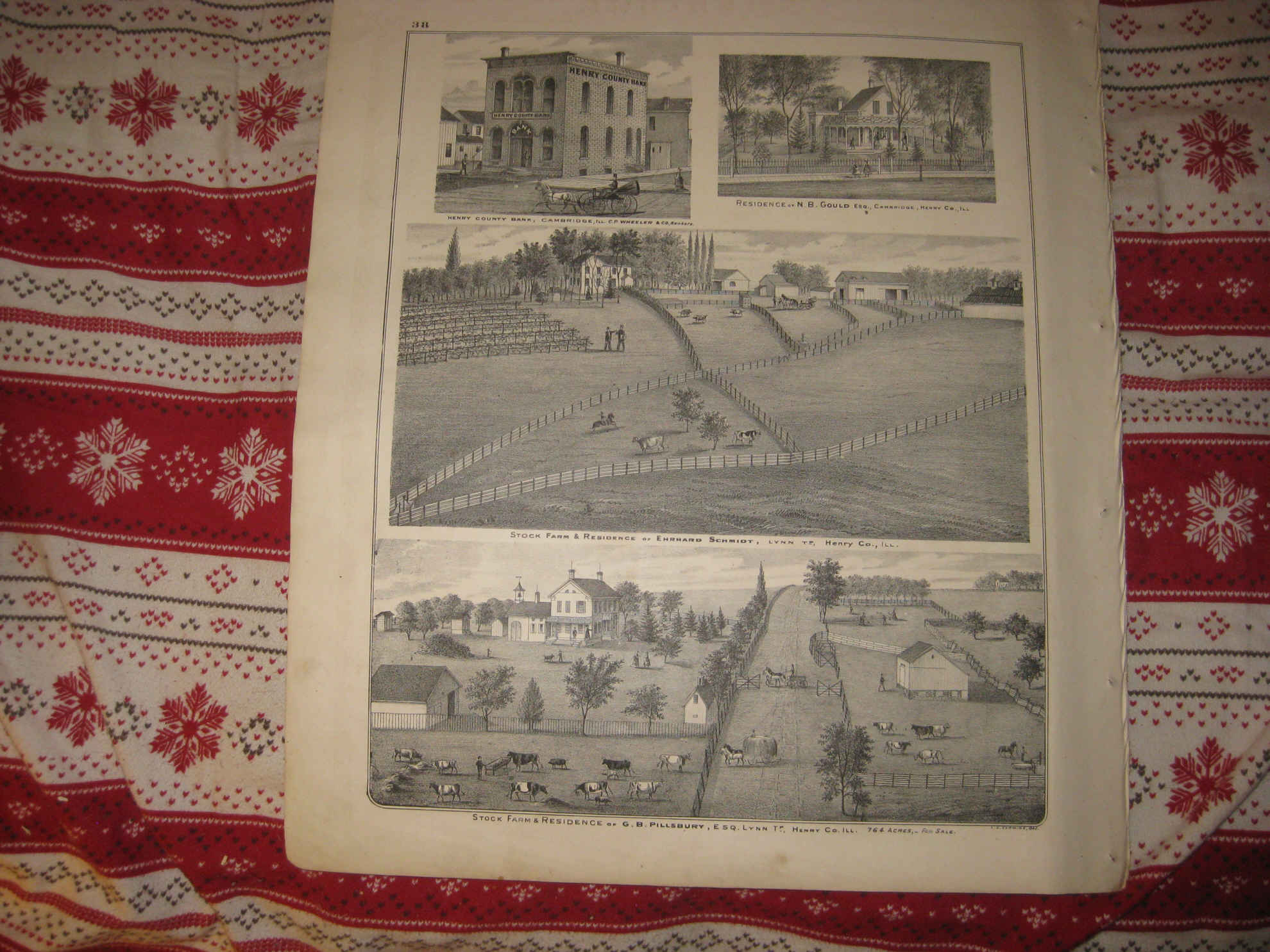
Vintage antique 1875 handcolored map. Very nicely printed on thick paper, no printing on verso. This is an antique 1875 map and not a reprint or reproduction. The superb handcoloring on the map is period,this is before color printing. The map is 2 sided, and either side would frame nicely. One side is Munson , this is Munson Township. On the map I see named home and land owners, named schools and churchs, named railroads, and much more. Verso is a nice lithograph print, showing views of Henry County Bank, Cambridge, Res of NB Gould, Cambridge, Stock farm & Res of Ehrhard Schmidt, Lynn Twp, and Stock Farm & res of GB Pillsbury, Lynn Twp. Very finely produced map, printed on thick fine paper. This is an antique map and not a reprint or reproduction. The map is from the very rare 1875 Illustrated Historical Atlas of Henry County Illinois. The map is a fascinating and historic period look at this area at this time. The photo wont show the full beauty of the map. The map is in nice shape and would frame and display quite beautifully. The size of the map is 16" by 18". Winning bidder pays $4.00 shipping domestic, more foreign.
Payment
I accept the following forms of payment:
- PayPal
Shipping & Handling
US Shipping |
International Shipping |
| FREE scheduling, supersized images and templates. Get Vendio Sales Manager. |
FREE scheduling, supersized images
and templates. Get Vendio Sales Manager.