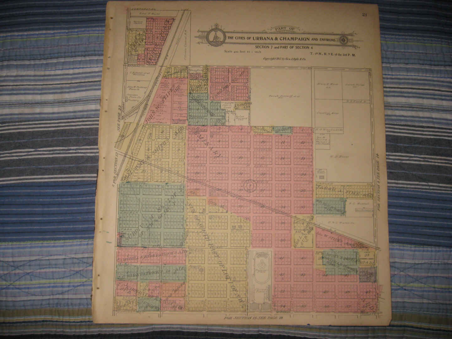
Vintage antique 1913 ,antique handcolored map. The fine handcoloring is period to the map. The map is titled Part of the City of Urbana and Environs. The map has part of the University of Illinois on it, with a Baseball field and so forth there. Printed at upper right hand side is Copyright 1913, by Geo. A Ogle & Co. The map shows named home and land owners, named additions, and much more. The map is printed on thick paper, with no printing on reverse. This is an antique map and not a reprint or reproduction. The map is from the very rare Standard Atlas of Champaign County Illinois, by George Ogle and Company , produced in 1913. The map is a fascinating and historic period look at this area at this time. The photo wont show the true beauty of the map. The size of the map is 15" by 17.5". Winning bidder pays $3.75 shipping domestic, more foreign.
Payment
I accept the following forms of payment:
- PayPal
Shipping & Handling
US Shipping |
International Shipping |
| FREE scheduling, supersized images and templates. Get Vendio Sales Manager. |
FREE scheduling, supersized images
and templates. Get Vendio Sales Manager.