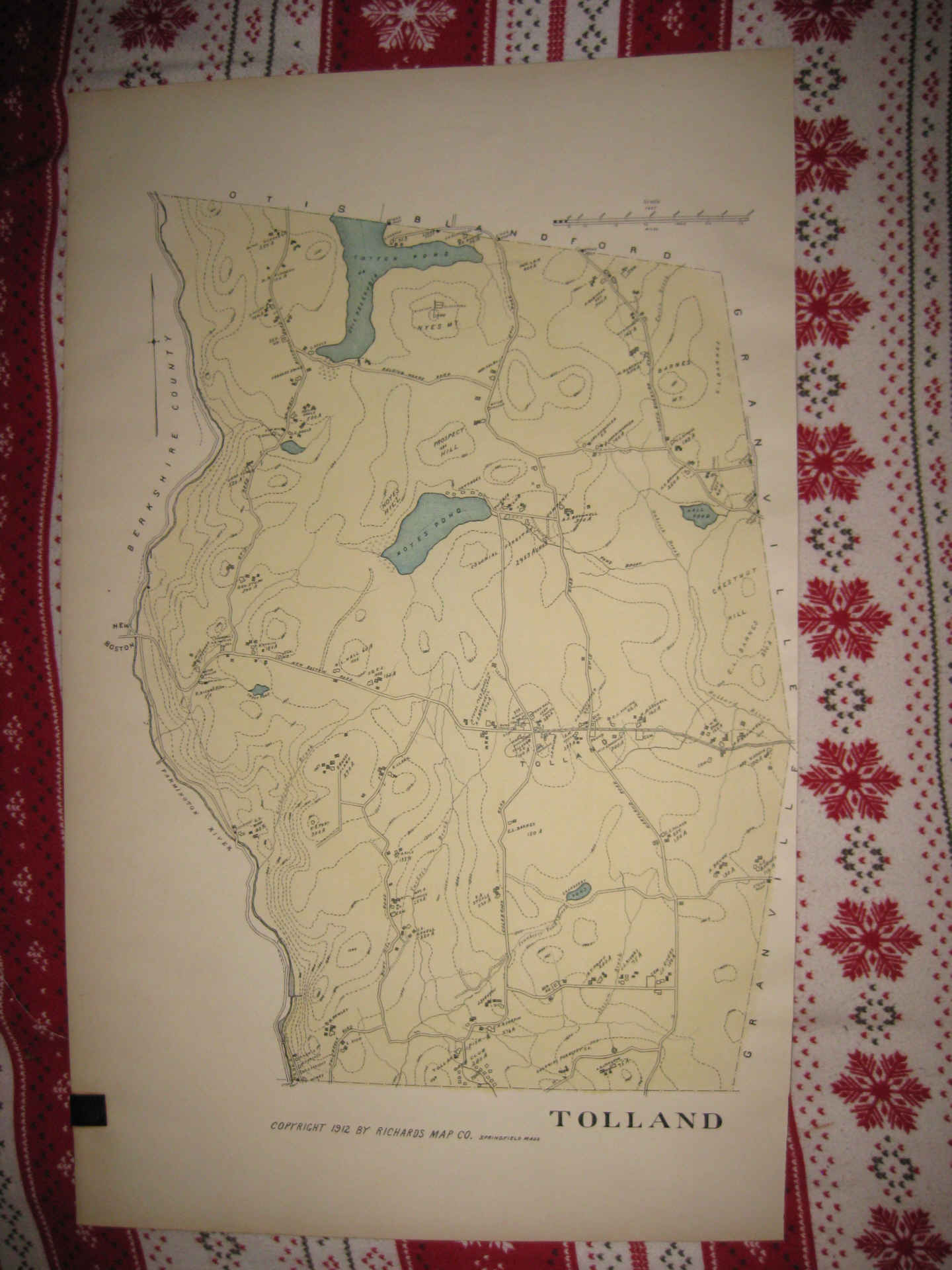
ANY UNUSUAL SHADOWS OR FUZZINESS IS ON THE PHOTO ONLY, THE MAP IS IN SUPERB CONDITION. Vintage antique 1912 handcolored map. Fascianting period map of this area. The map is in beautiful conditon, and would frame and display nicely. The map is titled Tolland. The map shows named home and land owners, named business and industry, named streets, named railroads, size and location of buildings, period layout, and much more. Printed on thick paper, with no printing on reverse. The fine handcoloring on the map is period, these atlases were produced in such small quanitity that is made more sense to handcolor them, than print the color. The photo will not show the true beauty of this map. This is an antique map and not a reprint or reproduction. The handcoloring on the map is period to the map, this is before color printing. The map is from the very rare 1912 L.J. Richards Atlas of Hampden County Massachusetts, the finest atlas ever done on Plymouth County . Richards was one of the best mapmakers of this golden era, creating masterpieces of cartography. The map is a fascinating and historic period look at this area at this time. The size of the map is 13.5" by 22". Winning bidder pays $4.00 shipping domestic, more foreign.
Payment
I accept the following forms of payment:
- PayPal
Shipping & Handling
US Shipping |
International Shipping |
| FREE scheduling, supersized images and templates. Get Vendio Sales Manager. |
FREE scheduling, supersized images
and templates. Get Vendio Sales Manager.