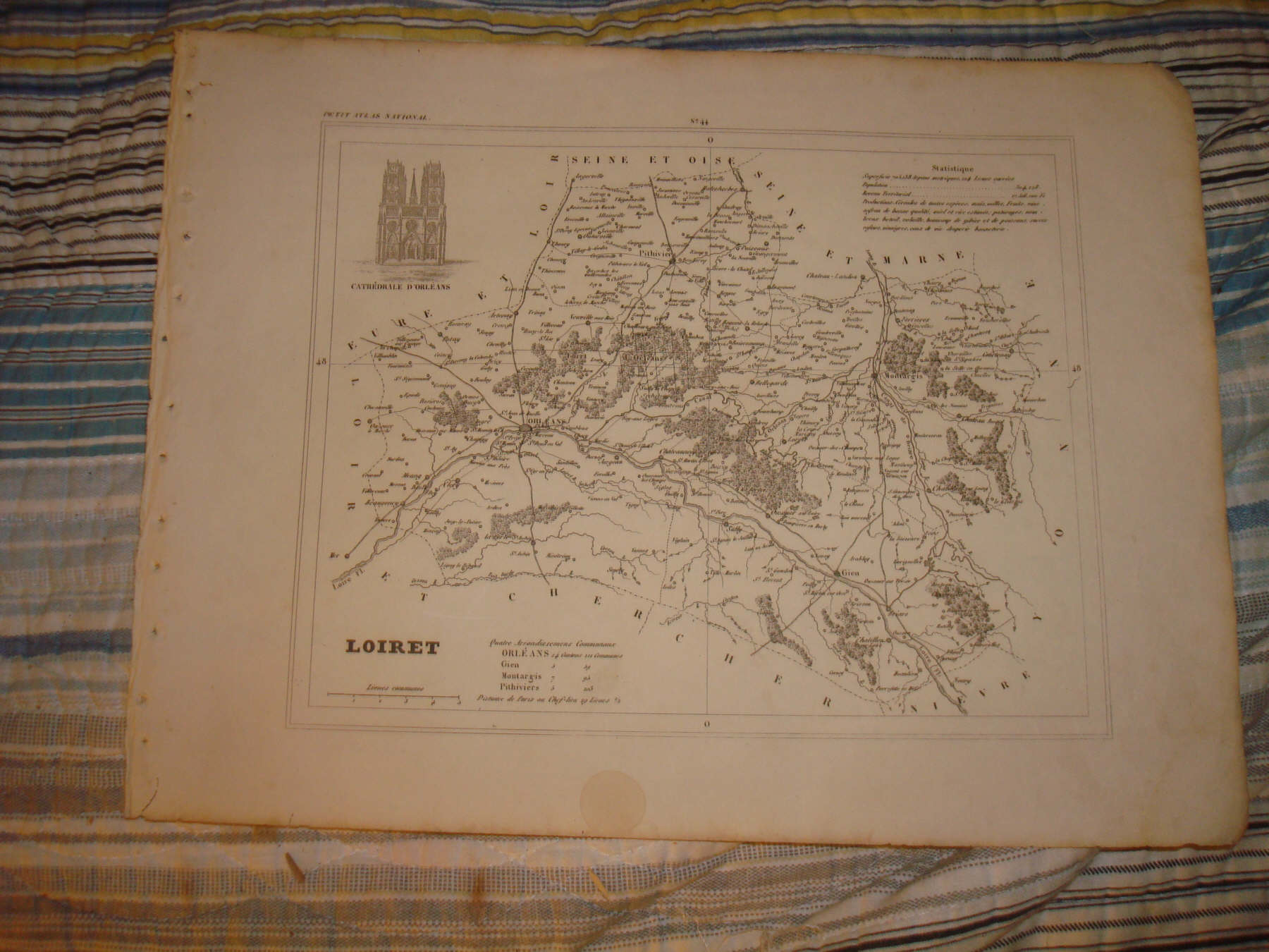
THE PHOTO MAY BE DARK ON THIS, THE MAP IS NOT DARK AT ALL BUT IN BEAUTIFUL FINE CONDITON. Superb, very finely produced, antique 1835 map, titled Loiret , near the title is a detailed Statistique chart listing period info, population, size of the area, business and commerce, items produced and so forth. Discusses what item were produced in this area. The map is very detailed and attractive, with a fine engraved art vignette, titled under the image, related to this area, very finely engraved, as is the map itself. This was produced in France in 1835, and is not a reprint or reproduction. The map is in excellent conditon, and would frame and display quite nicely. The size is 9.75" by 13". Rare. Winning bidder pays $3.25 shipping domestic, more foreign.
Payment
I accept the following forms of payment:
- PayPal
Preferred Checkout
Shipping & Handling
$3.25 USPS First-Class Mail®
| FREE scheduling, supersized images and templates. Get Vendio Sales Manager. |
FREE scheduling, supersized images
and templates. Get Vendio Sales Manager.