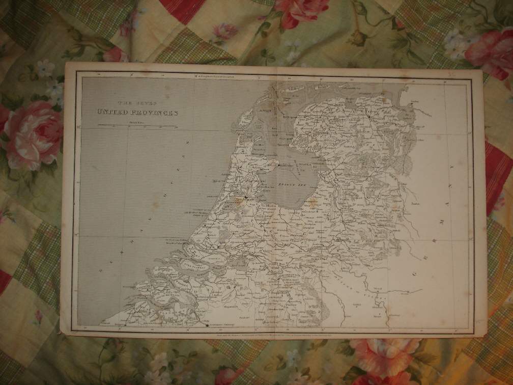
Superb, beautiful vintage antique dated map, titled upper left hand side, The Seven United Provinces. Printed at bottom middle is Drawn under direction of Mr. Arrowsmith, and Published as the act directs, Sepr 1st 1807, by Longman , Hurst , Rees & Orme, Paternoster Row. This dates the map nicely. Fascianting and detailed period map of what is now called The Netherlands. I see Holland , Utrecht , Friesland , Amsterdam , and much more. The map is in excellent conditon and would frame and display quite nicely. Nicely engraved on thick paper. The size of the map is 10.5" by 16.5". Rare. Winning bidder pays $3.25 shipping domestic, more foreign.
Payment
I accept the following forms of payment:
- PayPal
Preferred Checkout
Shipping & Handling
$3.25 USPS
| FREE image hosting (including supersized) with Vendio Sales Manager. |
Listing automation and FREE scheduled listings by Vendio.
