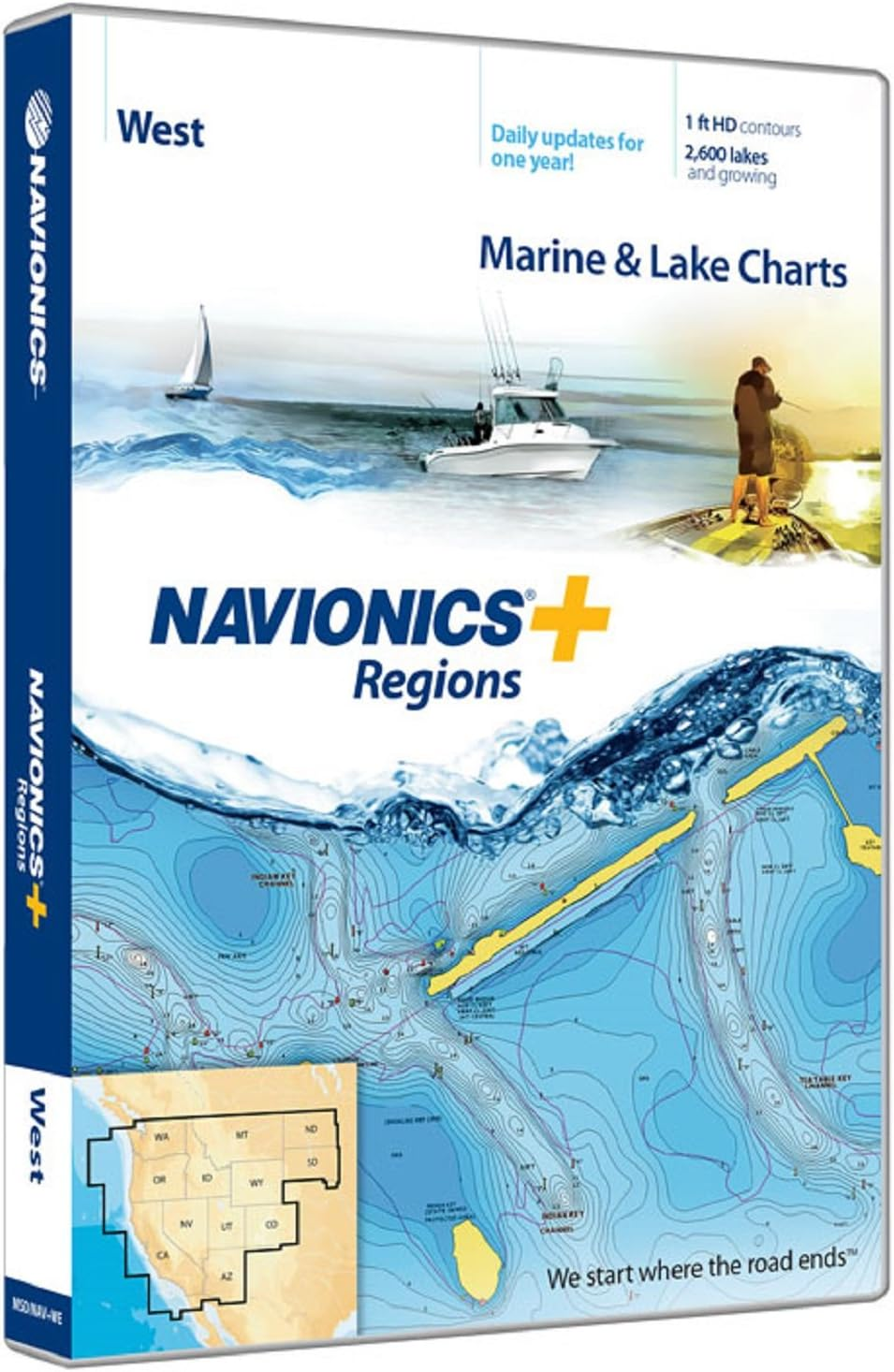
plus Regions West Marine and Lake Charts on SD/MSD

Just for you
We care about you and we always try to offer the best service possible. We choose with love our products and we'll bring to your home using third warehouses and suppliers for the best experience possible.
if you'll get any kind of problem please don't esitate to contact us, we'll do our best for finding the best solution for you.

Shipping
We always try to delivery the goods within 48 hours, but our maximum shipping and delivery time is between 5 and 8 days. Take in mind that some events out of our control could put in delay your order, like climatic events or logistic problems. In this case we will do the best for resolve the issue and we will get in touc withyou.
Note:
Some items could't be shipped in your address for some reason, like address not available with our shipping service or some particular island. So we can delete any order that can't fit with out service, and we will not take any responsability or any feedback for this. If you want know before placing the order if can be shipped, please get in touch with us before placing the order =)
You can return any item within 30 days, please contact us if you have any problem or just you don't like the item. We will guide you with the right process for the faster return and refund possible.

Contact us
We take seriously our reputation, if you have any issue, or the item has not been delivery, please contact us before taking any action or leaving any feedback. We will work together for finding the best solution that will fit for you.
- Max detailed charts for cruising, fishing and sailing.
- Get full marine coverage and Canadian waters of Puget Sound plus more than 2,600 lakes in AZ, CA, CO, ID, MT, ND, NV, OR, SD, UT, WA and WY.
- Includes SonarChartTM 1 foot HD bathymetry map that reflects ever changing conditions, and Community Edits, valuable local information added by millions of Navionics Boating app users.
- Get the most current charts every day with daily updates for one year.
View detailed shorelines with marinas, docks and boat ramp locations. Increase your awareness of shallow waters and hazardous areas at any depth level including shoals, rocks, wrecks and more. Consult tides and currents. Fish smarter with up to 1 foot HD contours. You will find the best fishing spots with roadbeds, foundations, bridges, brush piles, culverts and creek channels. Enhance your favorite areas. SonarChartTM becomes more precise every day with sonar logs contributed by the Navionics Community from all major plotter/sonar brands and mobile devices. And with SonarChartTM Live, you can create real time personal 1 foot HD bathymetry maps on your plotter or mobile and upload sonar logs to Navionics. Navionics charts are updated with around 2,000 edits per day. You will have the latest Nautical Chart, SonarChartTM and Community Edits enriched with information from official sources, our own surveys and research, and contributions from fellow boaters. Additional features including Plotter Sync, Dock to dock Autorouting, SonarChart Live display on plotter and Advanced Map Options are available with select Raymarine models. Nautical Chart and SonarChart are preloaded and ready to use. Download daily chart updates and Community Edits for one year.
Other details
Item model number
010-C1371-30
Whats in the box
Nautical Charts
Color
Black
Product Dimensions
1 x 0.1 x 1 inches
Item Weight
0.11 Kilograms
Paper Finish
Coated
Department
unisex-adult
Is Discontinued By Manufacturer
No
Map Type
Nautical
Other display features
Wireless
Expital, we offer the best to you since the 2013.