|
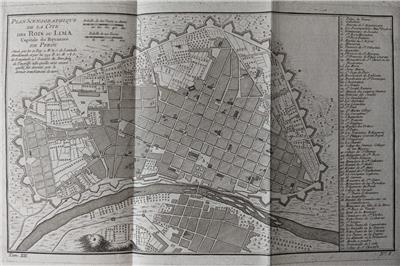
An ORIGINAL 18th century folding map
PLAN SCENOGRAPHIQUE DE LA CITE DES ROIS OU LIMA
CAPITALE DU ROYAUME DE PEROU
by
Jacques-Nicolas Bellin
(1703-1772), Royal Hydrographer, engineer of the French Navy and member of the Royal Society, London....
This map was part of Histoire générale des voyages. 1756
- Original 18th century copperplate engraved map
- Printed on one side only (blank reverse)
- Issued folded
- Uncolored as issued
Image size
7.6" x 12.5" (194 x 317 mm) inc. the key to 70 places at side, plus margins.
.
Shipping / Handling
Priority airmail with tracking $12.00 (approx. 7 / 10 days)
Multiple items are shipped together
ALL ITEMS ARE GENUINE
Thanks for interest
|