|
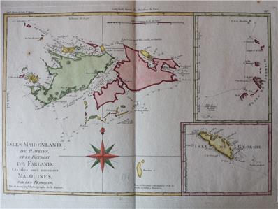
An ORIGINAL 18th-century map
by
Rigobert Bonne
from Bonne and Desmarest Atlas encyclopédique, volume 2, 1788
ISLES DE MAIDENLAND, DE HAWKINS ET LE DETROIT DE FAKLAND
CES ISLES SONT NOMMEES MALOUINES PAR LES FRANCOIS
Par M.Bonne, Ingénieur-Hydrographe de la Marine
- Original 18th-century copperplate engraved map
- Printed on one side only (blank reverse)
- Center fold as issued
- Later hand-coloring
Image size
9" x 13.4" (230 x 340 mm), plus margins.
Shipping / Handling
Priority airmail with tracking $12.00
ALL ITEMS ARE GENUINE
Thanks for interest
|