

We are offering for sale
Here you can buy our new software
Thermal Imaging Software "BFIC"
Can work with these formats:
JPG - FLIR radiometric image from FLIR cameras
ISI - Snapshot 525 camera
JPG - Plain JPG will be treated as thermal image
Basic support for these file types (still under development):
SNP, BMT, IS2, IRI, PGM, SIT, IMG, TIF, BMP
Works even with Therm-App when took in BW palette
more cameras coming soon
Your camera not on list ?
Send me file from your camera !
Working on WINDOWS XP, Vista, Win7, Win8, Win10.
If it will not work with your camera, you can send me your image
and I will try to make it work.
Please see youtube video:
I am the author of software.
I would like to improve it and make more functions.
You can download it for free too, but here you are buying
the download link with support.
Each sale will support me in future development!
Please consider to be part of this development!
Do you want to be more interested? Buy more copies.
What this software offers to you?
Batch processing. You can process unlimited photos by one click.
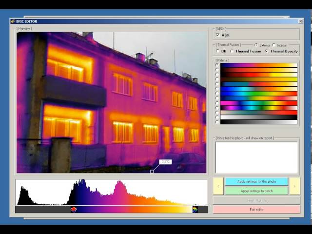
Combination of real image with thermal image including opacity!
GPS coordinates and placing over the interactive google map!
Temperature in °C or °F or °K
Use your own thermal palettes for images.
Create easy html report with notes.
Output resolution is 640x480 with thermal picture inside - see bellow!
Please make sure to see all photos and video!
Do not like commercial products?
Missing some functions but have no way to add it?
This is your chance.
Thermal pictures on interactive google map based on GPS:

Thermal fusion in action (resolution 640x480)

If not satisfied, keep the software and ask for refund - no problem!
NEWS IN 2015 - Thanks to your support!
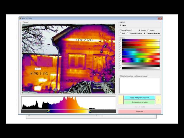
- added ability to define measure points and print the info on report
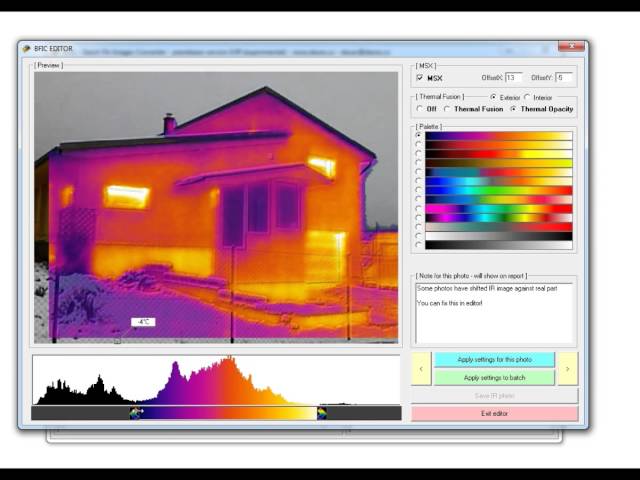
- now you can finetune MSX image - shift IR against Real image
WHAT YOU SEE IS WHAT YOU GET
We offer WORLDWIDE shipping.
You will always receive tracking number.
Economy shipping to CA+AU has no online tracking and can take 30 days or more!
Be sure to visit our other auctions and pay only one shipping! (click here)
Not sure about item or need more parts, but can't find it? Contact us!
If you are buying item which needs to specify model,size,type etc...:
- make sure you send us this information
- make sure you receive email or message with request confirmation!
- Notes to seller are not saved in sales record sometimes!
- You will receive just what is stated in the "ready to be packed" email.
- If your request is not stated there, contact us asap.
Do not hesitate to contact us for other parts!

