[Voyage du Capitaine Carteret] Carte des Découvertes du Capitaine Carteret, dans la Nouvelle Bretagne, avec une partie du passage du Capitaine Cook par le détroit de l’Endéavour, et les découvertes du Capitaine Dampierre dans ces parages // Baie de Bonthain dans l'Isle des Célebes // Côte Sud de Mindanao // Banc de Sable Dangereux // Isles de Joseph Freewill // Nouvelle Irlande [Voyage of Capitain Carteret - Map of Captain Carteret's discoveries in New Britain, with part of Captain Cook's passage through the Endeavour Strait, and the discoveries of Captain Dampierre in this vicinity // Bay of Bonthain, south Sulawesi // South coast of Mindanao // Dangerous sand bank // Joseph Freewill Islands, New Guinea // New Ireland, Papua New Guinea]
Antique 18th century copperplate map, 1790
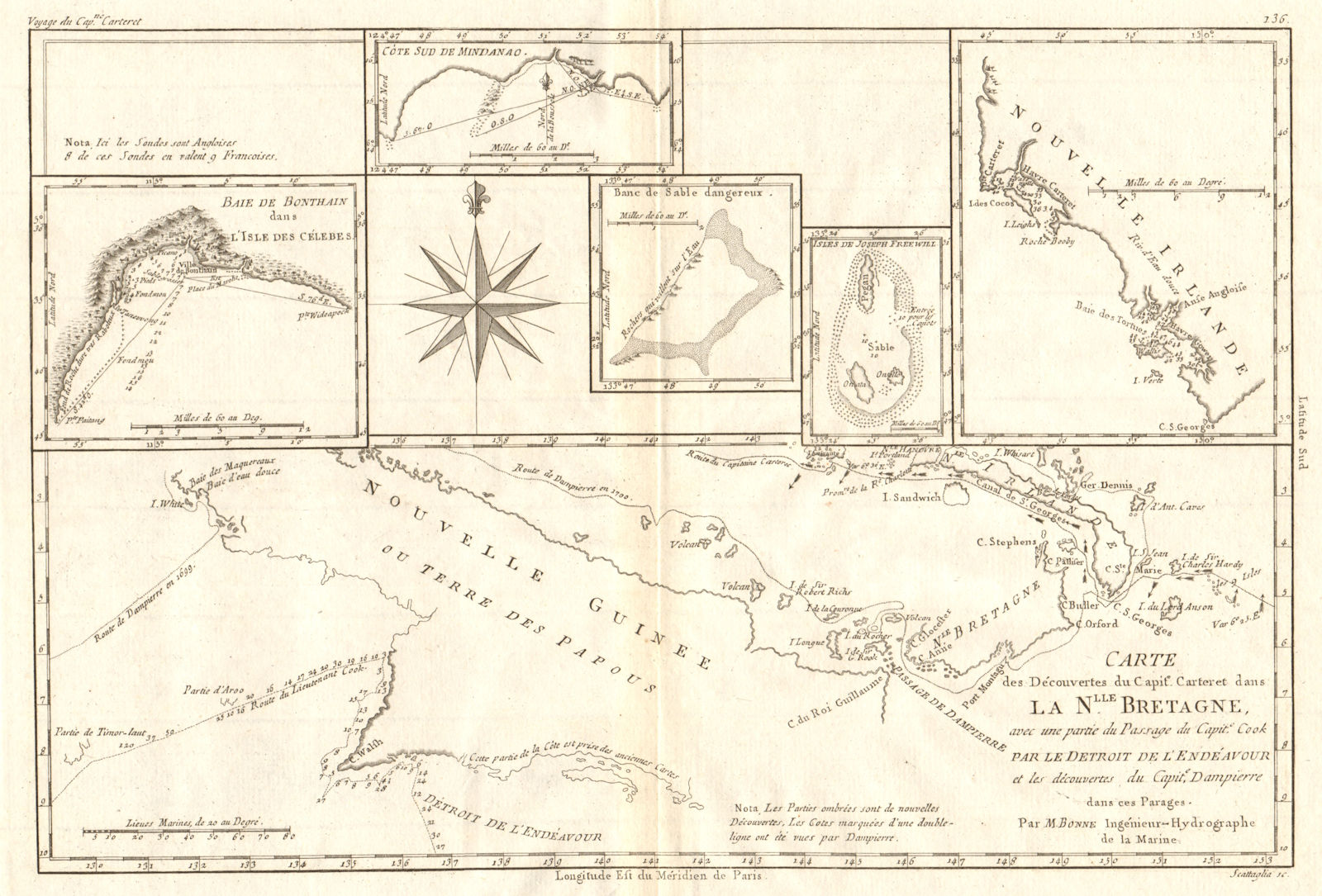
Title of map: '[Voyage du Capitaine Carteret] Carte des Découvertes du Capitaine Carteret, dans la Nouvelle Bretagne, avec une partie du passage du Capitaine Cook par le détroit de l’Endéavour, et les découvertes du Capitaine Dampierre dans ces parages // Baie de Bonthain dans l'Isle des Célebes // Côte Sud de Mindanao // Banc de Sable Dangereux // Isles de Joseph Freewill // Nouvelle Irlande [Voyage of Capitain Carteret - Map of Captain Carteret's discoveries in New Britain, with part of Captain Cook's passage through the Endeavour Strait, and the discoveries of Captain Dampierre in this vicinity // Bay of Bonthain, south Sulawesi // South coast of Mindanao // Dangerous sand bank // Joseph Freewill Islands, New Guinea // New Ireland, Papua New Guinea]'
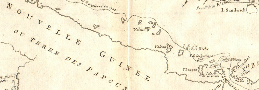
The image below shows an enlarged cross section from the centre of the map to show the level of printed detail. This map is folding hence the centrefold line may show on the image below:
DATE PRINTED: 1790
IMAGE SIZE: Approx 24.0 x 35.5cm, 9.5 x 14 inches (Large); Please note that this is a folding map.
ARTIST/CARTOGRAPHER/ENGRAVER: Rigobert Bonne
PROVENANCE: "Atlas Encyclopedique, contenant la géographie ancienne et quelques cartes sur la geographie du moyen age, la geographie moderne et les cartes relatives a la géographie physique", par M. Bonne, Ingenieur-Hydrographe de la Marine: et par M. Desmarest, de l'Academie Royale des Sciences, à Padoue
TYPE: Antique 18th century copperplate map
VERSO: There is nothing printed on the reverse side, which is plain
CONDITION: Good; suitable for framing. Please check the scan for any blemishes prior to making your purchase. Virtually all antiquarian maps and prints are subject to some normal aging due to use and time which is not obtrusive unless otherwise stated. I offer a no questions asked return policy - see below.
AUTHENTICITY: This is an authentic historic print, published at the date stated above. I do not offer reproductions. It is not a modern copy. The term 'original' when applied to a print means that it was printed at the first or original date of publication; it does not imply that the item is unique. 'Print' means any image created by applying an inked block to paper or card under pressure by any method including wood engraving, steel engraving, copperplate, wood cut and lithography.
REMARKS: FRANCE: Gravures et Cartes anciennes. DEUTSCHLAND: Alte Lankarten und Stadt ansichten. ITALIA: Stampe e Mappe antiche. ESPAÑA: Mapas antiquos y impresiones antiguas. E and OE. Force Majeure. English law shall apply.
RETURNS POLICY: I offer a no questions returns policy. All I ask is that you pay return shipping and mail back to me in original condition, suitably packed & insured, within 14 days of receipt.