The same detailed charts built-in (see
photos), covers from Eastern Denmark all the way around the UK / Ireland to the
far eastern Mediterranean.
This has enough power to work through the hull without drilling a hole.
Can also use C MAP MAX SD charts
AIS input to display AIS targets dynamically on the chart.
Flush or bracket mount with adjustable angle
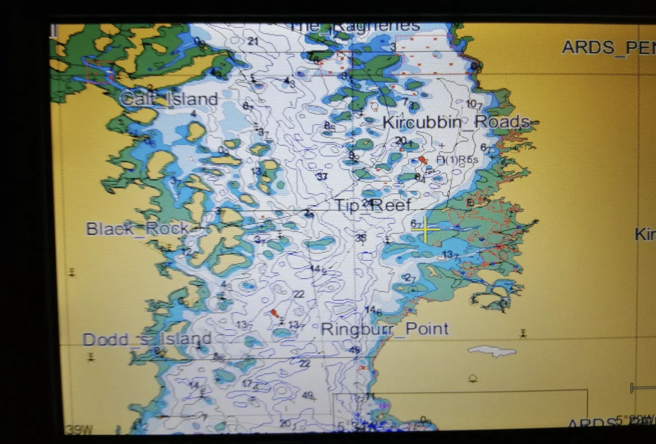
Actual
charts below which are very good quality. Other traders don't have
these!
Includes
Shetlands, Orkneys, Hebrides, Scilly Isles, Isle of Man, Ireland, Canaries,
Madeira,
I don't think you need to buy
C-Map charts as these are very good.
Connect to your DSC radio or any other devices via NMEA.
This unit uses a self-developed algorithm to remove interference effectively.
Certificate of conformity.
Items in package are the Fishfinder/plotter, antenna with mount, plotter mounting bracket with screws, power and NMEA cables and a solid bronze echo transducer which will work perfectly even when sitting inside the hull of your boat, no need to drill any holes.
Also has worldwide base charts.
Display unit: Screen type 10.4" Colour TFT LCD screen with
resolution 800 × 480 pixels (WVGA)
C-Map MAX SD Card support
Language; English
Standard chart screen
GPS data: 3D navigation; compass;
6.000 Waypoints, 10,000 marker points; 800 tracks; 200 routes
interface 2 channels NMEA0183 output, 1 channel AIS input data
capability
Chart; Detailed XINUO chart (C-Map compatible)
Working Temperature -15℃~+55℃
Waterproof grade IPX5 which is standard for all Marine Chartplotters
Power supply DC 12V~36 V
GPS/WAAS/EGNOS
GPS receiving type 22 tracking/66 channel receiving, support
WAAS/EGNOS/MSAS/GAGAN
Receiving frequency L1 (1575.42MHz)
The first positioning time is less than 39 seconds (cold start)
Tracking rate 999 nautical miles/hour
Coordinate system WGS-84 (or other)
precision
DGPS (WAAS) positioning: <3 m (95%) within range of WAAS beacons
speed: 0.1 nautical mile/hour RMS steady state
GPS positioning <15 meters (95%) out of range of WAAS beacons
Speed: 0.1 nautical mile/hour RMS steady state