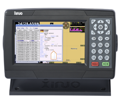
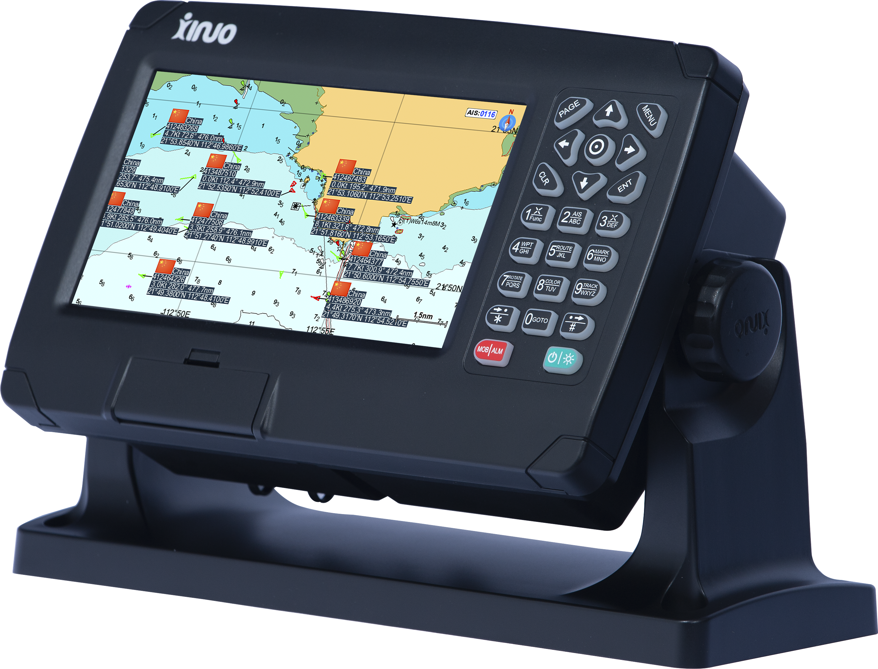
This 7" GPS / AIS dual system Chartplotter's
charts covers UK, Irish sea, North sea, English channel, Bristol channel,
Scilly isles, Orkneys, Shetlands, IOM etc, etc. C-Map Max SD card
compatible.
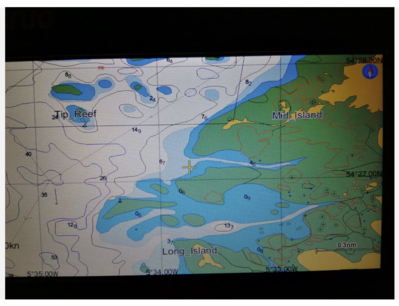
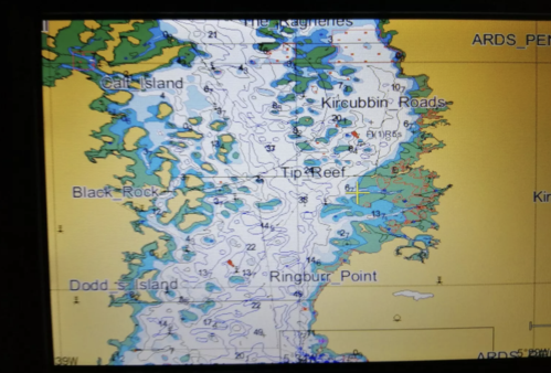
Detailed charts built-in (see
photos), covers from Eastern Denmark all the way around the UK / Ireland to the
far eastern Mediterranean. And the Canaries.
The plotter is delivered by Royal Mail and the 1.18 metre VHF aerial by DPD
Can also use C MAP MAX SD charts
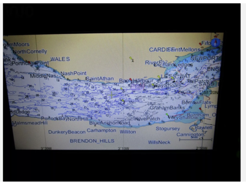
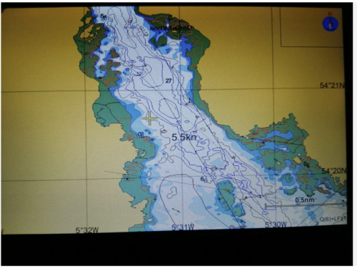
Actual charts below which are very good quality.
Includes
Shetlands, Orkneys, Hebrides, Scilly Isles, Isle of Man, Ireland, Canaries,
Madeira,
I don't think you need to buy
C-Map charts as these are very good.
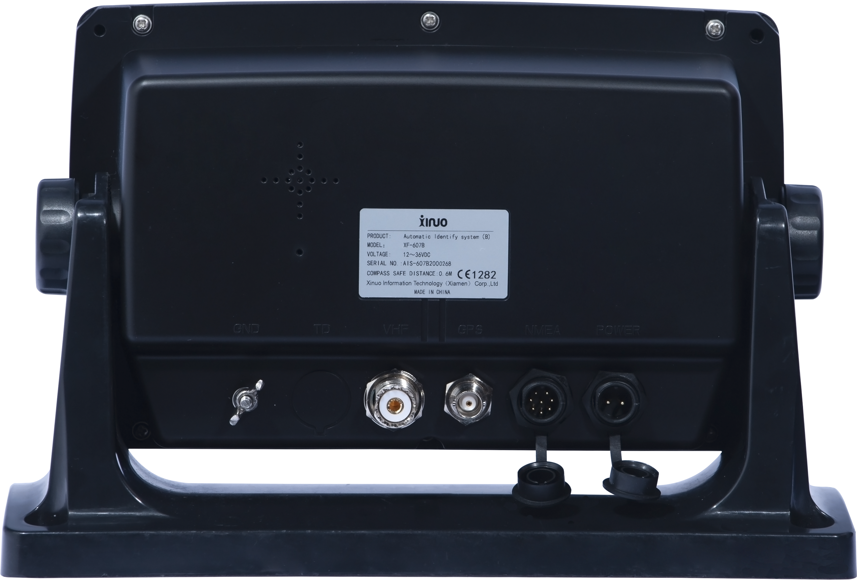
Connect to your DSC radio or any other devices via NMEA.
Certificate of conformity

Beware of buying these from Chinese traders on ebay, they will not have these charts and no warranty as they will come from China. They only have basic worldwide charts and not all of it. If it has a problem it will cost a fortune to return and they will make you pay for its return to you. BEWARE!
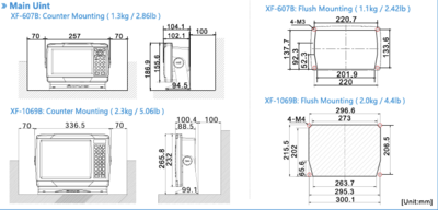
Unit is 24.2 cm x 15.2 cm, when bracket fitted width is 28.5
Items in package are the plotter, screen cover, antenna with mount, plotter mounting bracket with screws, power and NMEA cables. and 1 mtr VHF aerial and mount.
Also has worldwide base charts.
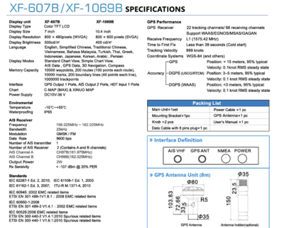
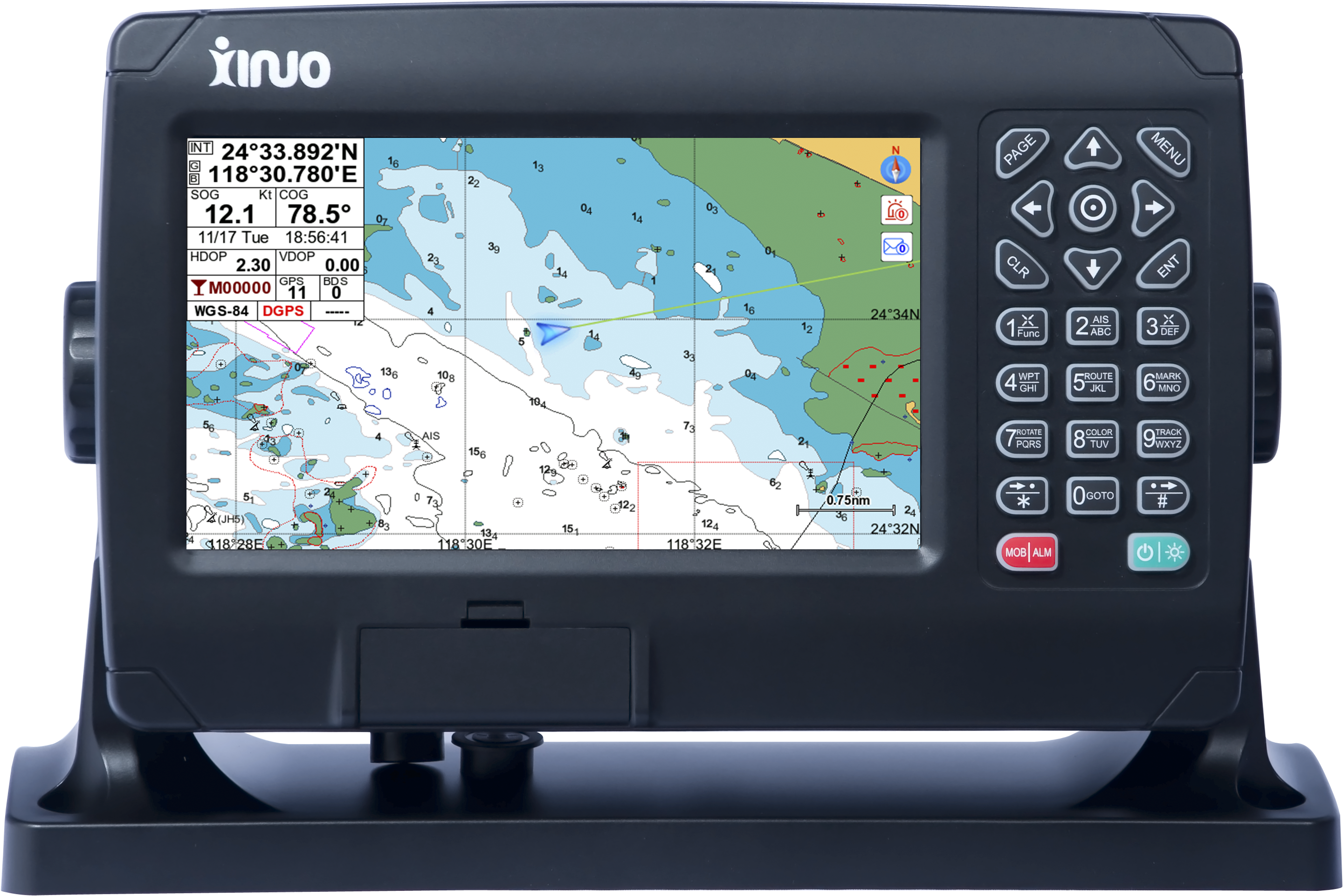
Display unit: Screen type 7" Colour TFT LCD screen with
resolution 800 × 480 pixels (WVGA)
C-Map MAX SD Card support
Brightness 500cd/㎡
Language; English
Standard chart screen
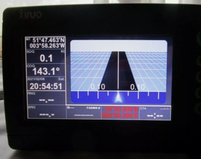
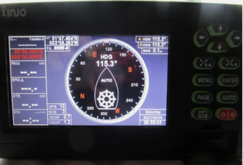
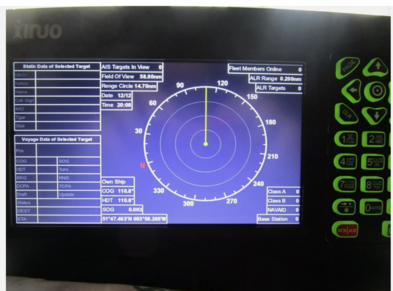
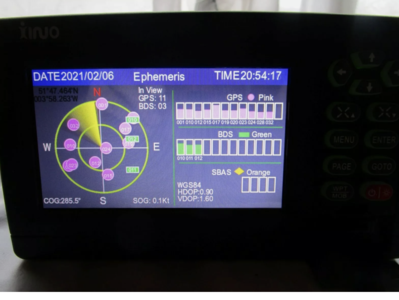
AIS data
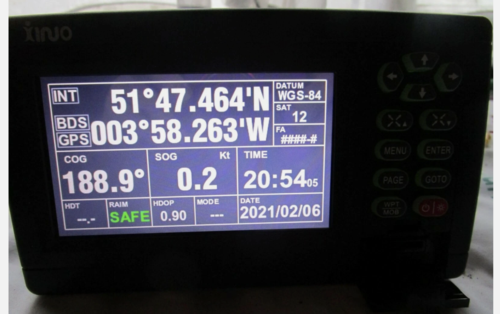
GPS data: 3D navigation; compass;
10,000 waypoints; 200 routes (100 points each);
10,000 2 marker points; 200 boundary lines (40 points each); 1.5 million
track points
interface 2 channels NMEA0183 output, 1 channel AIS input data
capability
Chart; Detailed XINUO chart (C-Map compatible)
Working Temperature -15℃~+55℃
Waterproof grade IPX5 which is standard for all Marine Chartplotters
Power supply DC 12V~36 V
GPS/WAAS
GPS receiving type 22 tracking/66 channel receiving, support
WAAS/EGNOS/MSAS/GAGAN
Receiving frequency L1 (1575.42MHz)
The first positioning time is less than 39 seconds (cold start)
Tracking rate 999 nautical miles/hour
Coordinate system WGS-84 (or other)
precision
GPS positioning <15 meters (95%)
out of range of WAAS beacons
Speed: 0.1
nautical mile/hour RMS steady state
DGPS (WAAS) positioning: <3
m (95%) within range of WAAS beacons
speed: 0.1 nautical mile/hour RMS steady state