J. HOMANN (1664-1724), Historische Karte Oberelsass, um 1720, Kupferstich
200.00 EUR*
*inkl. MwSt. (Differenzbesteuerung gem. §25a UStG, Kunstgegenstände/Sonderregelung)
Kostenloser Versand innerhalb Deutschlands
- kostenloser Versand innerhalb Deutschlands
- besonders sichere Verpackung
- 1 Monat Rückgaberecht
- kostenloser Rückversand
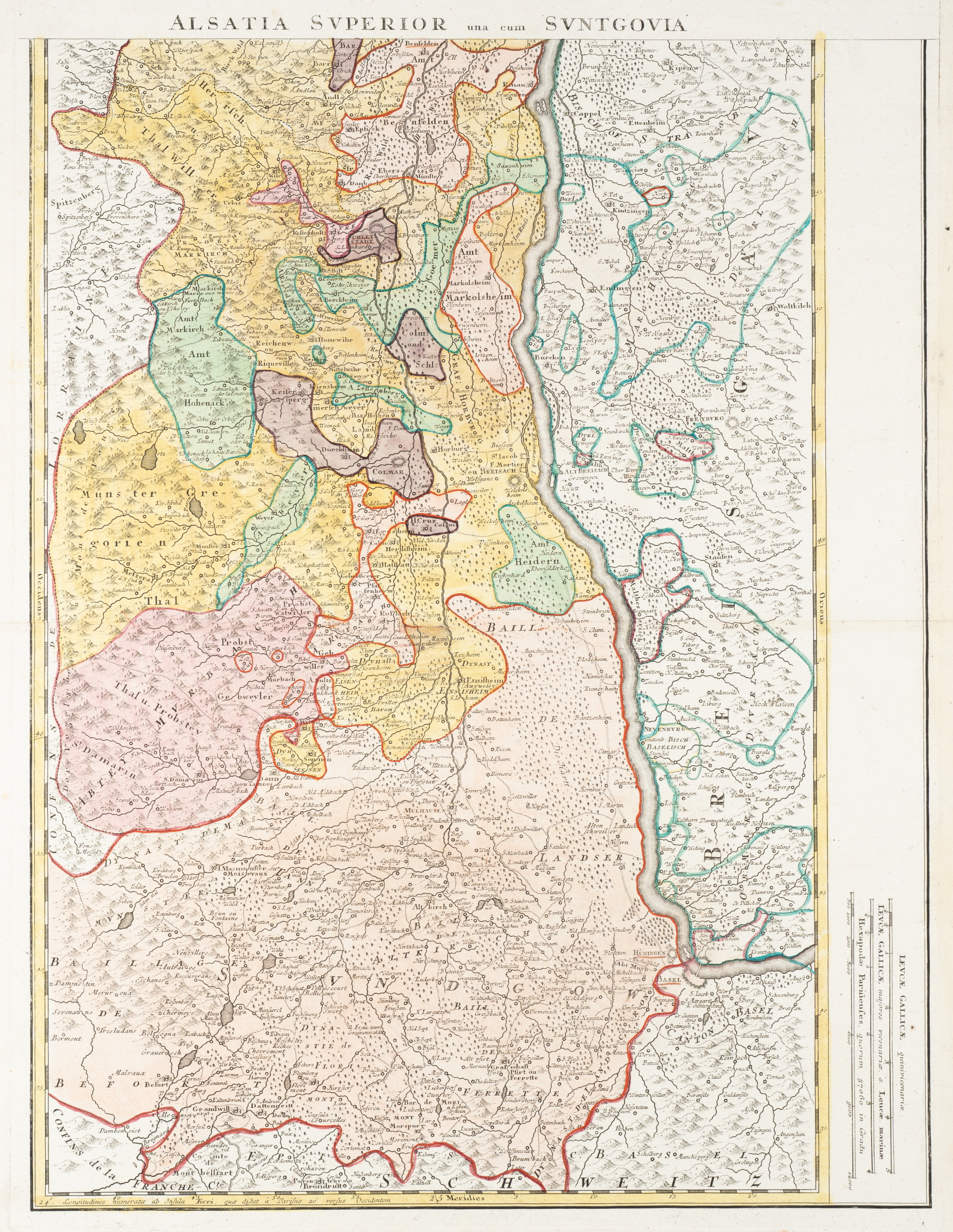
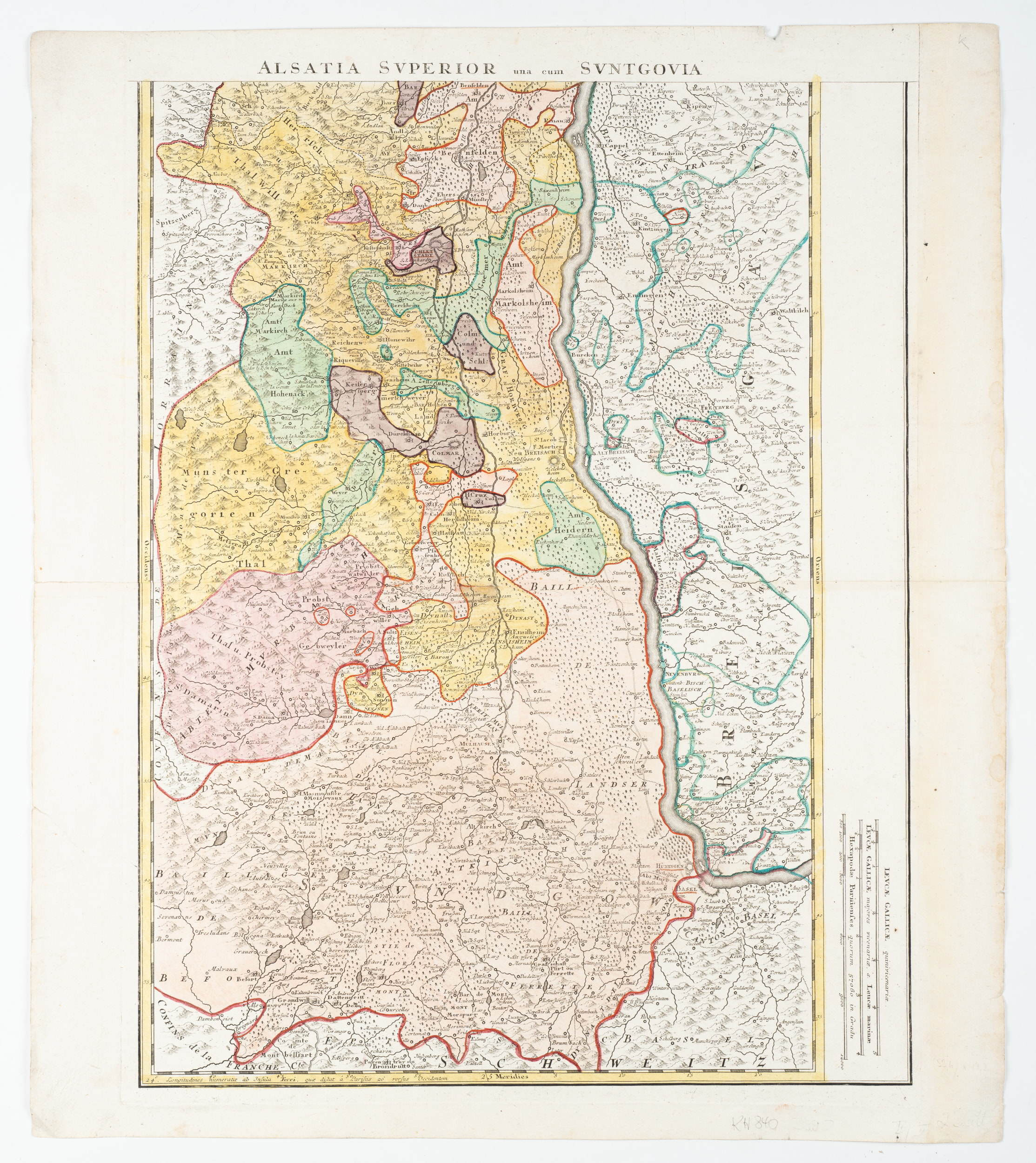
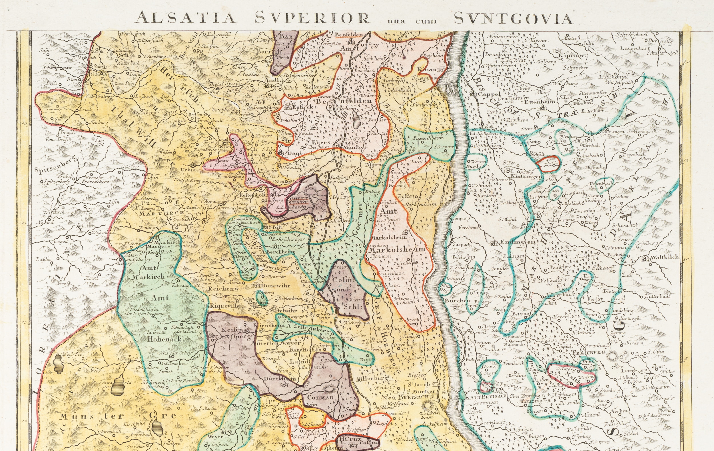
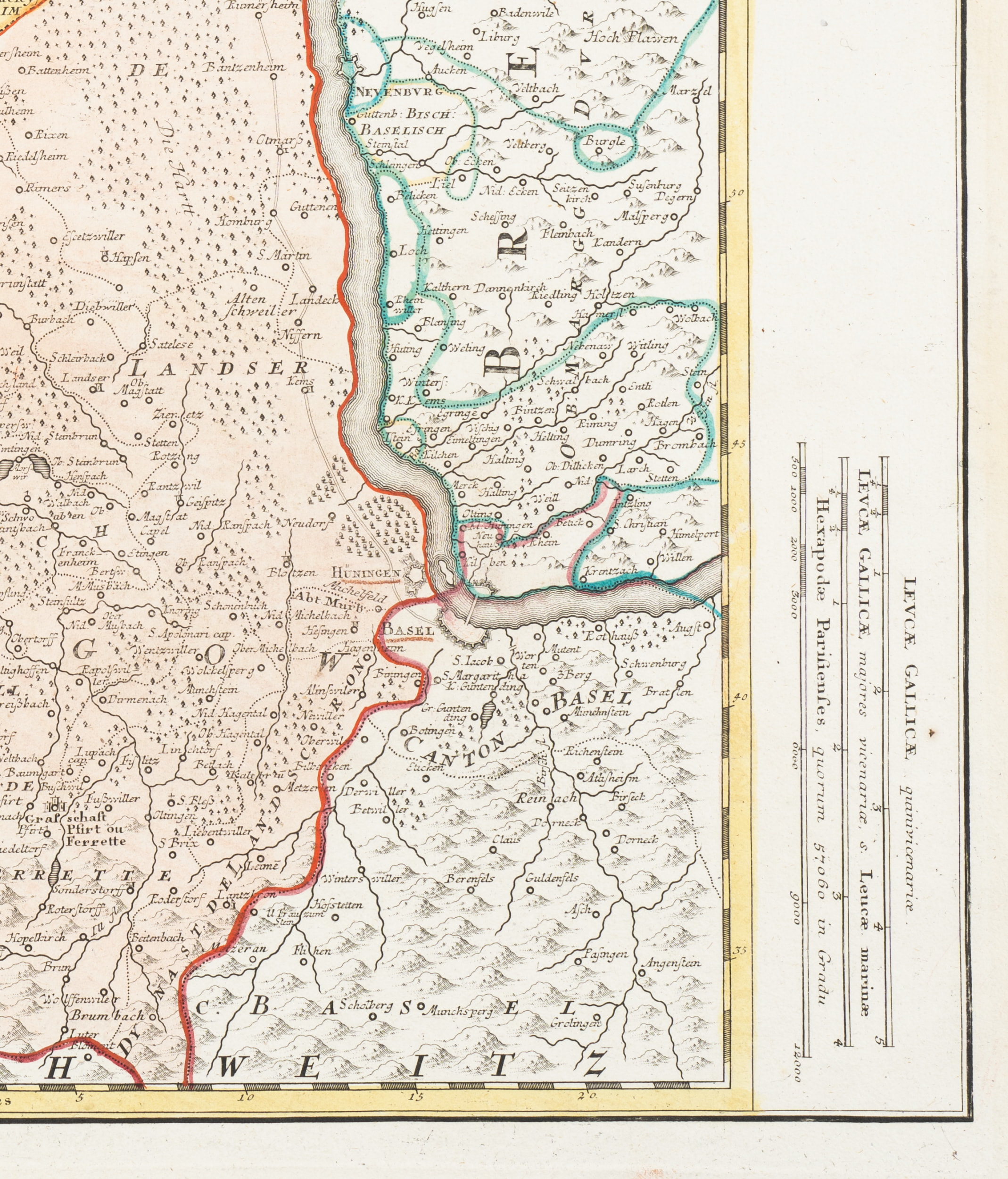
Johann Baptist Homann (1664 Kambach - 1724 Nürnberg), Historische Karte Oberelsass. Kartografische Darstellung Oberelsass und Sundgau, um 1720, Kupferstich
- Technik: Handkolorierter Kupferstich auf Papier
- Bezeichnung: Oben im Druck bezeichnet: "ALSATIA SUPERIOR una cum SUNTGOVIA".
- Datierung: um 1720
- Beschreibung: Das Kunstwerk zeigt eine präzise kartografische Darstellung der Region Oberelsass und Sundgau. Verschiedene Farben markieren territoriale Grenzen und Gebiete mit komplexer Detailfülle. Die lateinische Beschriftung deutet auf historische Kontexte des Gebietes hin, ohne eine spezifische Narration.
- Schlagworte: Karte; Oberelsass; Sundgau; Grenzen; Territorium; Historisch; Kartografie; Farbcodierung; Latainisch; Region; Alsace; Elsass; Geografie; Europa; Landkarte; Detail; Markierung; Historie; Gebiet; Zeichnung, Landkarten, Frankreich, Straßburg, Rokoko, 1700-1749
- Größe: Papier: 61.3 cm x 53.8 cm
- Zustand: Akzeptabler Zustand. Übliche horizontale Mittelfalz. Falz von den Seiten her eingerissen und knittrig. Auf dem Blattrand rechts deutlich verfärbt und entlang der Kanten mit Flüssigkeitsflecken. Entlang der Kanten einzelne kurze Randeinrisse. Oben rechts deutlicher Ausriss der Kante. Unten links druckbedingte Quetschfalte auf dem Blattrand. Die Blattecken sind geringfügig bestoßen und geknickt.
English Version:
Johann Baptist Homann (1664 Kambach - 1724 Nuremberg), Historical map of Upper Alsace Cartographic representation of Upper Alsace and Sundgau, c. 1720, Copper engraving
- Technique: Hand colored Copper engraving on Paper
- Inscription: At the upper part inscribed in the printing plate: "ALSATIA SUPERIOR una cum SUNTGOVIA".
- Date: c. 1720
- Description: The artwork shows a precise cartographic representation of the Upper Alsace and Sundgau region. Different colours mark territorial borders and areas with a complex wealth of detail. The Latin labelling indicates the historical context of the area without a specific narrative.
- Keywords: Map; Upper Alsace; Sundgau; Borders; Territory; Historical; Cartography; Colour coding; Latin; Region; Alsace; Alsace; Geography; Europe; Map; Detail; Marking; History; Territory; Drawing, 18th century, Rococo, Maps, France,
- Size: Paper: 61.3 cm x 53.8 cm (24.1 x 21.2 in)
- Condition: Rather good condition. Usual horizontal centrefold. Fold torn from the sides and creased. Clearly discoloured on the right margin and with liquid stains along the edges. Single short marginal tears along the edges. Upper right edge clearly torn out. Pressure-related crease in the lower left margin. The corners of the sheet are slightly bumped and creased.
For international customers outside the European Union: eBay will charge an "Internet Sales Tax". As of January 1, 2020, 38 states in the US, Australia and New Zealand require the collection of sales tax. Further states and countries may be included in this procedure. In such cases, eBay collects and remits Internet Sales Tax on your behalf. In these states, the way taxable transactions are processed, is as follows: 1. In states where eBay is required to collect Internet Sales Tax from buyers, order totals sent for processing will reflect the gross order amount inclusive of tax, if your shipping location is in one of these countries. The tax rate varies from state to state. 2. Once settled, the tax amount will be automatically deducted for remittance to the applicable taxing authority. This tax is to be paid by the buyer. Each state’s legislation dictates if shipping and handling are taxable or not. In those states where eBay is collecting tax, the tax on shipping and handling will be collected where applicable.
Furhter information can be found at this eBay customer service page.
Furhter information can be found at this eBay customer service page.
© 2022 Buchprojekt1 / powered by createyourtemplate