Please note that
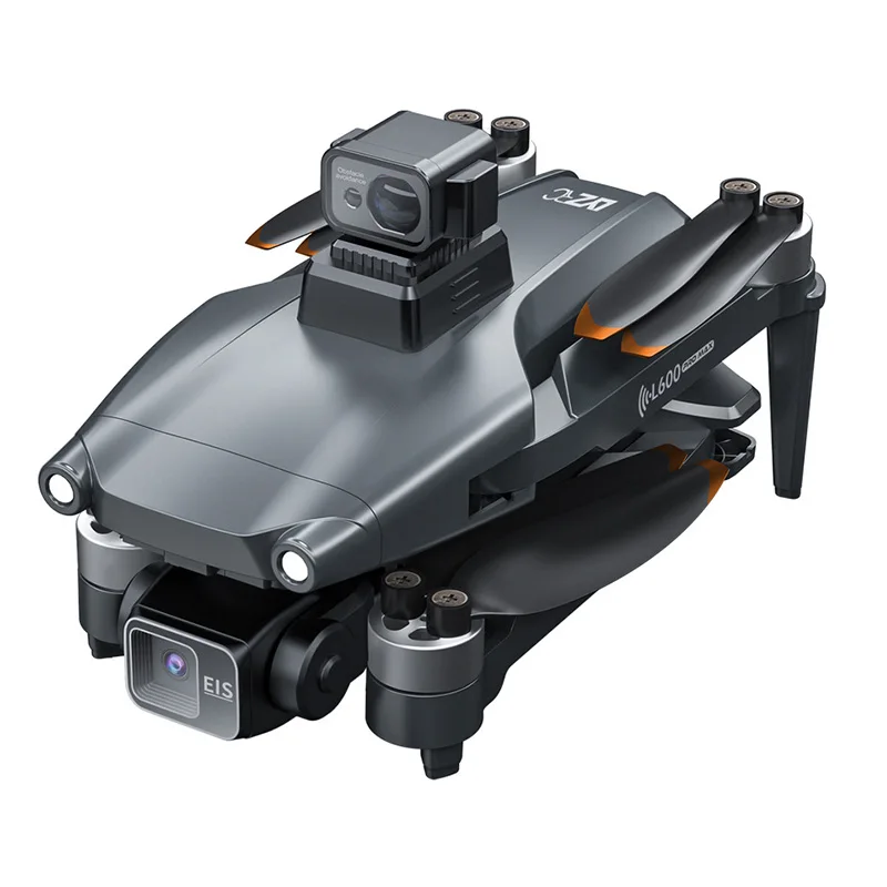
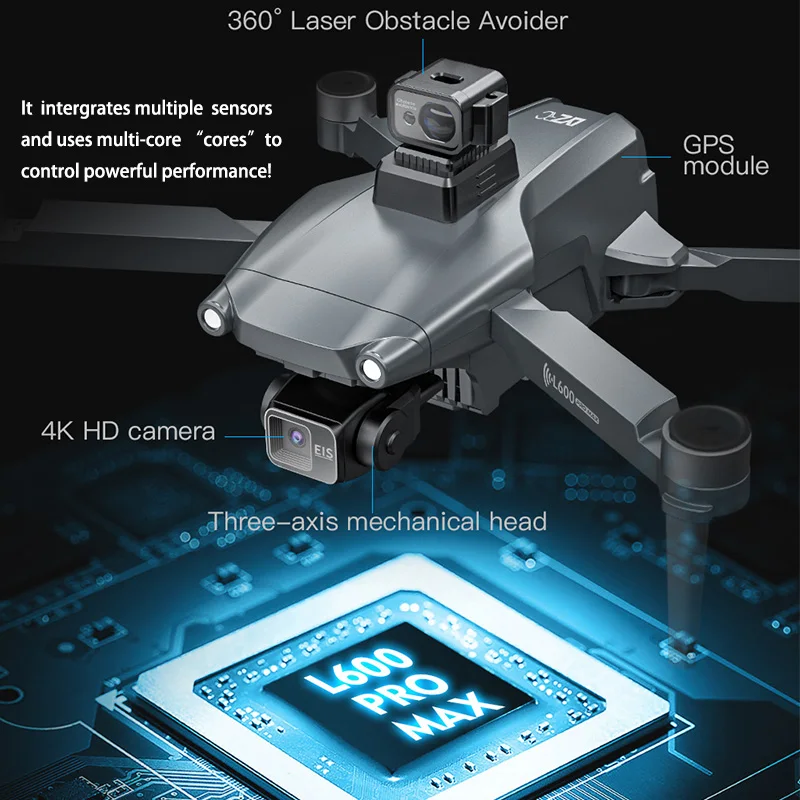
L600 PRO MAX with obstacle avoidance device
L600 PRO is the servo version, and L600 PRO MAX is the three-axis gimbal !!
L600 PRO MAX Description:
Drone Model: L600 PRO MAX Drone
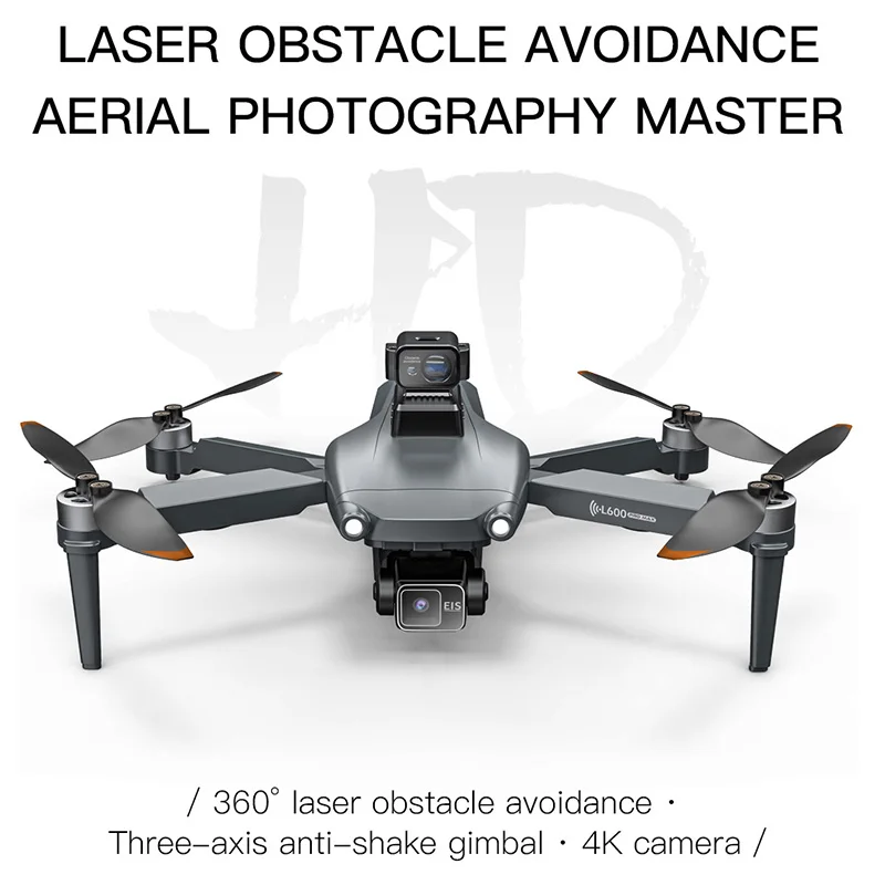
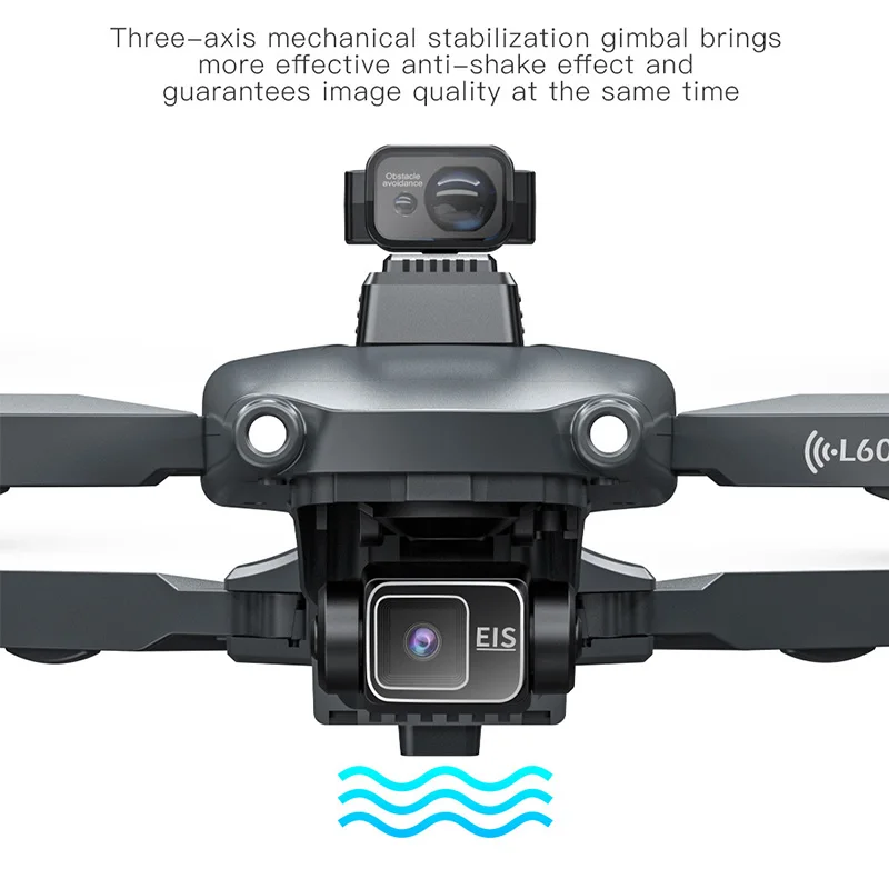
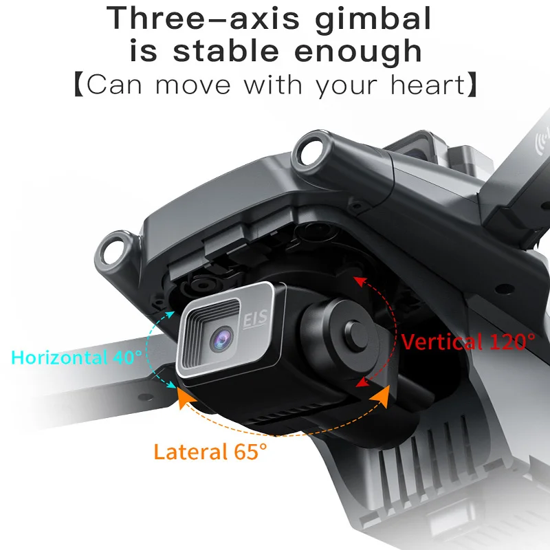
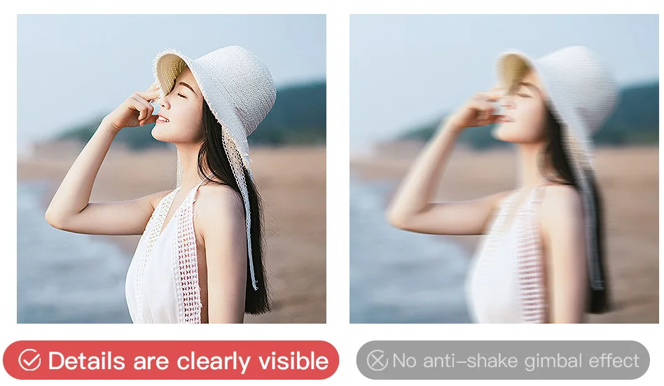
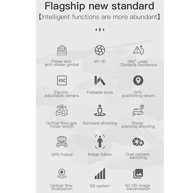
3-Axis Gimbal Stablizer
Channel: 4 Channels
Gyro: 6 Axis
Motor: Brushless Motor
Pressure sensor: Height setting
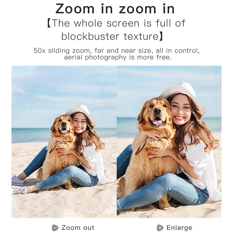
Camera Wide Angle: 110°
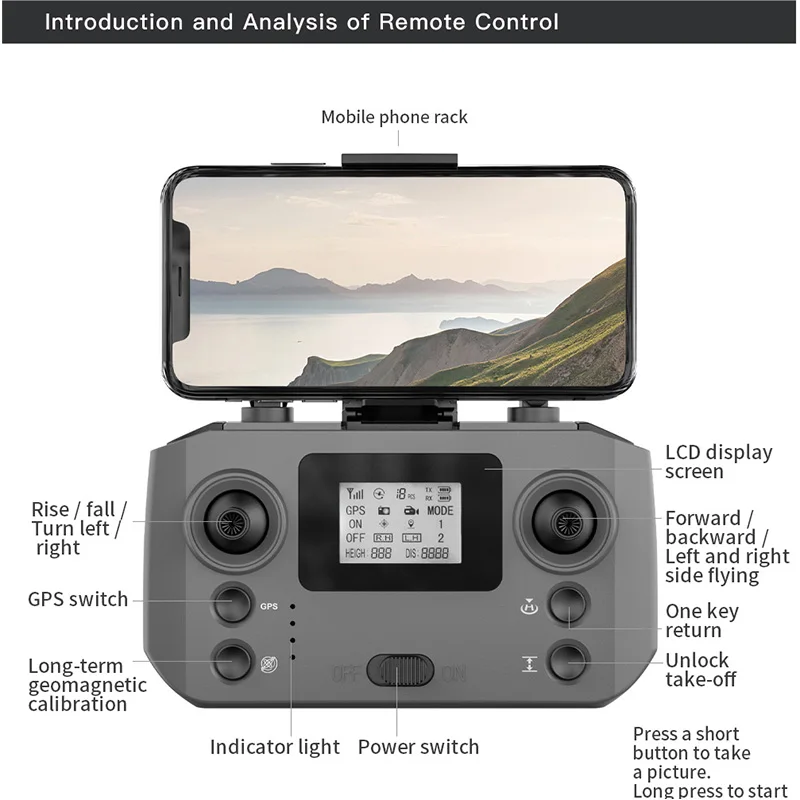
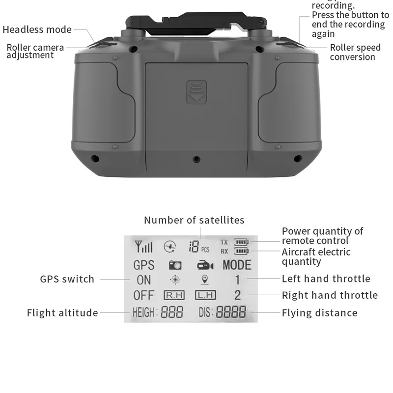
Remote Control Frequency: 2.4GHz
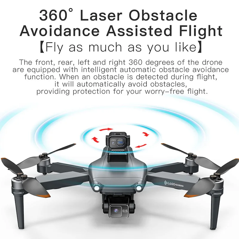
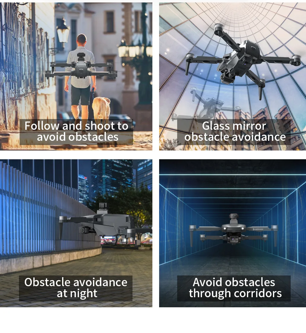
Laser obstacle avoidance: 360°
Laser obstacle avoidance distance: 25M
Remote Control Distance: About 3000 Meters (No Interference, No Occlusion)
Image Transmission Distance: 1200 Meters (No Interference, No Occlusion)
Flight altitude:300M
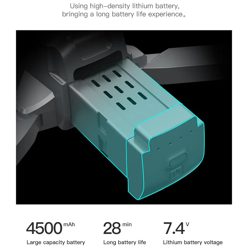
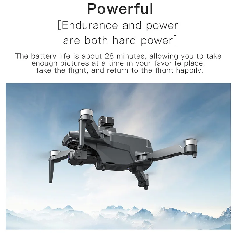
Drone Battery: 7.4V/4500mAh Lithium Battery Flight Time: Max 25 Minutes
Front Camera Photo Resolution: 3840*2160P
Front Camera Video Resolution: 2660*1440P(SD)
Bottom Camera Photo Resolution: 1280*720P
Bottom Camera Video Resolution: 1280*720P
Frame Rate: 30 fps
Photo Recording Mode: Remote Control + APP Control
Remote Control Battery: 3.7V/400mAh Lithium Battery (Included)
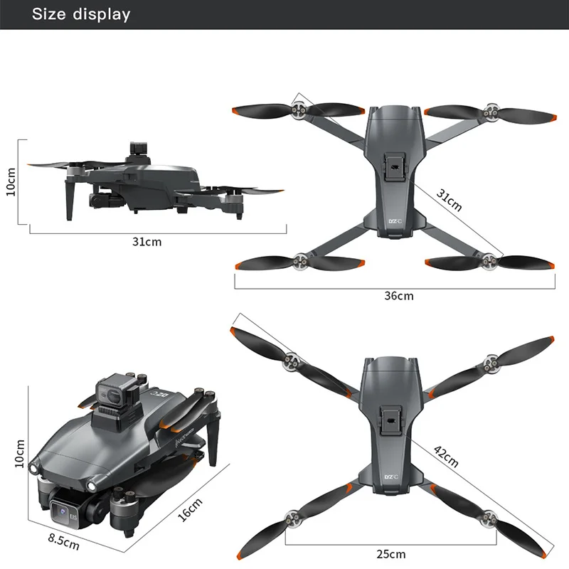
Quadcopter Size:420*360*10MM (Unfoldable),160*100*85MM (Foldable)
Quadcopter Weight:350g (NO battery)
Battery Weight: 96.4g
Obstacle Avoidance Device Weight: 23.8g
SD Card Support: Support 32-128G (NO sd card in the package)
Color: Silver Gray
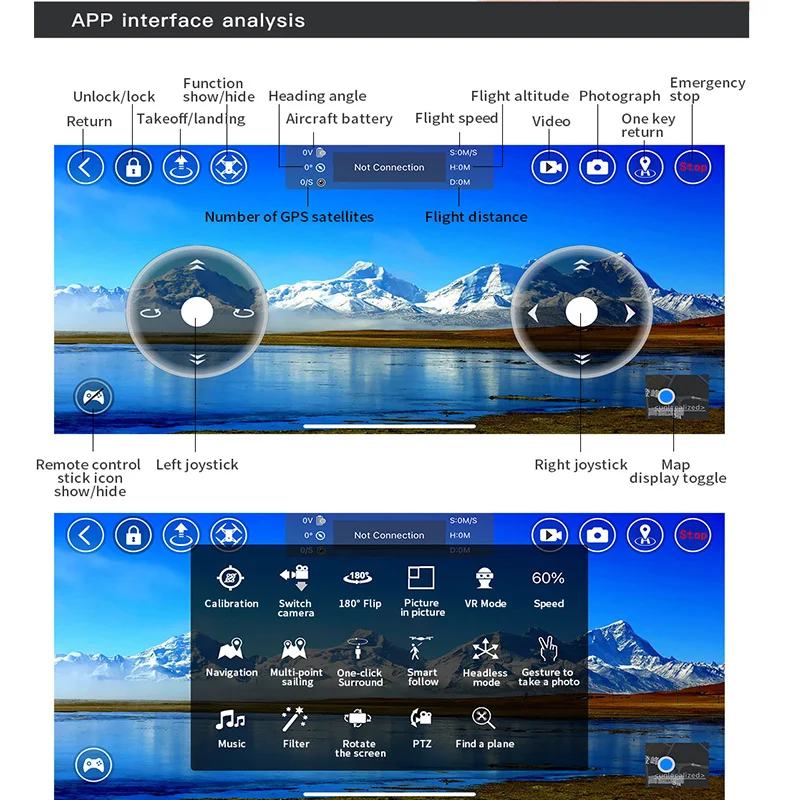
Function Introduction:
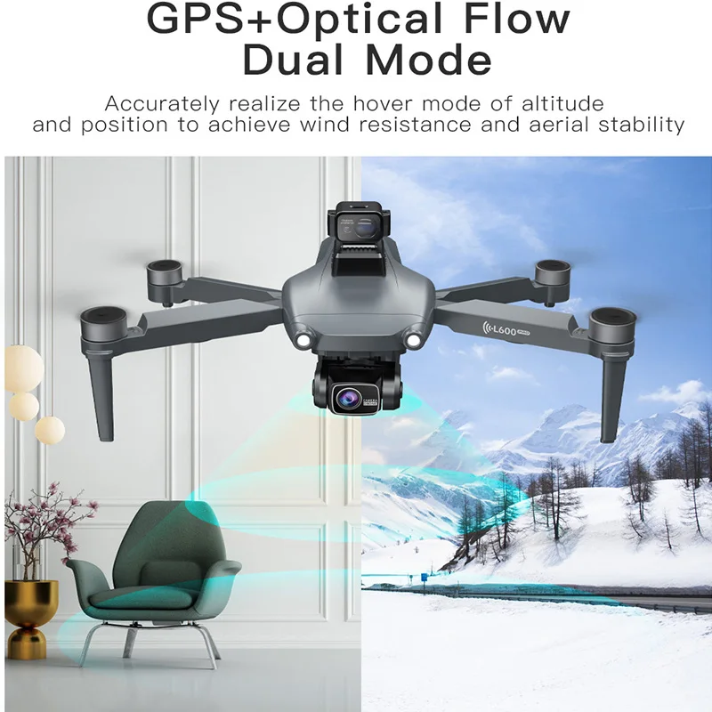
1. 360° laser obstacle avoidance, 3-Axis gimbal, automatically detect obstacles within 20 meters, making flight safer. (obstacle avoidance device optional).
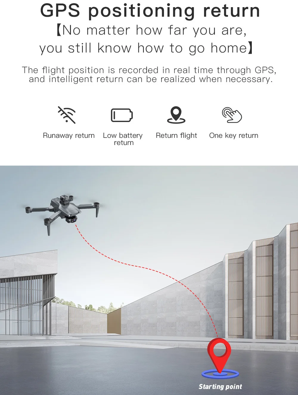
2. GPS one click return to takeoff point, low battery return, no signal return.
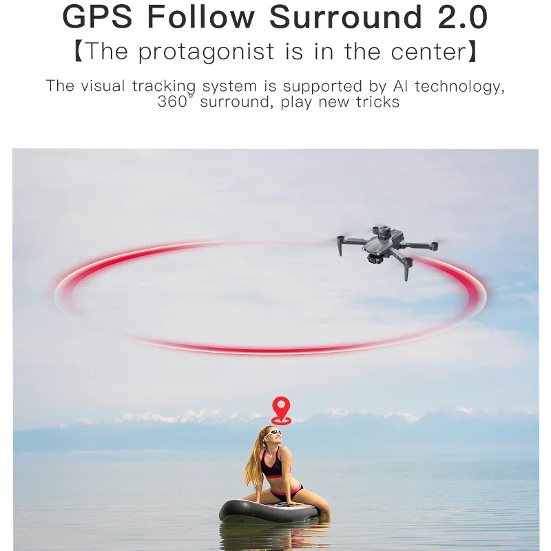
3. ① GPS intelligent tracking; ② Image following: Identify the shooting object and perform automatic following flight
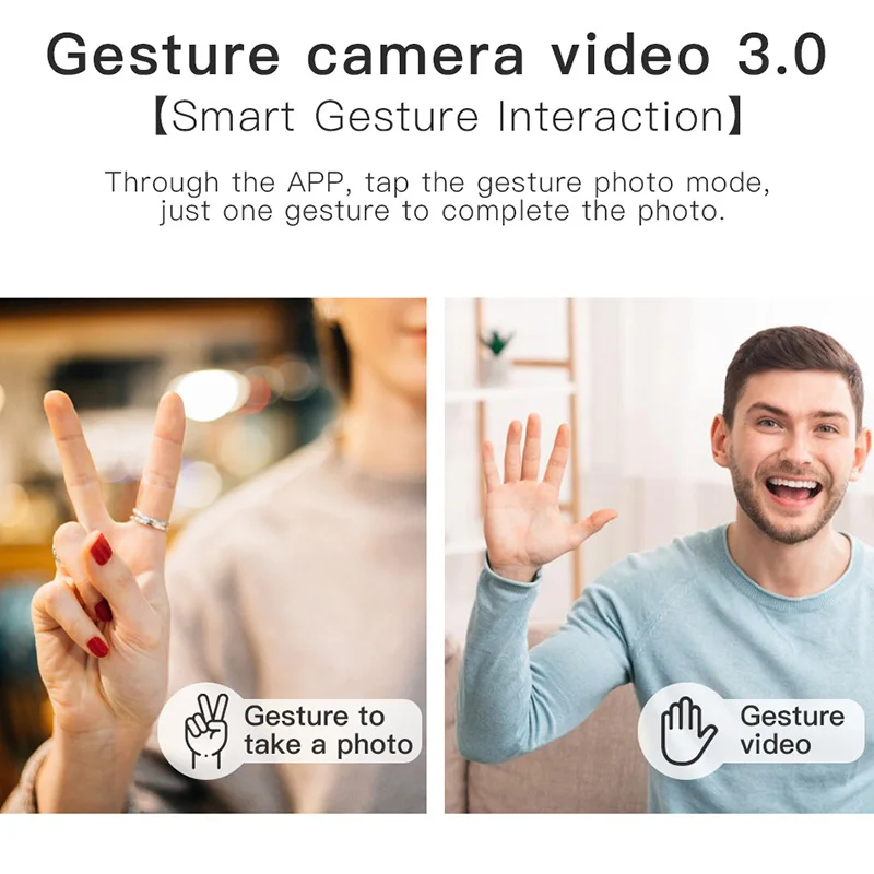
4. Gesture recognition: Within 1-3m from the aircraft, make a photo gesture/camera gesture in front of the camera
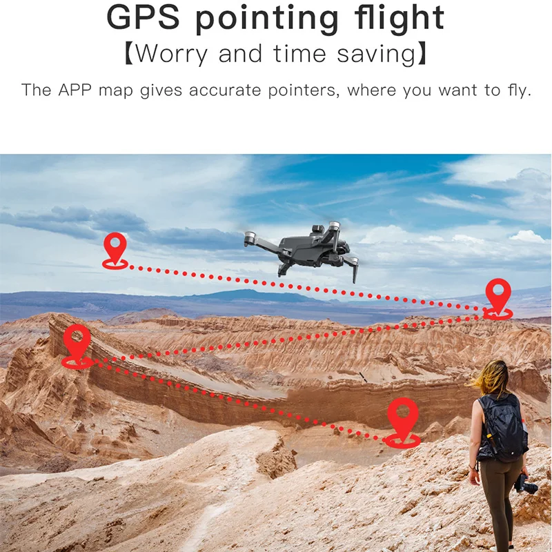
5. Route multi-point planning flight: The aircraft flies independently according to the pre-set route, and players focus on shooting.
6. Fixed point surround: Find the center point of the surround, and then use the joystick to move the desired surround radius.
7. Aircraft retrieval function: continuously click on the GPS signal icon 3 times to open the map interface, where the map displays the final distance, longitude and latitude position of the aircraft.
8. Pictures can be shared with music and videos: You can choose to share photos with one or more options, and videos can only be shared individually at a time.
9. ESC 4K HD Wide Angle Camera, 360° adjusted by controller. (laser obstacle avoidance optional).