Kurfürstentum Brandenburg Original Gunding Ottens 1740
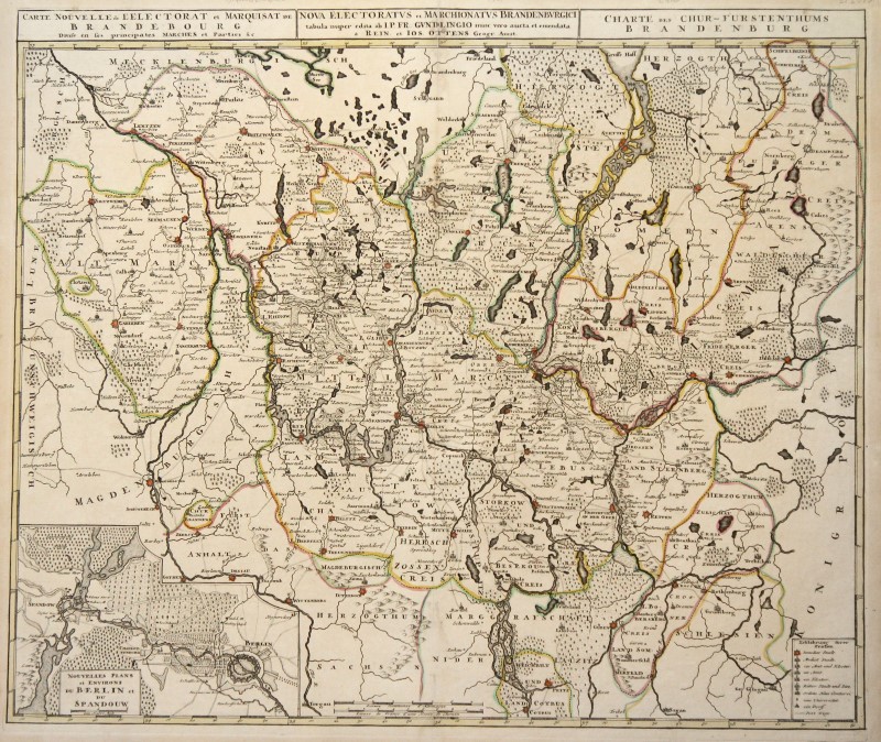
Brandenburg (electorado): Kst.- Map, n. Gundling b. R. u. J. Ottens, 'Carte Nouvelle de L'Electorat et Marquisat de Brandenbourg Divise en SES Principios Marches et Parties & c. - Nova Electoratvs et Marchionatvs Brandenbvrgici Tabula Nuper Edita. - Charte of the Chur - Principado de Brandenburg. '
con color de borde antiguo, alrededor de 1740, 48.5 x 57.5
¡Casi nunca! - Koemann, vol. 4 (Catalogne), p. 88, no. 92; Schulz, mapas de la ciudad de Berlín 1652 a 1920, no. 65; Copia inteligente y ampliamente distorsionada del mapa del erudito de la corte prusiano (e involuntaria Hofnarren) JP de Gundling; rangos desde el Müritz en el norte hasta Cottbus en el sur, desde Altmark en el oeste hasta Dramburg [Drawsko Pomorskie] en el este; Right at the bottom of Berlin 'Nouvelles Plans et Environs du Berlin et Spandouw': 'The importance of this secondary card lies in the first printed representation of the Friedrichstadt expansion of the rondel' (Schulz), the map ranges from Spandau in the west to Heinersdorf in the east, from the 'Spandovsche Heyde' to the leak of the Landwehr Canals from the Spree en el sur; El pliegue en la parte superior estalló ligeramente y almacenado, de lo contrario en buen estado.
Número de artículo: 323028


