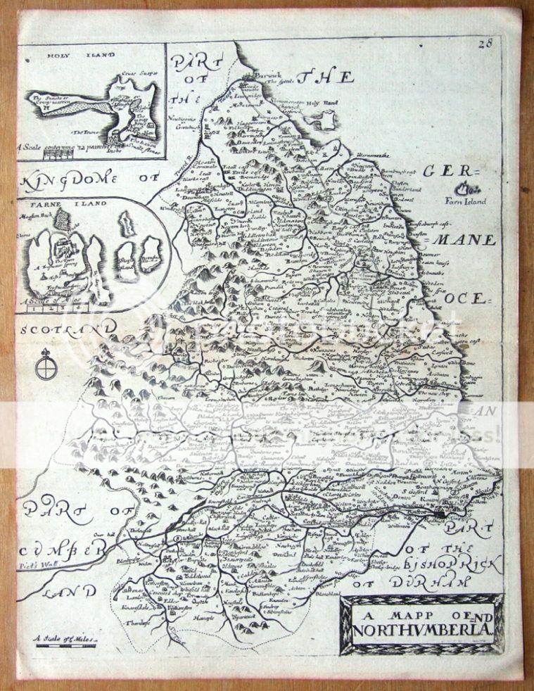
| A Mapp of NORTHUMBERLAND With its Hundreds by Richard Blome. Published London circa 1735 by Thomas Bakewell in "England Exactly Described". A fine copper engraved county map of Northumberland. Features two inset maps of Holy Island (Lindisfarne) with "a scale conteyning 32 pearches to one inch" and The Farne Islands with a scale of miles. This somewhat more scarce Bakewell edition was published in a larger book than the usual Taylor Blomes and hence has only a single fold as opposed to the three usually found. Some light patchy browning as seen. Centre fold as issued. Left margin cropped as issued. Sheet size approx. 10" x 8" (260mm x 195mm) on hand laid paper.
Richard Blome ( 1635-1705) was an active and prominent map publisher in 1670's London. He drew much contemporary crticism for blatant plagiarism but this did not seem to impede his success. His notable achievements included the "Brittania" and "The Geographical Description of the Four Parts of the World". At least in his "Speed's Maps Epitomiz'd" he gave credit to his sources. Thomas Taylor was later to re issue Blome's English county maps in 1715 in a slightly smaller format in "England Exactly Described". A further edition of "England Exactly Described" was published circa 1735 by Thomas Bakewell.
A GENUINE ANTIQUE MAP GUARANTEED OVER 250 YEARS OLD FROM LINDISFARNE PRINTS We do not deal in reproductions, facsimiles or modern copies of any kind.
SHIPPING UK £2.50 via Royal Mail Recorded Delivery Europe £8.50 via Royal Mail International Signed For Airmail USA, AUSTRALIA and the rest of the World £9.95 via Royal Mail International Signed For Airmail
.............................................................. THANKS FOR YOUR INTEREST! ............................................................ Why not browse our ebaystore? Be sure to add me to your favorites list! Check out my other items! 
TJJ112 |