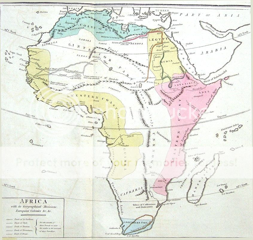
AFRICA WITH ITS GEOGRAPHICAL DIVISIONS, EUROPEAN COLONIES &c.
Engraved for
Le Sage's
Historical, Genealogical, Chronological & Geographical Atlas
Second Edition published London 1818
A most attractive & informative map of Africa from the English edition of Le Sage's impressive French folio atlas. This is the second English edition and is updated until 1818.
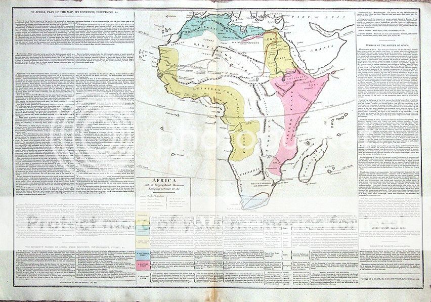
The map is surrounded on three sides ( please see the last image) by a wealth of information including a physical & historical summary and a coloured key to European possessions.
The map is finely engraved and clearly printed, while attractive hand colour accentuates detail.
Centrefold as issued and save for some light offsetting, in fine condition . Blank verso
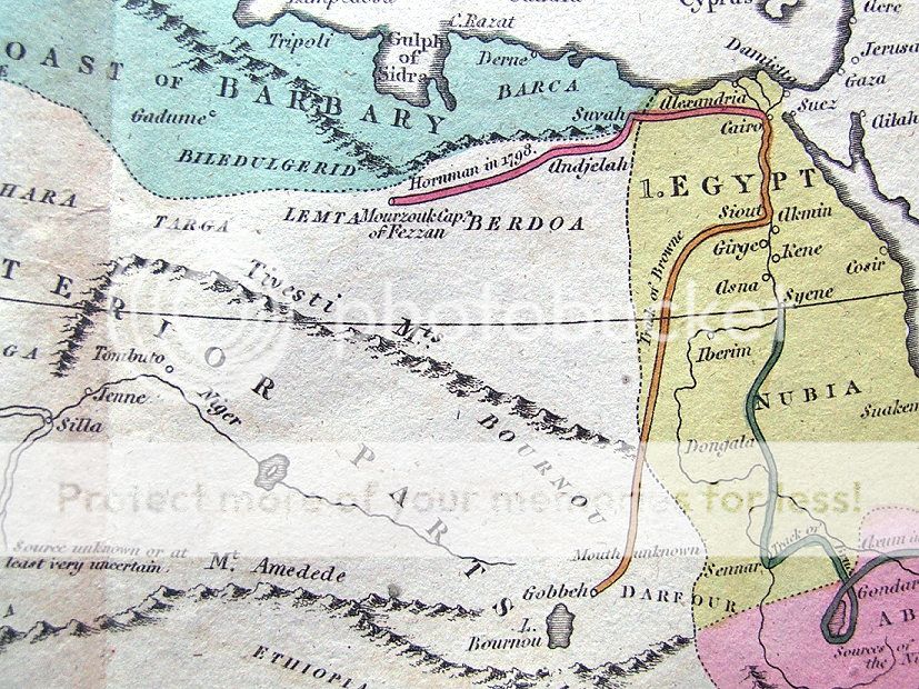
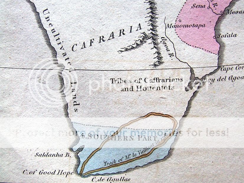
Please go to close ups to view further images.
Approx. 28" x 19.5" (710 mm x 490mm) overall , 14" x 13" ( 360mm x 330mm) map area only