See our ratings  Add this shop to my favorites  |
||
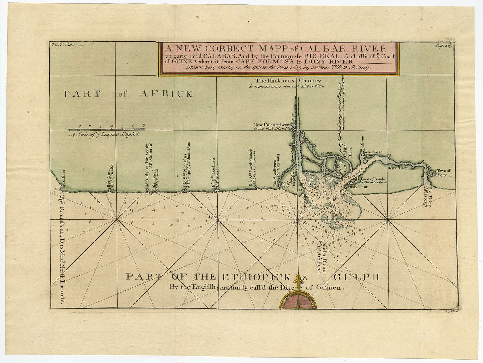 |
Antique Map of the Coast of Africa by Kip (1732) $ 659.06 instead of Availability: in stock Condition : Good, given age. A few minor spots. Some minor crinkles and creases. Original folds as issued. General age-related toning and/or occasional minor defects from handling. Please study image carefully. Date : 1732 Overall size : 43.8 x 32.4 cm. Image size : 37.7 x 24.5 cm. Description: Antique map titled 'The New Correct Mapp of Calbar River vulgarly call'd Calabar (..)'. An interesting map of the coast from Cape Formosa to the Dony River stated on the map to be "drawn very exactly on the Spot in the Year 1699 by several Pilots Jointly." Filled with soundings, showing the locations of shoals and oriented by a compass rose and rhumb lines. This map originates from volume 5 of 'A Description of the Coasts of North and South Guinea and of Ethiopic Inferior' by John Barbot. Artists and Engravers: Made by 'Johannes Kip' after 'John Churchill'. |
|