See our ratings  Add this shop to my favorites  |
||
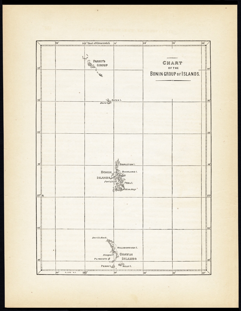 |
Antique Map of the Bonin Islands by Hawks (1856) $ 102.98 Availability: in stock Condition : Excellent given age. General age related toning and occasional light foxing. Please study image carefully. Date : 1856 Overall size : 21.5 x 28 cm. Image size : 16 x 22 cm. Description: Antique map titled 'Chart of the Bonin Group of Islands.' The Bonin Islands, known in Japan as the Ogasawara Group are an archipelago of over 30 subtropical and tropical islands, some 1,000 kilometres directly south of Tokyo, Japan. This print originates from 'Narrative of the expedition of an American squadron to the China seas and Japan, performed in the years 1852, 1853, and 1854, under the command of Commodore M.C. Perry (..)' by Francis L. Hawks. Artists and Engravers: Lithographs after W. Heine and E. Brown. |
|