See our ratings  Add this shop to my favorites  |
||
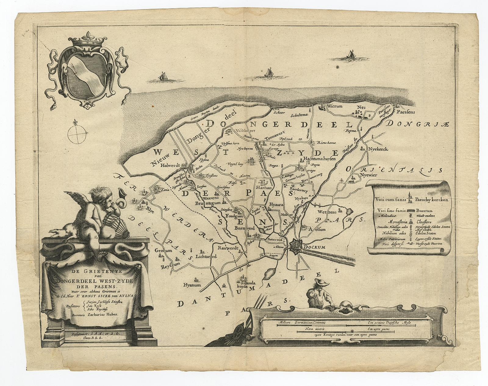 |
Antique Map of the region of Dongeradeel by Schotanus (1664) $ 173.59 instead of Availability: in stock Condition : Fair, given age. Two vertical creases, left and right. Edges with an occasional tiny tear. Bottom left and right corner paper loss; restored and part of the cartouche lower left retouched. Some creasing in the left and right margins. Original middle fold as issued. General age-related toning and/or occasional minor defects from handling. Please study image carefully. Date : 1664 Overall size : 40 x 31 cm. Image size : 36 x 27.7 cm. Description: Antique map titled 'De Grietenije van Dongeradeel West-zyde der Pasens (..)'. Map of the Grietenij of Dongeradeel, Friesland, The Netherlands. Multiple cartouches, key and coat of arms. Originates from "Beschrijvinge ende nieuwe caerten van de Heerlyckheydt van Frieslandt (…).", by Schotanus a Sterringa, first published in 1664. |
|