See our ratings  Add this shop to my favorites  |
||
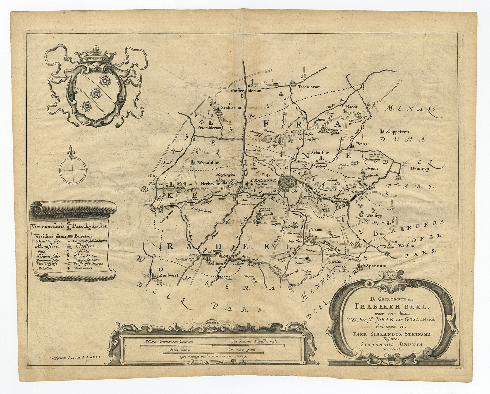 |
Antique Map of the region of Frankeradeel by Schotanus (1664) $ 228.91 Availability: in stock Condition : Good, given age. Slight discolouration of paper. Original middle fold as issued. Some faint creasing. Offsetting, from folding when the ink had not fully dried. General age-related toning and/or occasional minor defects from handling. Please study image carefully. Date : 1664 Overall size : 38.7 x 30.8 cm. Image size : 36.4 x 27.8 cm. Description: Antique map titled 'De Grietenije van Franeker deel (..)'. Map of the Grietenij of Franekeradeel, Friesland, The Netherlands. Multiple cartouches, key and coat of arms. Originates from "Beschrijvinge ende nieuwe caerten van de Heerlyckheydt van Frieslandt (…).", by Schotanus a Sterringa, first published in 1664. |
|