See our ratings  Add this shop to my favorites  |
||
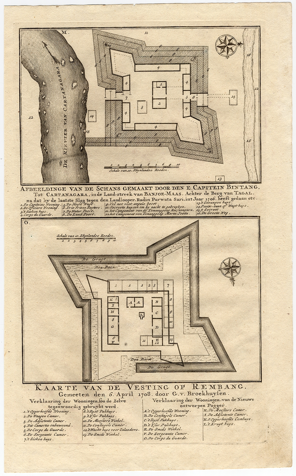 |
Antique Map of the Fortress of Captain E. Bintang by Valentijn (1726) $ 108.86 instead of Availability: in stock Condition : Good, given age. Three tiny holes, closed using contemporary paper backed with acid free archival tape. General age-related toning and/or occasional minor defects from handling. Please study image carefully. Date : 1726 Overall size : 20.5 x 33.6 cm. Image size : 18 x 30.4 cm. Description: Antique print titled 'Kaarte van de Schans gemaakt door den E. Capitein Bintang. Kaarte van de Vesting op Rembang.' A plan of the fort constructed by the Captain E. Bintang, in the Banyumas region of Java, Indonesia. A second plan of the Fortress of Rembang. This print originates from 'Oud en Nieuw Oost-Indiën' by F. Valentijn. Artists and Engravers: François Valentijn (1666-1727), a missionary, worked at Amboina from 1684 to 1694 and 1705 to 1713 and travelled extensively in the VOC's lands. |
|