See our ratings  Add this shop to my favorites  |
||
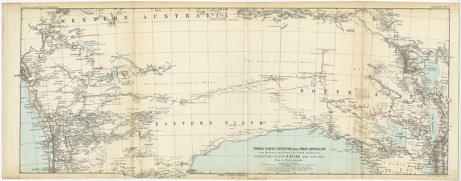 |
Antique Map of Australia from Beltana to Perth by Petermann (1876) $ 294.22 instead of Availability: in stock Condition : Good, general age-related toning. Some creasing and wear, please study image carefully. Date : 1876 Overall size : 69 x 27.5 cm. Image size : 65 x 25 cm. Description: Antique map titled 'Thomas Elders' Expedition durch Inner-Australien von Beltana im Osten bis Perth im Western ausgefuhrt durch E. Giles (..)'. Old map of Australia from Bunbury to Adelaide in the south, upper Murchison to north of Lake Eyre in the north. This map originates from Petermann's 'Geographische Mittheilungen'. Artists and Engravers: Lithograph by C. Helifarth in Gotha. |
|