See our ratings  Add this shop to my favorites  |
||
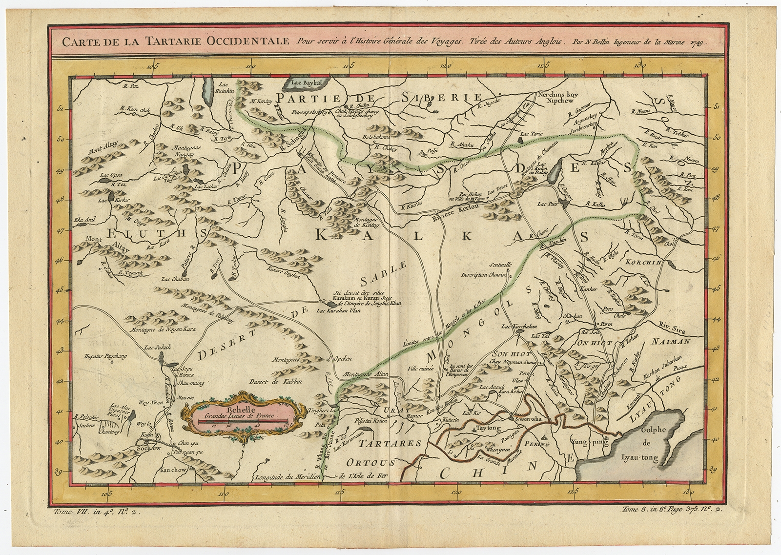 |
Antique Map of Western Tartary by Bellin (1749) $ 517.83 instead of Availability: in stock Condition : Good, given age. Original middle fold as issued. General age-related toning and/or occasional minor defects from handling. Please study image carefully. Date : 1749 Overall size : 34.6 x 24.5 cm. Image size : 30.8 x 22 cm. Description: Antique map titled 'Carte de la Tartarie Occidentale pour Servir a l'Histoire Générale des Voyages. Tirée des Auteurs Anglois.' This map covers western Tartary and focuses on the region of present-day Mongolia. This map reflects information from Kyrkov's important surveys of this remote region in addition to Jesuit and English sources. It includes detail of the roads and shows sections of the Great Wall. Source unknown, to be determined. Artists and Engravers: Jacques-Nicolas Bellin (1703-1772) was a French hydrographer, geographer and member of The Philosophes. His career, spanning over 50 years, caused an enormous outpt in maps, particular of maritime interest. |
|