See our ratings  Add this shop to my favorites  |
||
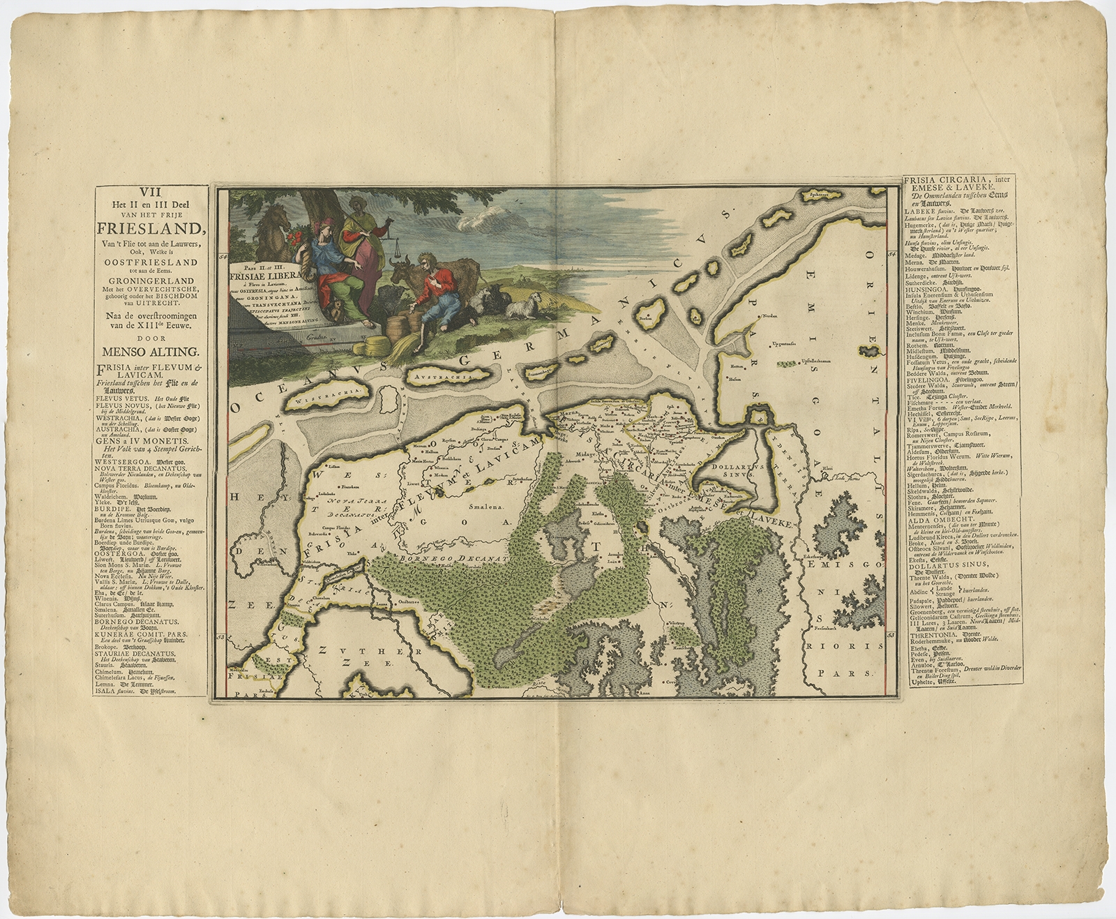 |
Antique Map of Friesland after the floods of the 13th century by Halma (1718) $ 411.91 instead of Availability: in stock Condition : Good, general age-related toning. Minor wear, blank verso. Please study image carefully. Date : 1718 Overall size : 66 x 55 cm. Image size : 42 x 32 cm. Description: Antique map Friesland titled 'Pars II et III Frisiae Libera(..)'. Old map of Friesland, the Netherlands, after the floods of the 13th century. Originates from 'Uitbeelding van de Heerlijkheid van Friesland' by Bernardus Schotanus à Sterringa. This atlas is considered the best atlas of Friesland, the Netherlands. Artists and Engravers: Published by F. Halma, Leeuwarden. |
|