See our ratings  Add this shop to my favorites  |
||
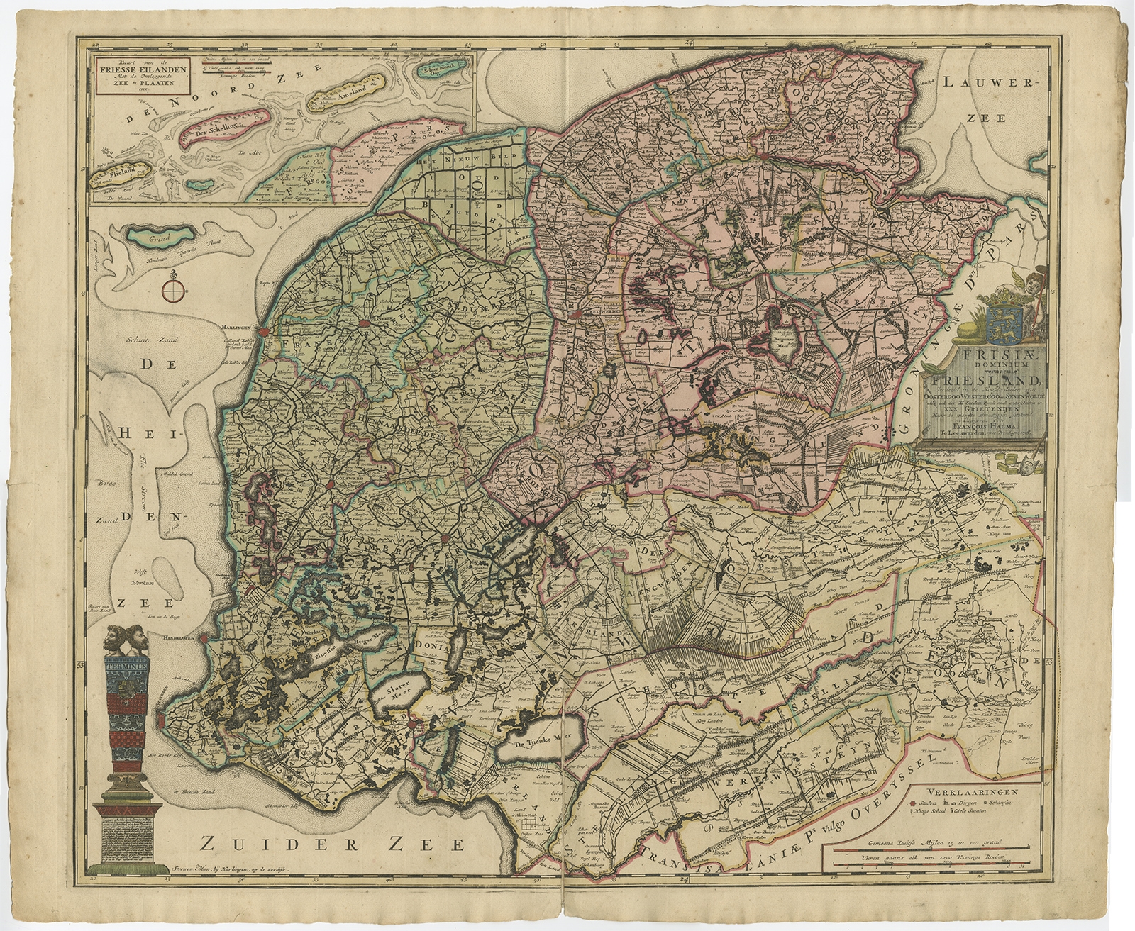 |
Antique Map of Friesland by Halma (1718) $ 882.67 Availability: in stock Condition : Fair/good, general age-related toning. Original/contemporary hand colring. Original folding line, with splits. Minor wear, blank verso. Please study image carefully. Date : 1718 Overall size : 67 x 56 cm. Image size : 59.5 x 52 cm. Description: Antique map titled 'Frisiae Dominium vernacule Friesland (..)'. Original antique map of Friesland, the Netherlands. Originates from 'Uitbeelding van de Heerlijkheid van Friesland' by Bernardus Schotanus à Sterringa. This atlas is considered the best atlas of Friesland, the Netherlands. Artists and Engravers: Published by F. Halma, Leeuwarden. |
|