See our ratings  Add this shop to my favorites  |
||
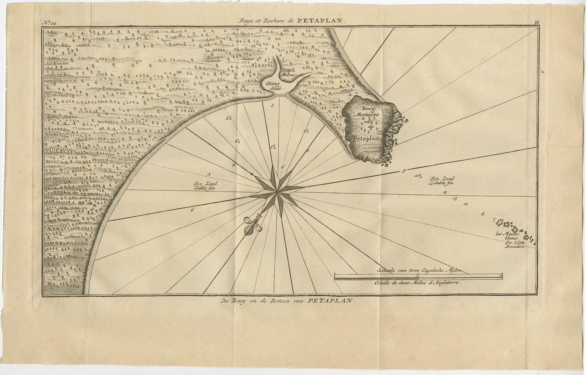 |
Antique Map of the Bay and Rocks of Petatlan by Anson (1749) $ 187.71 instead of Availability: in stock Condition : Good, general age-related toning. Original folding lines. Minor wear, some foxing. Blank verso, please study image carefully. Date : 1749 Overall size : 42 x 27 cm. Image size : 36 x 21 cm. Description: Antique map titled 'Baye et Rochers de Petaplan (..) - De Baay en de Rotsen van Petaplan (..)'. Original antique map of the bay and rocks of Petatlan, Mexico. This map originates from 'Reize rondsom de Werreld (..)' by George Anson, published 1749. Artists and Engravers: Admiral of the Fleet George Anson, 1st Baron Anson, PC, FRS (23 April 1697 – 6 June 1762) was a Royal Navy officer. |
|