See our ratings  Add this shop to my favorites  |
||
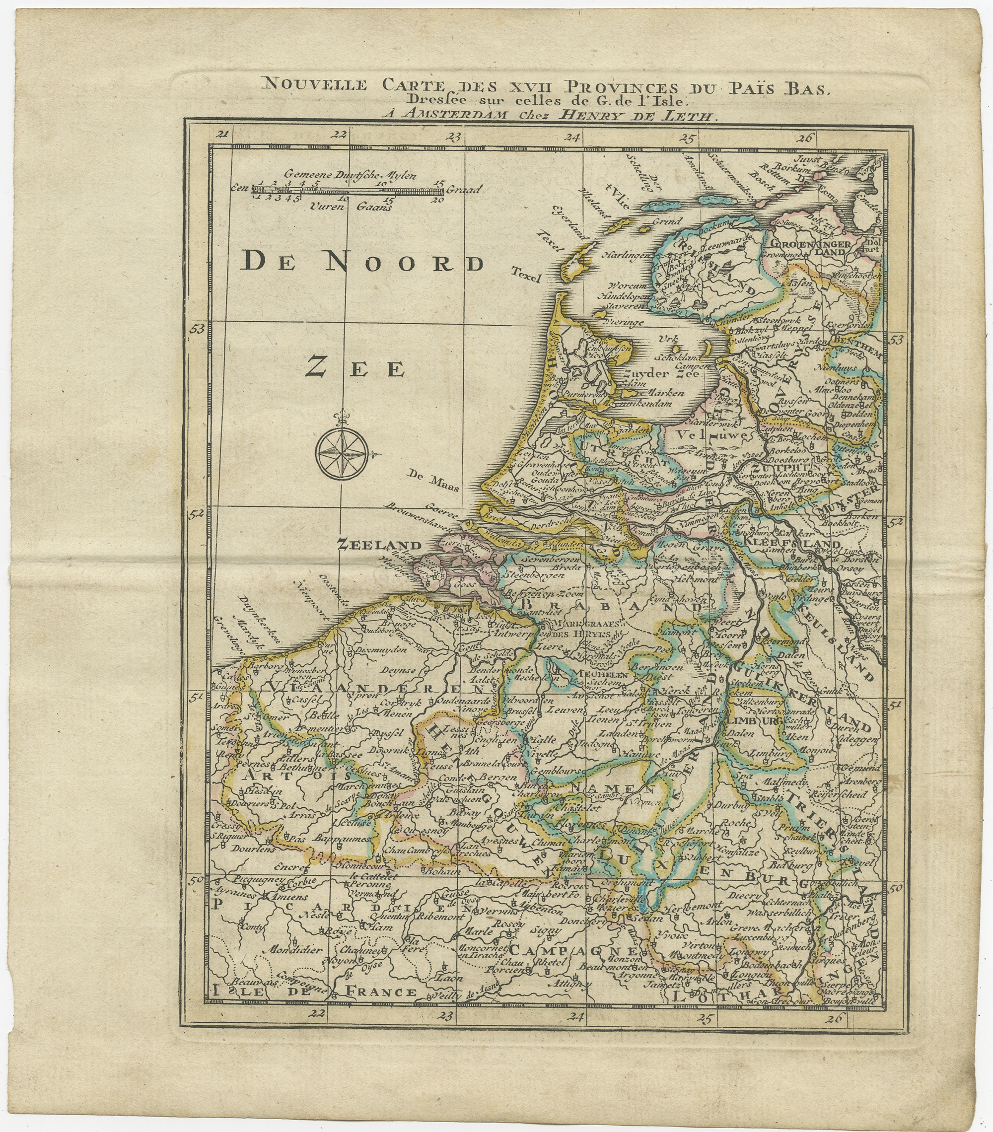 |
Antique Map of the Netherlands and Belgium by Keizer & De Lat (1788) $ 384.26 Availability: in stock Condition : General age-related toning. Original folding lines. Original/contemporary hand coloring, blank verso. Minor wear, please study image carefully. Date : 1788 Overall size : 19.5 x 22.5 cm. Image size : 14.5 x 19.5 cm. Description: Antique map titled 'Nouvelle Carte des XVII Provinces du Païs Bas (..)'. Uncommon antique map of Holland and Belgium. This map originates from 'Nieuwe Natuur- Geschied- en Handelkundige Zak- en Reisatlas' by Gerrit Brender à Brandis. Artists and Engravers: Published by J. Keizer and I. de Lat, 1788. |
|