See our ratings  Add this shop to my favorites  |
||
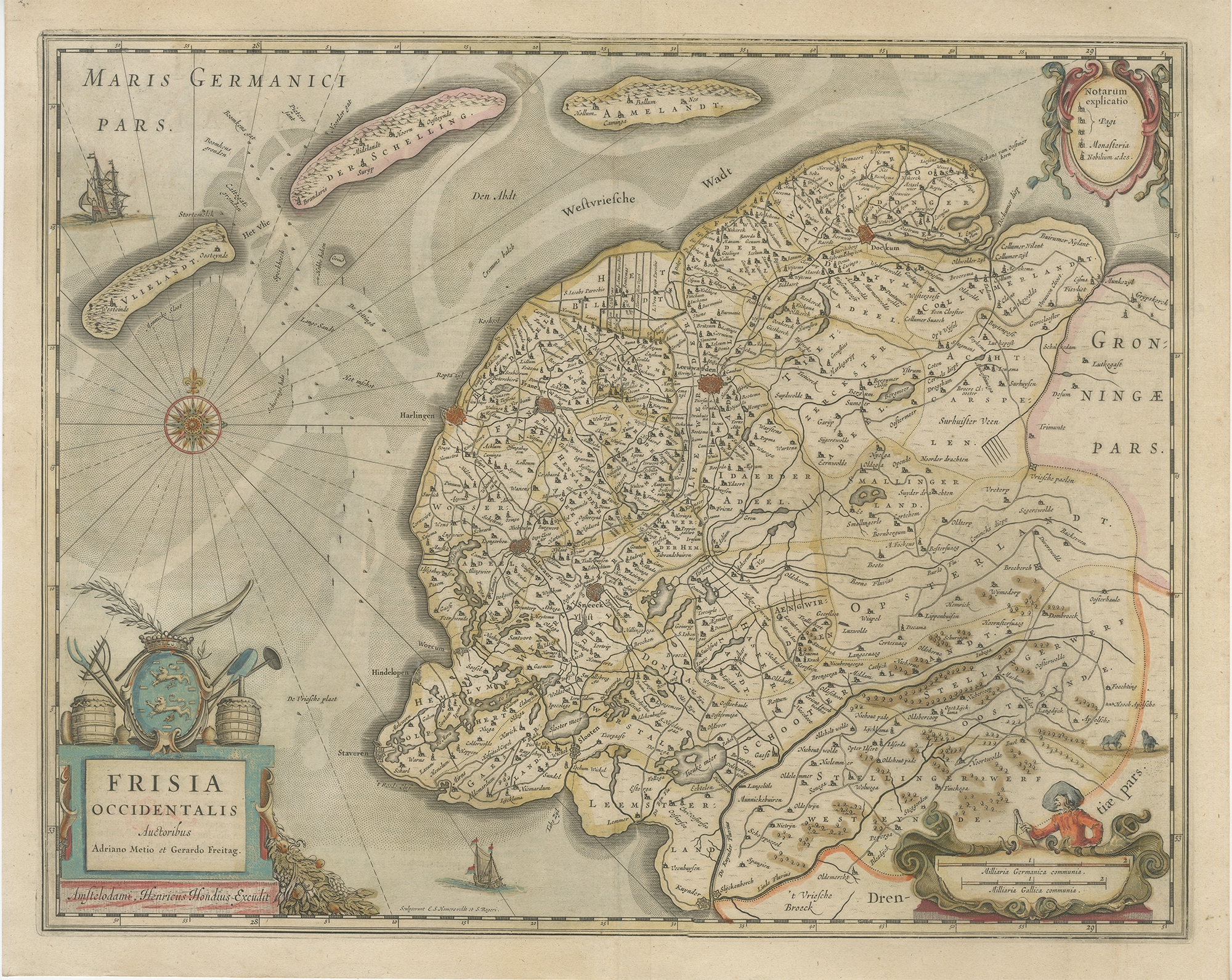 |
Antique Map of Friesland by Hondius (1638) $ 558.44 Availability: in stock Condition : Fair/good, general age-related toning. Minor wear, repair on folding line. Latin text on verso. Please study image carefully. Date : 1638 Overall size : 54 x 43 cm. Image size : 50 x 39 cm. Description: Antique map titled 'Frisia Occidentalis'. Original antique map of Friesland, the Netherlands. First state, originating from 'Atlantis novi pars secunda' published 1638. Artists and Engravers: Henricus Hondius II (1597 – 16 August 1651) was a Dutch engraver, cartographer, and publisher. |
|