See our ratings  Add this shop to my favorites  |
||
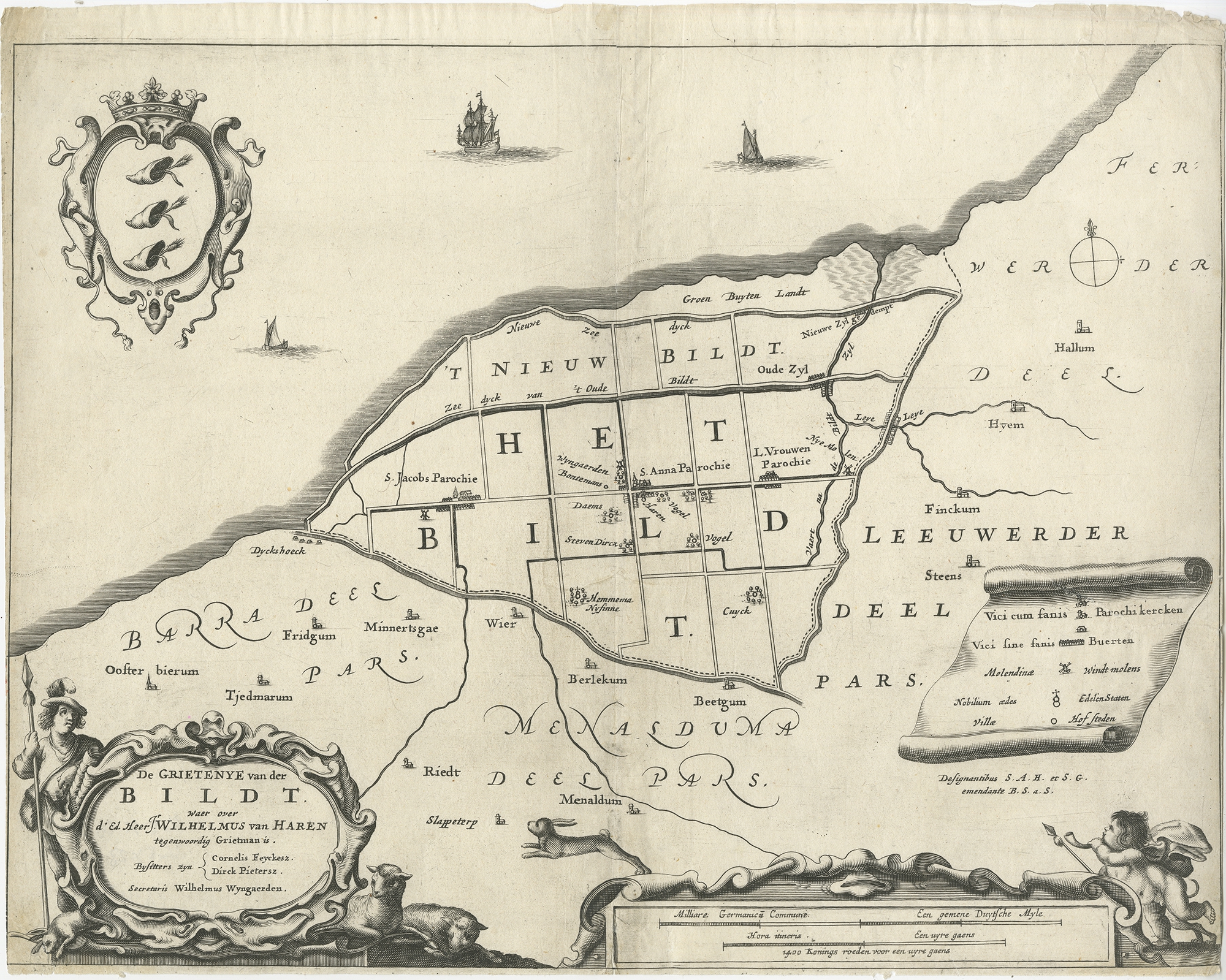 |
Antique Map of the Bildt region by Schotanus (1664) $ 128.87 Availability: in stock Condition : Fair, general age-related toning. Repairs on folding line and tears, also affecting image. Minor wear, blank verso. Please study image carefully. Date : 1664 Overall size : 36.5 x 29.5 cm. Image size : 36.5 x 28 cm. Description: Antique map titled 'De Grietenije van der Bildt (..)' Map of the Grietenij of Het Bildt, Friesland, The Netherlands. Multiple cartouches, key and coat of arms. Originates from "Beschrijvinge ende nieuwe caerten van de Heerlyckheydt van Frieslandt (…).", by Schotanus a Sterringa, first published in 1664. |
|