See our ratings  Add this shop to my favorites  |
||
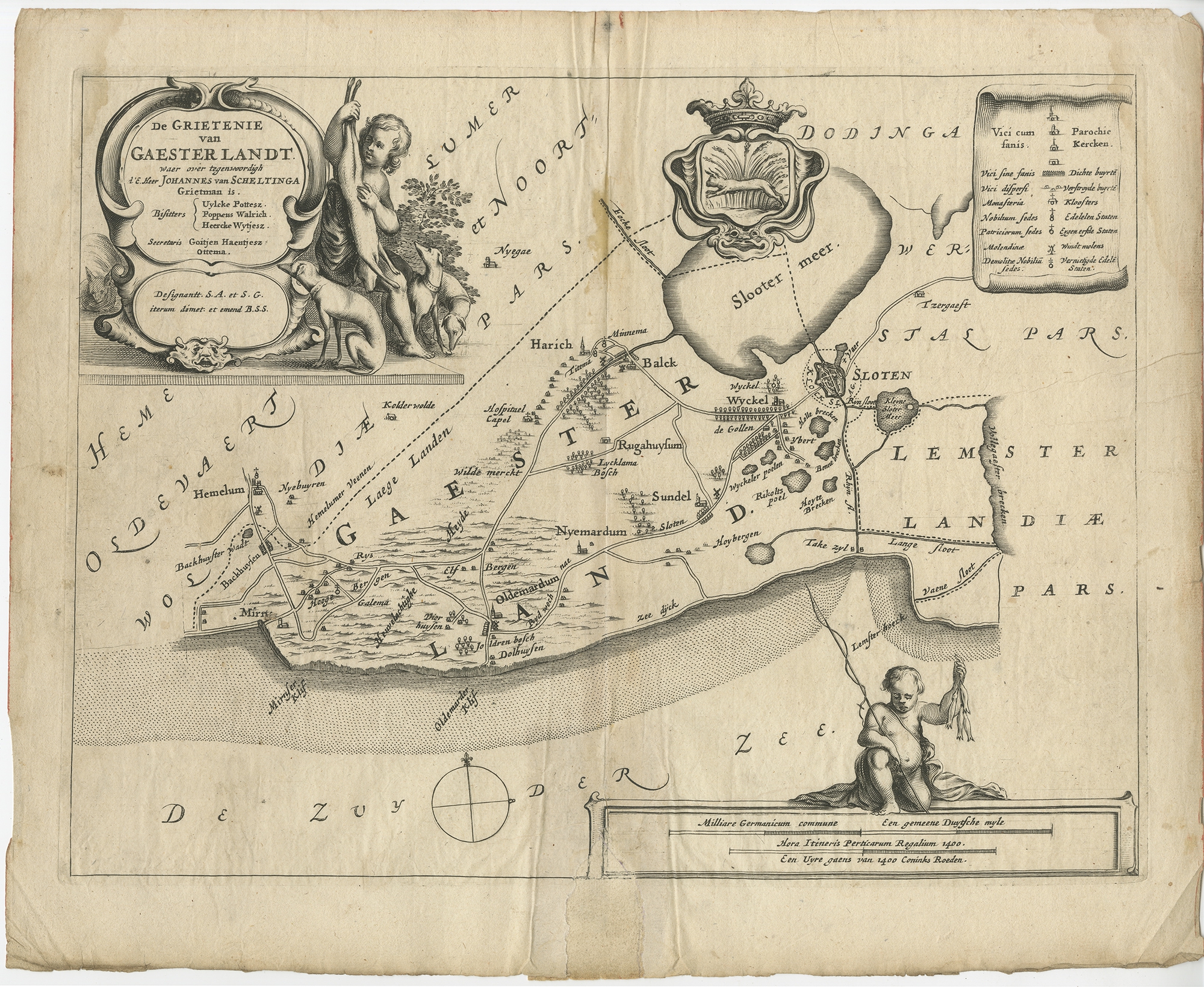 |
Antique Map of the region of Gaasterland by Schotanus (1664) $ 140.64 Availability: in stock Condition : Fair, original folding line. Shows some creasing and staining. Large repair on folding line, also affecting image. Blank verso, please study image carefully. Date : 1664 Overall size : 37.5 x 30 cm. Image size : 33 x 25 cm. Description: Antique map titled 'De Grietenie van Gaesterlandt (..)'. Map of the region of Gaasterland in Friesland, the Netherlands. This region includes the villages of Balk, Sloten, Wyckel and many others. This map originates from 'Beschrijvinge ende nieuwe caerten van de Heerlyckheydt van Frieslandt (..)', by Schotanus a Sterringa, first published in 1664. |
|