See our ratings  Add this shop to my favorites  |
||
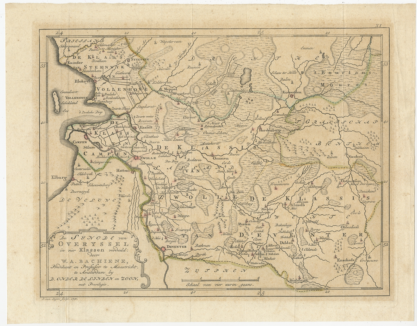 |
Antique Map of Overijssel by Van Jagen (1771) $ 150.05 instead of Availability: in stock Condition : Fair/good, original hand coloring and folding lines. General age-related toning, minor wear. Blank verso. Please study image carefully. Date : 1771 Overall size : 32 x 25 cm. Image size : 27.5 x 21 cm. Description: Antique map titled 'De Synode van Overyssel in vier Klassen verdeeld (..)'. Map of the province of Overijssel, the Netherlands. This map originates from 'Nieuwe kerkelyke geographische zak- en reisatlas der Vereenigde Nederlanden'. Artists and Engravers: Jan van Jagen (1709-1800) was a famous Dutch engraver and cartographer, often employed in Amsterdam. Van Jagen worked alone or together with other engravers/artists and produced multiple maps of the Netherlands, France, Palestine and other countries. |
|