See our ratings  Add this shop to my favorites  |
||
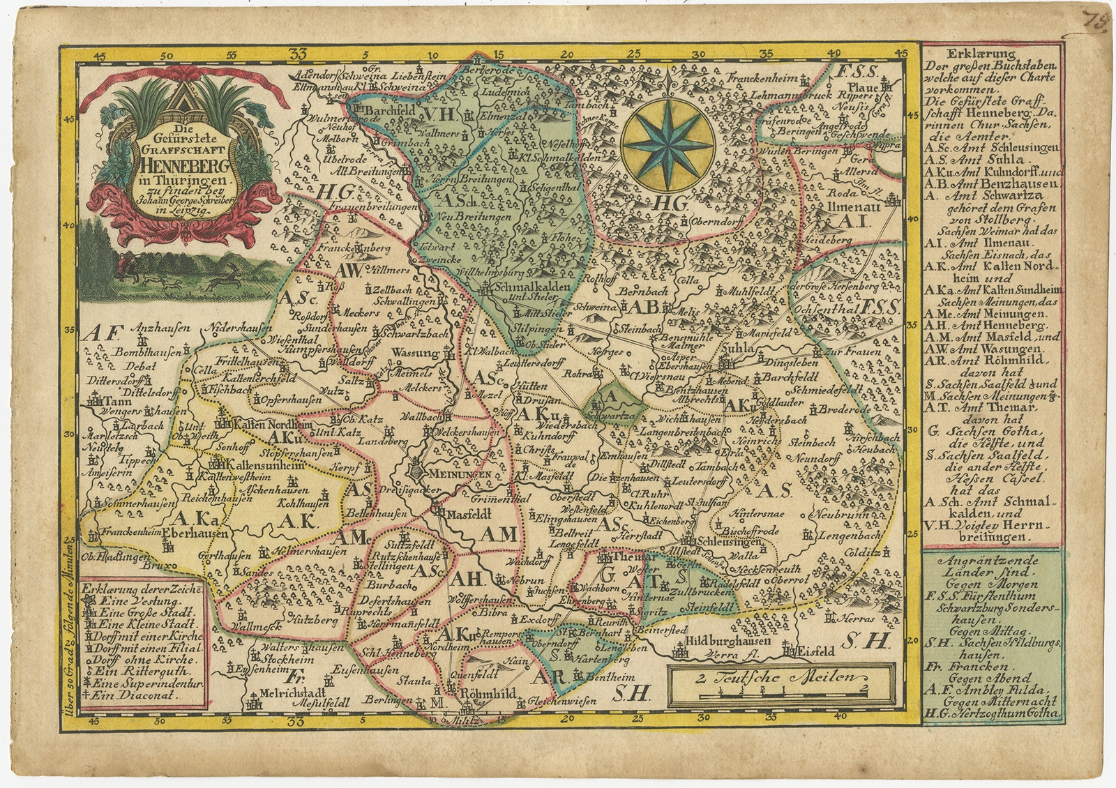 |
Antique Map of the Region of Henneberg by Schreiber (1749) $ 106.38 Availability: in stock Condition : Fair, original/contemporary hand coloring. Strong toning, minor wear. Blank verso, please study image carefully. Date : 1749 Overall size : 27 x 19 cm. Image size : 24.5 x 17 cm. Description: Antique map titled 'Die Gefürstete Henneberg'. Map of the region of Henneberg, Germany. This map originates from 'Atlas Selectus von allen Konigreichen und Landern der Welt' by Johann Georg Schreiber. Artists and Engravers: Johann Georg Schreiber, a German cartographer and geographer, was born 1676 and lived in Leipzig. His only work was the Atlas Selectus published first 1740 and reissued 1749. He died in 1745. |
|