See our ratings  Add this shop to my favorites  |
||
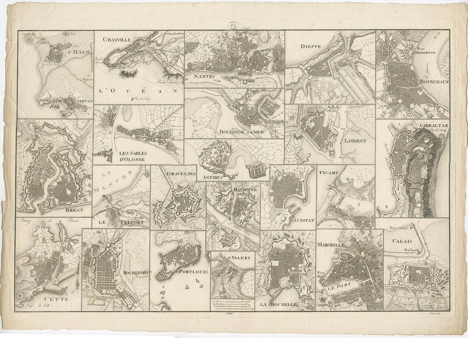 |
Antique Map of various Ports in France by Röder (c.1800) $ 2,130.38 Availability: in stock Condition : Good. general age-related toning, minor wear (mainly in margins, slightly affecting image). Blank verso. Please study image carefully. Date : c.1800 Overall size : 69 x 49 cm. Description: Antique print showing various ports in France. Including plans of St. Malo, Granville, Nantes, Dieppe, Bourdeauz, Gibraltar, Lorient, Boulogne sur Mer, Les Sables d'Olonne, Brest, Le Trèport, Antibes, La Ciotat, Fécamp, Calais, Marseille, La Rochelle, St. Valery, Bayonne, Gravelins, Port Louis, Rochefort and Cette. Source unknown, to be determined. Artists and Engravers: Engraved by Röder. |
|