See our ratings  Add this shop to my favorites  |
||
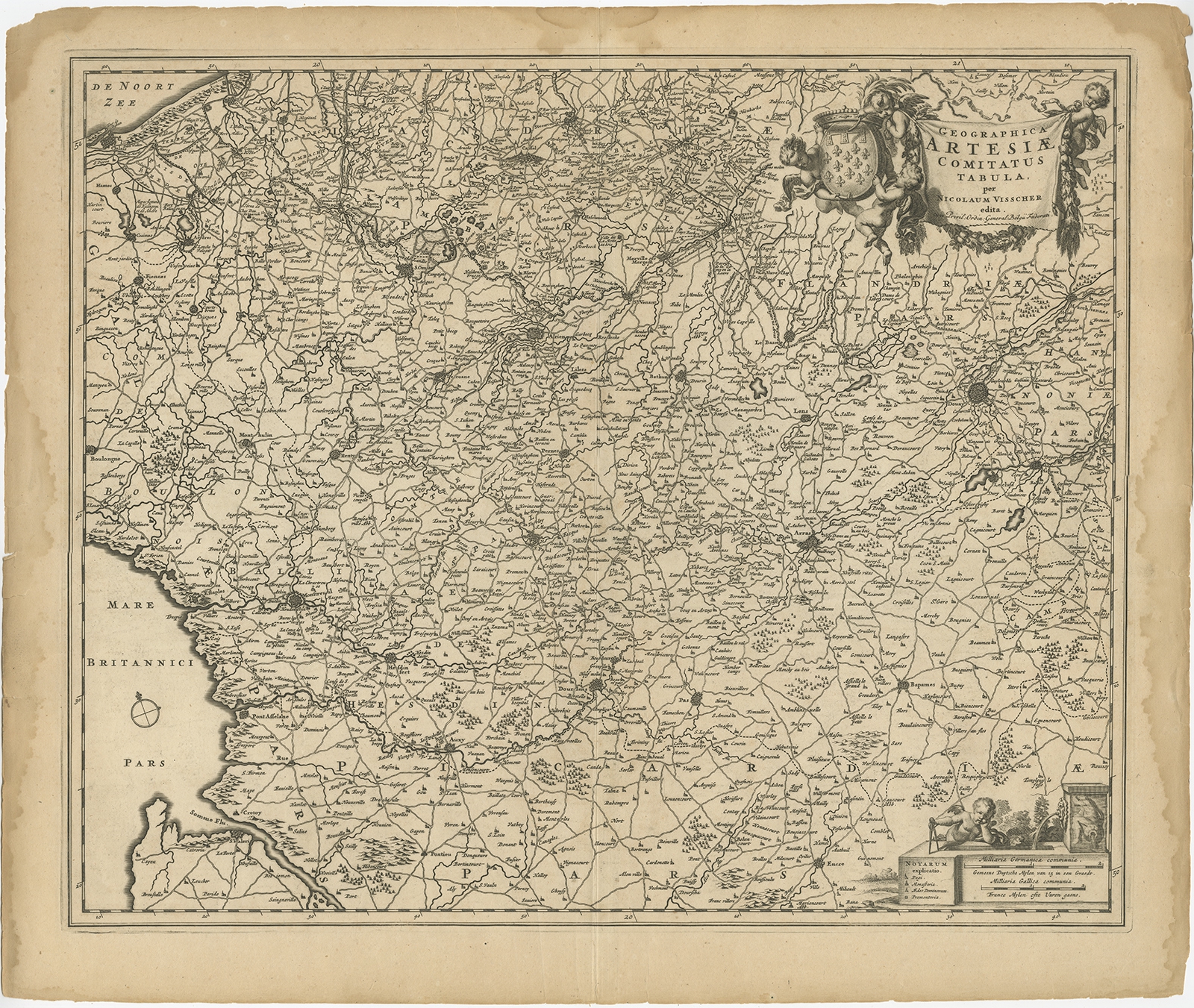 |
Antique Map of the Artois region by Visscher (c.1690) $ 383.53 Availability: in stock Condition : Fair, age-related toning and some staining (mainly in margins). Several larger creases and few other minor defects. Blank verso, please study image carefully. Date : c.1690 Overall size : 62 x 53.5 cm. Image size : 56.5 x 47 cm. Description: Antique map titled 'Geographica Artesiae Comitatus Tabula'. Large map of the Artois region, France. Also shows part of Flanders. Artists and Engravers: Nicolaes Visscher II (1649, Amsterdam – 1702, Amsterdam) was a Dutch engraver, cartographer and publisher. He was the son of Nicolaes Visscher I and the grandson of Claes Janszoon Visscher. After his death, his wife, Elisabeth, continued the family tradition of mapmaking and publishing. The works, engraved plates, were then sold to Peter Schenk, who also reprinted them. |
|