See our ratings  Add this shop to my favorites  |
||
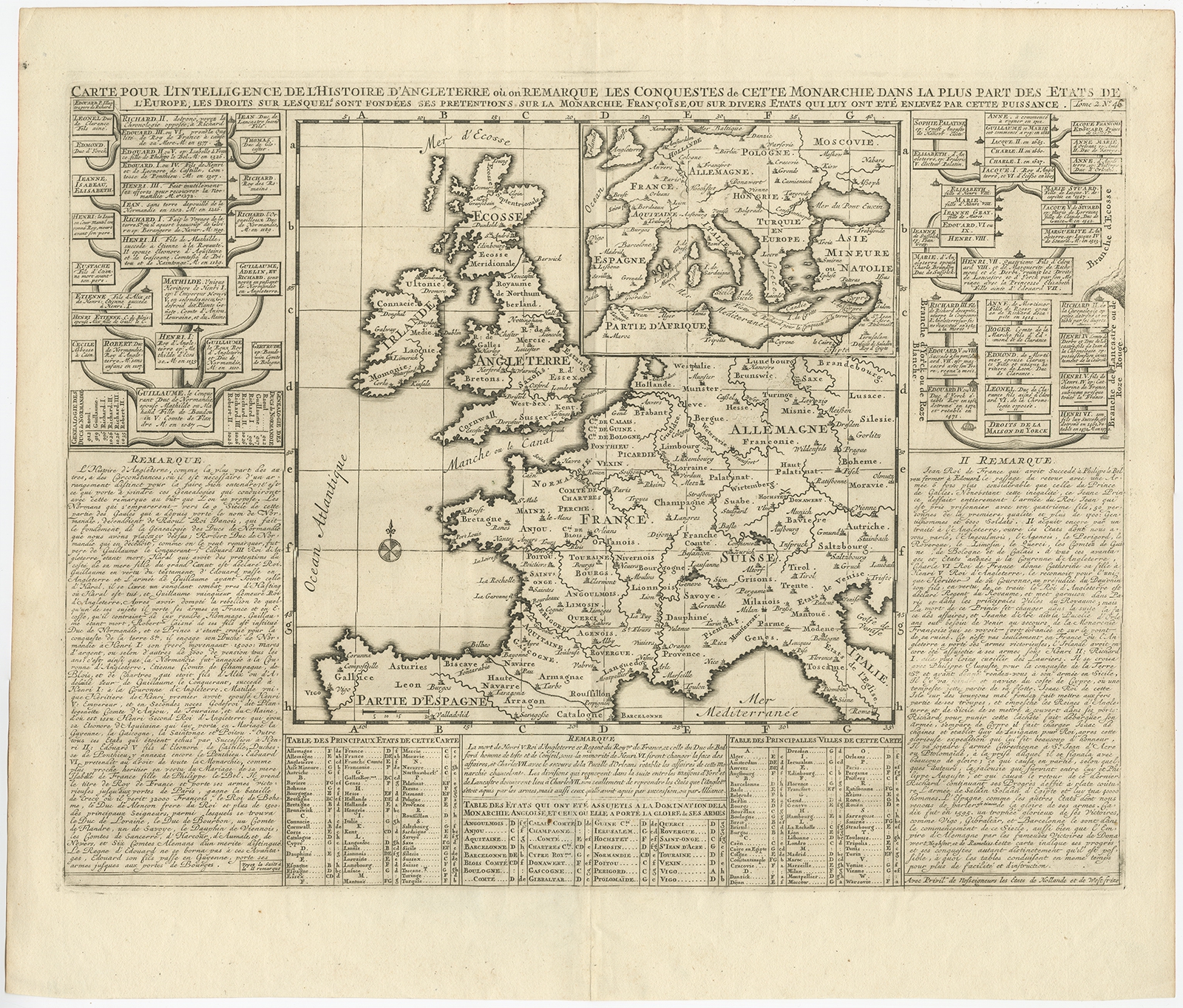 |
Antique Map of the British Isles and part of Europe by Chatelain (c.1720) $ 186.88 Availability: in stock Condition : Good, general age-related toning. Some creasing, blank verso. Please study image carefully. Date : c.1720 Overall size : 50.5 x 43 cm. Image size : 46 x 35 cm. Description: Antique map titled 'Carte pour l'Intelligence de l'Histoire d'Angleterre (..)'. Decorative map showing the British Isles and the various regions conquered in Europe. Includese two elaborate family trees for the House of York and William The Conqueror. This map originates from Chatelain's 'Atlas Historique'. Artists and Engravers: Henri Abraham Chatelain (1684-1743), his father Zacharie Chatelain (d.1723) and Zacharie Junior (1690-1754), worked as a partnership publishing the Atlas Historique, Ou Nouvelle Introduction A L'Histoire under several different Chatelain imprints, depending on the Chatelain family partnerships at the time of publication. |
|