See our ratings  Add this shop to my favorites  |
||
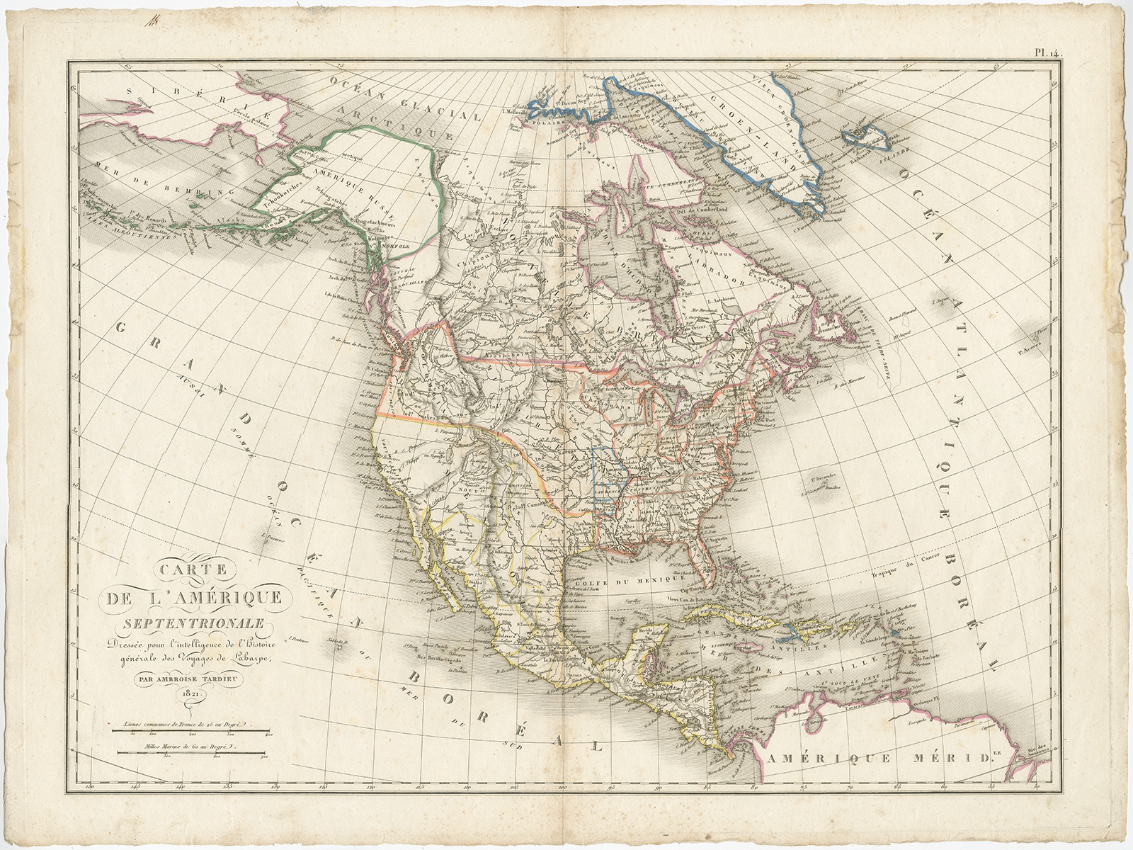 |
Antique Map of North America by Tardieu (1821) $ 1,313.88 Availability: in stock Condition : Good, some light, mostly marginal foxing. Minor toning along folding line. Small defect near title. Please study image carefully. Date : 1821 Overall size : 61 x 46 cm. Image size : 54 x 40 cm. Description: Antique map of America titled 'Carte de l'Amerique septentrionale'. Scarce map of North America, shortly after the Louisiana Purchase and the first publication of Lewis & Clark's official report. Includes the rare pre-Louisiana Purchase territories, including St. Louis, Arkansas and Lawrence. Many Indian Tribes named. This map originates from 'Atlas pour Servir a l'Intelligence de l'Histoire Generale des Voyages, de Laharpe' by A. Tardieu. Artists and Engravers: Ambroise Tardieu was an important French cartographer and engraver. |
|