See our ratings  Add this shop to my favorites  |
||
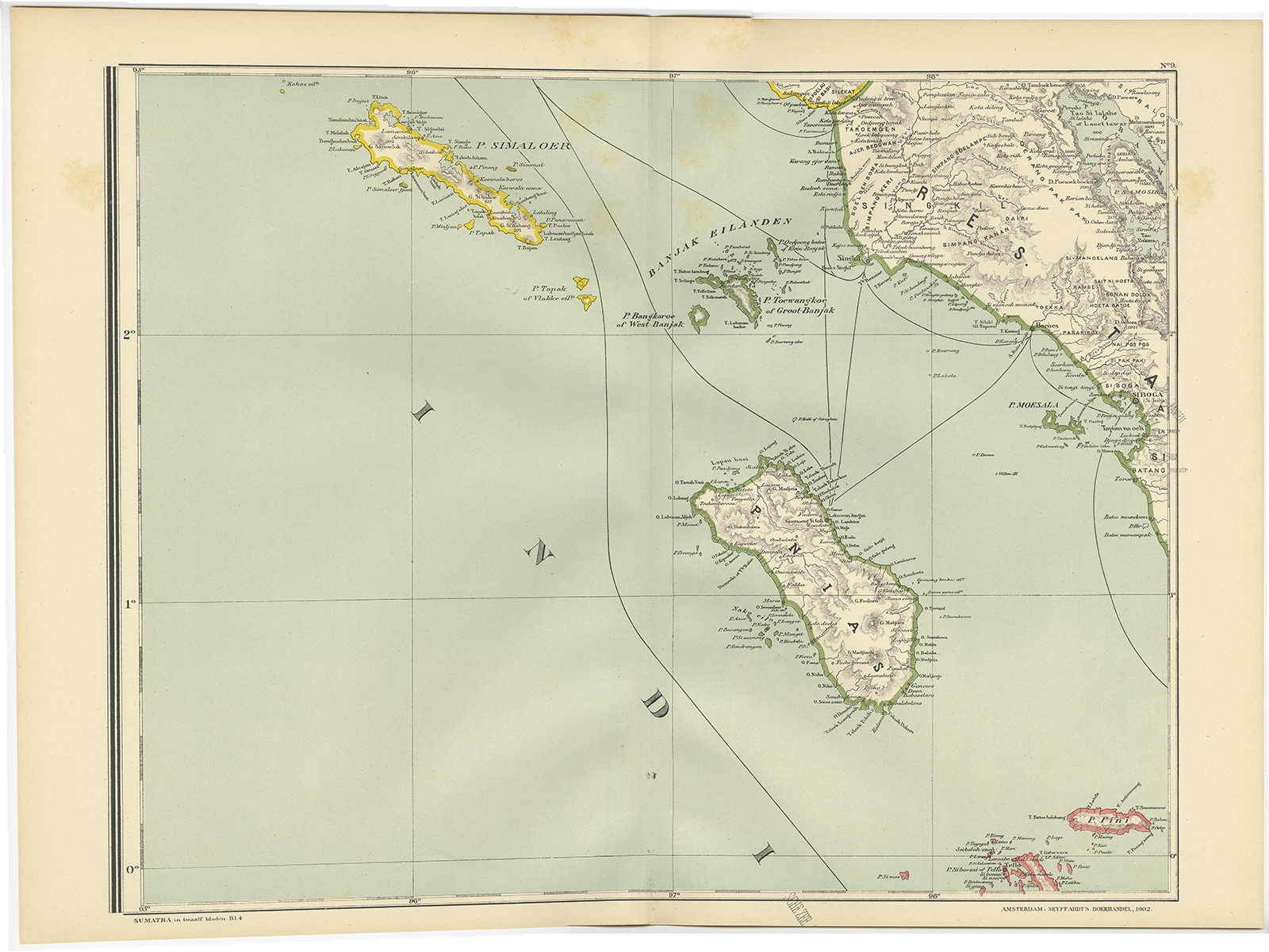 |
Antique Map of the Nias Archipelago by Dornseiffen (1900) $ 122.48 Availability: in stock Condition : Very good, general age-related toning. Please study image carefully. Date : 1900 Overall size : 52.6 x 38.9 cm. Image size : 45.3 x 35.5 cm. Description: Antique map of Nias Island and surrounding islands including the Banyak islands, Pini island and Simeulue Island. This map originates from 'Atlas van Nederlandsch Oost- en West-Indië' by I. Dornseiffen. Artists and Engravers: Published by Seyffardt's Boekhandel, Amsterdam. |
|