See our ratings  Add this shop to my favorites  |
||
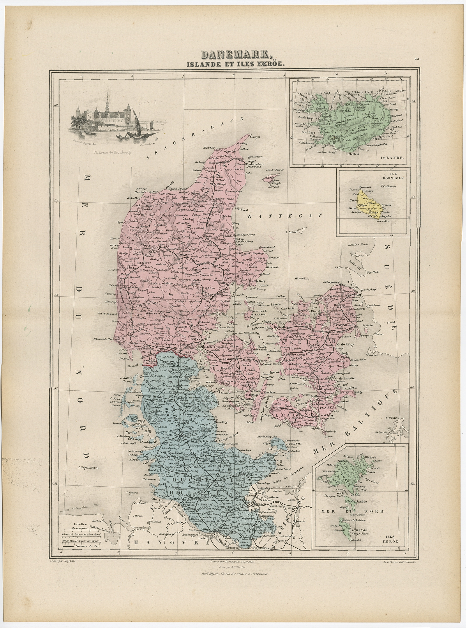 |
Antique Map of Denmark, Iceland and the Faroe Islands by Migeon (1880) $ 133.98 Availability: in stock Condition : Good, age-related toning. Please study image carefully. Date : 1880 Overall size : 34.5 x 47.5 cm. Image size : 28 x 37 cm. Description: Antique map titled 'Danemark, Islande et Iles Faeröe'. Old map of Denmark, Iceland and the Faroe Islands. With decorative vignette of the Kronborgh Castle and three inset maps of Island, the Bornholm and the Faeroe Islands. This map originates from 'Géographie Universelle Atlas-Migeon' by J. Migeon. Artists and Engravers: Published by J. Migeon. Reviewed by A. Vuillemin. Alexandre Vuillemin (1812-1880) was a cartographer and an book editor based in Paris, France. |
|