See our ratings  Add this shop to my favorites  |
||
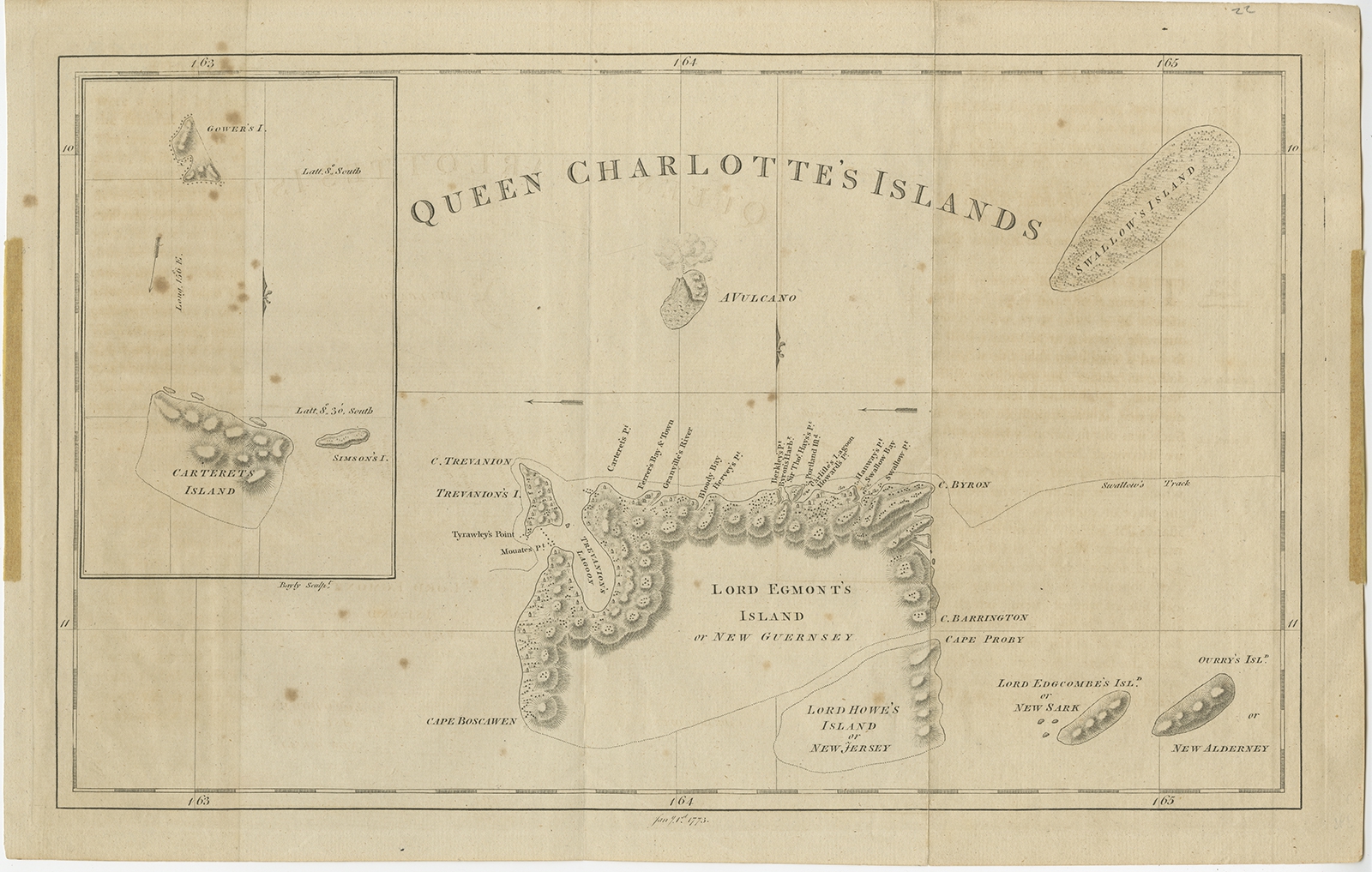 |
Antique Map of Queen Charlotte's Islands by Hogg (1773) $ 400.14 instead of Availability: in stock Condition : Fair, age-related toning and some staining. Few pieces of tape, please study image carefully. Date : 1773 Overall size : 42 x 27 cm. Image size : 38.5 x 23.5 cm. Description: Antique map Canada titled 'Queen Charlotte's Islands'. Old map of Queen Charlotte's Islands, Canada. With an inset map of Carteret's, Simson's and Gower's islands. Shows the Swallow's track. Originates from 'A New, Authentic and Complete Collection of Voyages Around the World after measurements from Voyages by James Cook 1728-79'. Artists and Engravers: Author: George William Anderson. |
|